Country:
 USA
USARegion:
City:
Latitude and Longitude:
Time Zone:
Postal Code:
IP information under different IP Channel
ip-api
Country
Region
City
ASN
Time Zone
ISP
Blacklist
Proxy
Latitude
Longitude
Postal
Route
IPinfo
Country
Region
City
ASN
Time Zone
ISP
Blacklist
Proxy
Latitude
Longitude
Postal
Route
MaxMind
Country
Region
City
ASN
Time Zone
ISP
Blacklist
Proxy
Latitude
Longitude
Postal
Route
Luminati
Country
USRegion
mi
City
alger
ASN
Time Zone
America/Detroit
ISP
123NET
Latitude
Longitude
Postal
db-ip
Country
Region
City
ASN
Time Zone
ISP
Blacklist
Proxy
Latitude
Longitude
Postal
Route
ipdata
Country
Region
City
ASN
Time Zone
ISP
Blacklist
Proxy
Latitude
Longitude
Postal
Route
Popular places and events near this IP address

Moffatt Township, Michigan
Civil township in Michigan, United States
Distance: Approx. 8614 meters
Latitude and longitude: 44.11055556,-84.08722222
Moffatt Township is a civil township of Arenac County in the U.S. state of Michigan. The population was 1,166 at the 2020 census.

Bourret Township, Michigan
Civil township in Michigan, United States
Distance: Approx. 6645 meters
Latitude and longitude: 44.11416667,-84.2625
Bourret Township is a civil township of Gladwin County in the U.S. state of Michigan. As of the 2020 census, the township population was 390.

Horton Township, Michigan
Civil township in Michigan, United States
Distance: Approx. 7456 meters
Latitude and longitude: 44.20638889,-84.19194444
Horton Township is a civil township of Ogemaw County in the U.S. state of Michigan. The population was 902 at the 2020 census.
Alger, Michigan
Unincorporated community in Michigan, United States
Distance: Approx. 5503 meters
Latitude and longitude: 44.1256,-84.1211
Alger ( AL-jər) is an unincorporated community in Arenac County in the U.S. state of Michigan. The community is located within Moffatt Township. As an unincorporated community, Alger has no legally defined boundaries or population statistics of its own but does have its own post office with the 48610 ZIP Code.
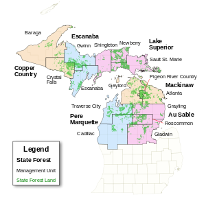
Au Sable State Forest
State forest on the Lower Peninsula of Michigan, US
Distance: Approx. 4607 meters
Latitude and longitude: 44.1,-84.17
The Au Sable State Forest is a state forest in the north-central Lower Peninsula of Michigan. It is operated by the Michigan Department of Natural Resources. The Au Sable State Forest is a byproduct of the lumbering boom in Michigan during the late 19th century.
Hard Luck, Michigan
Ghost town in Michigan, United States
Distance: Approx. 7566 meters
Latitude and longitude: 44.07166667,-84.19305556
Hard Luck is a ghost town in Gladwin County in the U.S. state of Michigan. Hard Luck is located within Grim Township in the Au Sable State Forest about 14 mi (23 km) northeast of Gladwin. The settlement was involved in the lumber trade.
Weather in this IP's area
clear sky
3 Celsius
3 Celsius
3 Celsius
7 Celsius
1032 hPa
93 %
1032 hPa
1002 hPa
10000 meters
07:55:42
18:47:34