Country:
 USA
USARegion:
City:
Latitude and Longitude:
Time Zone:
Postal Code:
IP information under different IP Channel
ip-api
Country
Region
City
ASN
Time Zone
ISP
Blacklist
Proxy
Latitude
Longitude
Postal
Route
IPinfo
Country
Region
City
ASN
Time Zone
ISP
Blacklist
Proxy
Latitude
Longitude
Postal
Route
MaxMind
Country
Region
City
ASN
Time Zone
ISP
Blacklist
Proxy
Latitude
Longitude
Postal
Route
Luminati
Country
USRegion
mi
City
rochester
ASN
Time Zone
America/Detroit
ISP
123NET
Latitude
Longitude
Postal
db-ip
Country
Region
City
ASN
Time Zone
ISP
Blacklist
Proxy
Latitude
Longitude
Postal
Route
ipdata
Country
Region
City
ASN
Time Zone
ISP
Blacklist
Proxy
Latitude
Longitude
Postal
Route
Popular places and events near this IP address

Rochester, Michigan
City in Michigan
Distance: Approx. 2841 meters
Latitude and longitude: 42.68055556,-83.13388889
Rochester is a city in Oakland County in the U.S. state of Michigan. The population was 12,711 at the 2010 census. It is a northern suburb in Metro Detroit located 20 miles north of the city of Detroit.

Rochester Hills, Michigan
City in Michigan, United States
Distance: Approx. 3052 meters
Latitude and longitude: 42.66583333,-83.15805556
Rochester Hills is a city in Oakland County in the U.S. state of Michigan. A northern suburb of Detroit, Rochester Hills is located about 25 miles (40 km) north of downtown Detroit. As of the 2020 census, the city had a population of 76,300.
Paint Creek (Oakland County, Michigan)
River in Michigan, United States
Distance: Approx. 2370 meters
Latitude and longitude: 42.67725,-83.12827
Paint Creek is a 16.8-mile-long (27.0 km) stream in the U.S. state of Michigan, located in northern Oakland County and rising in Brandon Township in the northern part of the county. The creek drains through a series of lakes that lead into Lake Orion. Paint Creek continues as the outflow from the east end of Lake Orion in downtown Lake Orion.

Islamic Association of Greater Detroit
Religious organization in Michigan
Distance: Approx. 3190 meters
Latitude and longitude: 42.635,-83.14916667
Islamic Association of Greater Detroit (IAGD) was founded in 1978 by immigrants from South Asia and the Middle East. After IAGD was formed, it purchased the current property situated in the city of Avon Township. Eventually, the city name changed to Rochester Hills, Michigan.
KDTI
Radio station in Rochester Hills, Michigan
Distance: Approx. 2486 meters
Latitude and longitude: 42.67861111,-83.12444444
KDTI (90.3 FM, "K-Love 2000s") is a radio station broadcasting a Christian contemporary music format focusing on songs from the 2000s. Licensed to Rochester Hills, Michigan, United States, the station is currently owned by the Educational Media Foundation. Formerly licensed to Sheridan, Wyoming, on March 10, 2015, the station moved to Rochester Hills, Michigan (a suburb of Detroit) and signed on at 90.3 MHz with an effective radiated power of 37 watts.

Yates Cider Mill
Distance: Approx. 2977 meters
Latitude and longitude: 42.673,-83.0947
Yates Cider Mill is a cider mill in Rochester, Michigan. The mill traces its roots to 1863, when it was known as Yates Grist Mill. In order for the mill to utilize water power, the Yates Dam was built.

Royal Park Hotel (Rochester, Michigan)
Distance: Approx. 2855 meters
Latitude and longitude: 42.6816,-83.1288
The Royal Park Hotel is a luxury boutique hotel located in Rochester, Michigan. Architect Victor Saroki designed the hotel in a stately English manor house style. The hotel contains the newly renovated PARK 600 bar + kitchen.
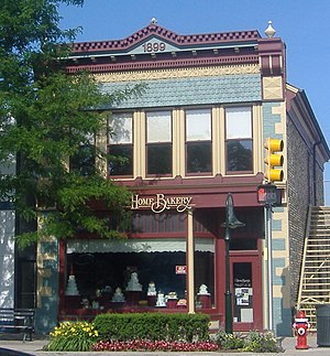
Rollin Sprague Building
United States historic place
Distance: Approx. 2709 meters
Latitude and longitude: 42.67944444,-83.13333333
The Rollin Sprague Building, also known as the Old Stone Store, is a commercial building located at 300 Main Street in Rochester, Michigan. It was listed on the National Register of Historic Places in 1999. The building is a rare example of coursed, cobblestone construction, and is the only known commercial building in Michigan featuring this type of construction.

Western Knitting Mills
United States historic place
Distance: Approx. 2749 meters
Latitude and longitude: 42.68027778,-83.13111111
The Western Knitting Mills is a former industrial building located at 400 Water Street in Rochester, Michigan. The building has been renovated to serve commercial tenants, including Rochester Mills Beer Company. It was listed on the National Register of Historic Places in 2000.
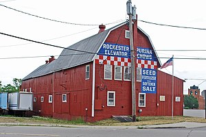
Rochester Grain Elevator
United States historic place
Distance: Approx. 2940 meters
Latitude and longitude: 42.68194444,-83.13166667
The Rochester Grain Elevator, formerly the Griggs Brothers Grain Elevator, is a grain elevator located at 303 East University Drive in Rochester, Michigan. It was listed on the National Register of Historic Places in 2010.
Milo Prentice Newberry House
United States historic place
Distance: Approx. 2321 meters
Latitude and longitude: 42.67694444,-83.11916667
The Milo Prentice Newberry House is a single-family house located at 705 Bloomer Road in Rochester, Michigan. It was listed on the National Register of Historic Places in 2018. It is the last remaining Victorian-era farmhouse located within the limits of the City of Rochester.
Rochester Christian University
Private university in Rochester Hills, Michigan, US
Distance: Approx. 2185 meters
Latitude and longitude: 42.66722222,-83.14527778
Rochester Christian University is a private Christian college in Rochester Hills, Michigan. It was founded by members of the Churches of Christ in 1959. Rochester Christian University is primarily undergraduate-focused and offers some graduate programs, such as a Master of Religious Education program.
Weather in this IP's area
clear sky
8 Celsius
8 Celsius
7 Celsius
9 Celsius
1033 hPa
81 %
1033 hPa
1005 hPa
10000 meters
1.03 m/s
270 degree
07:50:47
18:43:37