Country:
Region:
City:
Latitude and Longitude:
Time Zone:
Postal Code:
IP information under different IP Channel
ip-api
Country
Region
City
ASN
Time Zone
ISP
Blacklist
Proxy
Latitude
Longitude
Postal
Route
Luminati
Country
Region
mi
City
saline
ASN
Time Zone
America/Detroit
ISP
RURALREACH-01
Latitude
Longitude
Postal
IPinfo
Country
Region
City
ASN
Time Zone
ISP
Blacklist
Proxy
Latitude
Longitude
Postal
Route
db-ip
Country
Region
City
ASN
Time Zone
ISP
Blacklist
Proxy
Latitude
Longitude
Postal
Route
ipdata
Country
Region
City
ASN
Time Zone
ISP
Blacklist
Proxy
Latitude
Longitude
Postal
Route
Popular places and events near this IP address

Saline, Michigan
City in the United States
Distance: Approx. 192 meters
Latitude and longitude: 42.17083333,-83.77972222
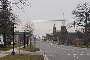
Saline ( sə-LEEN) is a city in Washtenaw County in the U.S. state of Michigan. The population was 8,948 at the 2020 census. The city borders Saline Township to the southwest, and the two are administered autonomously.
Saline First Presbyterian Church
Historic church in Michigan, United States
Distance: Approx. 384 meters
Latitude and longitude: 42.16722222,-83.78055556
Saline First Presbyterian Church is a historic church located at 143 E. Michigan Avenue in Saline, Michigan. It was added to the National Register in 1985 and designated a Michigan State Historic Site in 1995.
East Michigan Avenue Historic District
United States historic place
Distance: Approx. 552 meters
Latitude and longitude: 42.16916667,-83.77555556
The East Michigan Avenue Historic District is a residential historic district located at 300-321 East Michigan Avenue, 99-103 Maple Street, and 217, 300 and 302 East Henry in Saline, Michigan. It was listed on the National Register of Historic Places in 1985. The East Michigan Avenue Historic District consists of eighteen houses with nine barns and carriage houses clustered around the distinctive William H. Davenport House, which is individually listed on the National Register.
Jortin Forbes House
United States historic place
Distance: Approx. 275 meters
Latitude and longitude: 42.16805556,-83.7825
The Jortin Forbes House is a single-family home located at 211 North Ann Arbor Street in Saline, Michigan. It was listed on the National Register of Historic Places in 1985.
Charles Guthard House
United States historic place
Distance: Approx. 387 meters
Latitude and longitude: 42.16861111,-83.77805556
The Charles Guthard House is a single-family home located at 211 E. Michigan Avenue in Saline, Michigan. It was listed on the National Register of Historic Places in 1985.

Miller-Walker House
United States historic place
Distance: Approx. 447 meters
Latitude and longitude: 42.16666667,-83.78361111
The Miller-Walker House was a single-family home located at 117 McKay Street in Saline, Michigan. It was listed on the National Register of Historic Places in 1985. The house is missing and is presumed to have been demolished some time after 1985.
North Ann Arbor Street Historic District
United States historic place
Distance: Approx. 144 meters
Latitude and longitude: 42.17,-83.78361111
The North Ann Arbor Street Historic District is a residential historic district, consisting of the houses at 301, 303, and 305-327 North Ann Arbor Street in Saline, Michigan. It was listed on the National Register of Historic Places in 1985.
Louis Sturm House
United States historic place
Distance: Approx. 300 meters
Latitude and longitude: 42.16833333,-83.78416667
The Louis Sturm House is a single family home located at 100 Russell in Saline, Michigan. It was listed on the National Register of Historic Places in 1985.
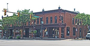
Union Block (Saline, Michigan)
United States historic place
Distance: Approx. 468 meters
Latitude and longitude: 42.16638889,-83.78083333
The Union Block is a commercial building located at 100-110 East Michigan Avenue in Saline, Michigan. It was listed on the National Register of Historic Places in 1985.
Wallace Block
United States historic place
Distance: Approx. 498 meters
Latitude and longitude: 42.16611111,-83.78083333
The Wallace Block is a commercial building located at 101-113 South Ann Arbor Street in Saline, Michigan. It was listed on the National Register of Historic Places in 1985.
Zalmon Church House
United States historic place
Distance: Approx. 365 meters
Latitude and longitude: 42.16722222,-83.78194444
The Zalmon Church House is a single-family home located at 113 North Ann Arbor in Saline, Michigan. It was listed on the National Register of Historic Places in 1985.
Saline station
United States historic place
Distance: Approx. 170 meters
Latitude and longitude: 42.17166667,-83.78333333
The Saline station, also known as the Detroit, Hillsdale and Indiana Railroad-Saline Depot, is a former railroad depot located at 402 North Ann Arbor Street in Saline, Michigan. It was listed on the National Register of Historic Places in 1994. The building now houses the Saline Depot Museum.
Weather in this IP's area
clear sky
9 Celsius
8 Celsius
8 Celsius
10 Celsius
1017 hPa
63 %
1017 hPa
987 hPa
10000 meters
2.06 m/s
100 degree
07:23:42
17:15:29


