Country:
 USA
USARegion:
City:
Latitude and Longitude:
Time Zone:
Postal Code:
IP information under different IP Channel
ip-api
Country
Region
City
ASN
Time Zone
ISP
Blacklist
Proxy
Latitude
Longitude
Postal
Route
IPinfo
Country
Region
City
ASN
Time Zone
ISP
Blacklist
Proxy
Latitude
Longitude
Postal
Route
MaxMind
Country
Region
City
ASN
Time Zone
ISP
Blacklist
Proxy
Latitude
Longitude
Postal
Route
Luminati
Country
USASN
Time Zone
America/Chicago
ISP
123NET
Latitude
Longitude
Postal
db-ip
Country
Region
City
ASN
Time Zone
ISP
Blacklist
Proxy
Latitude
Longitude
Postal
Route
ipdata
Country
Region
City
ASN
Time Zone
ISP
Blacklist
Proxy
Latitude
Longitude
Postal
Route
Popular places and events near this IP address
Flushing, Michigan
City in Michigan, United States
Distance: Approx. 2301 meters
Latitude and longitude: 43.06305556,-83.85111111
Flushing is a city in Genesee County, Michigan, United States. The population was 8,411 at the 2020 census. Flushing is considered a suburb of Flint.

Flushing Township, Michigan
Charter township in Michigan, United States
Distance: Approx. 3923 meters
Latitude and longitude: 43.09694444,-83.85805556
Flushing Charter Township is a charter township of Genesee County in the U.S. state of Michigan. The population was 10,701 at the 2020 census. Flushing Township was rated the 63rd safest community in America with a population over 10,000 by SafeWise, a home security and safety brand, in 2017.
Flushing High School (Michigan)
School in Flushing, Michigan, United States
Distance: Approx. 1620 meters
Latitude and longitude: 43.0758,-83.844
Flushing High School is a four-year public high school in Flushing, Michigan, U.S.A. It is operated by Flushing Community Schools. Its sports teams are known as the Raiders. Colors: Orange and Black.
Flushing Community Schools
School district in Michigan
Distance: Approx. 2207 meters
Latitude and longitude: 43.07055556,-83.85222222
Flushing Community Schools is a school district in Flushing, Michigan, U.S.A. The superintendent is Matthew Shanafelt. Schools operated by the board include: Early Childhood Center Central Elementary School Elms Elementary School Seymour Elementary School Springview Elementary School Flushing Middle School Flushing High School The new Flushing Jr. High School was completed in 2005 and houses approximately 750 seventh and eighth grade students.
Westwood Heights Schools
School district in Michigan
Distance: Approx. 6199 meters
Latitude and longitude: 43.05766667,-83.75116667
Westwood Heights School District is a public school district in Genesee County in the U.S. state of Michigan and in the Genesee Intermediate School District.
Flushing Riverview Park
Distance: Approx. 2675 meters
Latitude and longitude: 43.06113889,-83.85497222
Flushing Riverview Park is a public park along the Flint River in the city of Flushing, Michigan. Riverview Park has a kayak/canoe access site into the Flint River. Along with river access, the park has a tennis court, basketball court, playgrounds, pavilions, amphitheater, walkways and open field.

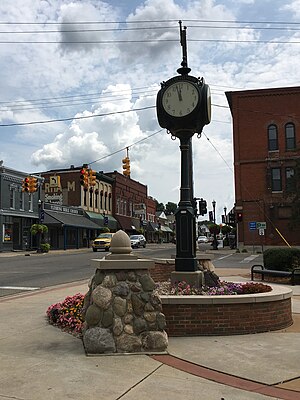
Main Street Historic District (Flushing, Michigan)
United States historic place
Distance: Approx. 2239 meters
Latitude and longitude: 43.06305556,-83.85027778
The Main Street Historic District, located in Flushing Michigan, includes buildings on Main St from Maple to 628 (East) Main St and the Flushing Depot at 431 W Main St. Properties in this district are listed on the National Register of Historic Places. 82 structures located on 22.4 acres of land create the district with commercial buildings reflecting ornate Italianate and early twentieth-century styles constructed between 1850 and 1918 and residences exhibiting a wide variety of Greek Revival, Italianate, Queen Anne, Colonial Revival, and Bungaloid styles and their vernacular derivatives built from 1850 to 1932..

House at 10410 Stanley Road
United States historic place
Distance: Approx. 6281 meters
Latitude and longitude: 43.10361111,-83.88833333
The House at 10410 Stanley Road is a single-family home located in Flushing, Michigan. It was listed on the National Register of Historic Places in 1982. The construction date of this house is unknown.

House at 5556 Flushing Road
United States historic place
Distance: Approx. 4133 meters
Latitude and longitude: 43.04416667,-83.79027778
The House at 5556 Flushing Road is a single-family home located in Flushing, Michigan. It was listed on the National Register of Historic Places in 1982. The house was likely built sometime between 1840 and 1860.

Daniel O'Sullivan House
United States historic place
Distance: Approx. 5415 meters
Latitude and longitude: 43.03929,-83.77486
The Daniel O'Sullivan House (also known as the Halfway House) is a single-family home located at 5035 Flushing Road in Flushing, Michigan. It was listed on the National Register of Historic Places in 1982. Daniel O'Sullivan, one of the first settlers in Flint Township, helped found the city of Flint.

Flushing Mutton Park
Distance: Approx. 836 meters
Latitude and longitude: 43.066389,-83.833
Mutton Park is a 3.5 acre city park located on the corner of Coutant and Chestnut Streets in the city of Flushing, Michigan. Bonnieview Court is located on the north side of the park. The park has a softball diamond, basketball court, playground and picnic area.

Sri Kasi Vishwanatha Temple Flint
Hindu temple in Nashville Metropolitan Area
Distance: Approx. 6702 meters
Latitude and longitude: 43.011962,-83.810379
The Sri Kasi Vishwanatha Temple is a Hindu temple located in Flint, Michigan. The temple is dedicated to Shiva, who is revered as Kasi Vishwanatha. The temple serves as a religious and cultural center for the Hindu community in Flint and the surrounding areas, providing a space for worship, cultural events, and religious education.
Weather in this IP's area
clear sky
7 Celsius
5 Celsius
5 Celsius
9 Celsius
1033 hPa
80 %
1033 hPa
1006 hPa
10000 meters
3.62 m/s
5.15 m/s
193 degree
07:54:07
18:45:53