Country:
 USA
USARegion:
City:
Latitude and Longitude:
Time Zone:
Postal Code:
IP information under different IP Channel
ip-api
Country
Region
City
ASN
Time Zone
ISP
Blacklist
Proxy
Latitude
Longitude
Postal
Route
IPinfo
Country
Region
City
ASN
Time Zone
ISP
Blacklist
Proxy
Latitude
Longitude
Postal
Route
MaxMind
Country
Region
City
ASN
Time Zone
ISP
Blacklist
Proxy
Latitude
Longitude
Postal
Route
Luminati
Country
USRegion
mi
City
detroit
ASN
Time Zone
America/Detroit
ISP
123NET
Latitude
Longitude
Postal
db-ip
Country
Region
City
ASN
Time Zone
ISP
Blacklist
Proxy
Latitude
Longitude
Postal
Route
ipdata
Country
Region
City
ASN
Time Zone
ISP
Blacklist
Proxy
Latitude
Longitude
Postal
Route
Popular places and events near this IP address
WPXD-TV
Ion Television station in Ann Arbor, Michigan
Distance: Approx. 1566 meters
Latitude and longitude: 42.48361111,-83.31222222
WPXD-TV (channel 31) is a television station licensed to Ann Arbor, Michigan, United States, serving as the Ion Television affiliate for the Detroit area. Owned by Inyo Broadcast Holdings, the station broadcasts from a transmitter on West 11 Mile Road in Southfield, Michigan. Channel 31 in Ann Arbor was inserted in 1973 at the request of Gershom Morningstar, a local resident.
Southfield High School
Distance: Approx. 3092 meters
Latitude and longitude: 42.47,-83.262
Southfield High School for the Arts and Technology is a public high school located in Southfield, Michigan. The school was founded in 1951. It serves grades 9–12 for the Southfield Public Schools.
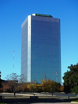
American Center
Office/retail in Southfield-Detroit, United States
Distance: Approx. 1871 meters
Latitude and longitude: 42.49,-83.29888889
The American Center is a high-rise tower in the Metro Detroit suburb of Southfield, Michigan, built in 1975 as the corporate headquarters for the automaker American Motors Corporation (AMC), which was subsequently acquired by Chrysler Corporation in 1987. The building is located adjacent to Interstate 696, M-10, and US 24 interchange. Upgraded in 2001, the office tower has 27 floors, including a basement, and has been owned and managed since 2017 by Redico, a Southfield-based real estate developer.
WSHJ
Radio station in Southfield, Michigan
Distance: Approx. 2928 meters
Latitude and longitude: 42.47,-83.264
WSHJ (88.3 FM) is a high school radio station broadcasting an Urban Contemporary format. Licensed to Southfield, Michigan it first began broadcasting in 1967.
Mercy High School (Farmington Hills, Michigan)
Private, all-girls school in Farmington Hills, , Michigan, United States
Distance: Approx. 3379 meters
Latitude and longitude: 42.48638889,-83.33647222
Mercy High School is a Roman Catholic college preparatory high school for girls in Farmington Hills, Michigan. The Sisters of Mercy opened Our Lady of Mercy High School in Detroit in 1945. The school moved to Farmington Hills in 1965.
Park West Gallery
Commercial art gallery in Michigan, United States
Distance: Approx. 3646 meters
Latitude and longitude: 42.50378,-83.31532
Park West Gallery is a commercial art gallery based in Southfield, Michigan, United States. Park West Gallery claims to be the largest private art gallery in the world, but that is largely disputed, and that it has sold hundreds of works of art for thousands of dollars. It exhibits work from historic artists such as Renoir, Picasso, Rembrandt, and Durer as well as contemporary artists such as Peter Max, Michael Godard and Mark Kostabi.
Beaumont Hospital, Farmington Hills
Hospital in Michigan, USA
Distance: Approx. 3576 meters
Latitude and longitude: 42.44658333,-83.32377778
Beaumont Hospital - Farmington Hills, formerly known as Botsford Hospital, is a 330-bed teaching hospital with level II trauma center status. Founded in 1965, the hospital is affiliated with Beaumont Health. The hospital earned three year accreditation from the American Osteopathic Association's Healthcare Facilities Accreditation Program in 2008.
Tel-Twelve Mall
Shopping mall in Michigan, United States
Distance: Approx. 3172 meters
Latitude and longitude: 42.499,-83.283
Tel-Twelve Mall is a shopping mall located in Southfield, Michigan, a suburb of Detroit, Michigan, United States. Developed as an enclosed mall in 1968, it was demolished and rebuilt in 2001 as a power center composed of big box tenants. Its anchor stores include Best Buy, DSW, Lowe's, Meijer, Michaels, Office Depot and PetSmart.

Nardin Park United Methodist Church
Historic church in Michigan, United States
Distance: Approx. 3733 meters
Latitude and longitude: 42.4843,-83.3423
Nardin Park United Methodist Church is a Methodist church situated in Farmington Hills, Michigan. Nardin Park was first formed in 1927 by the union of two large churches in northwest Detroit - the Grand River Avenue Church, established in 1891, and the Ninde Church, organized in 1886. The name 'Nardin Park' was taken from the park and the subdivision where the church was located Nardin Park United Methodist Church was officially listed in Michigan's register of historic sites on September 21, 1990.
Holy Sepulchre Cemetery (Southfield, Michigan)
Cemetery in Oakland County, Michigan
Distance: Approx. 183 meters
Latitude and longitude: 42.471569,-83.29963
Holy Sepulchre Cemetery in Southfield, Michigan, is an American cemetery operated by the Roman Catholic Archdiocese of Detroit.

Mother of God Cathedral (Southfield, Michigan)
Church in Michigan, United States
Distance: Approx. 1637 meters
Latitude and longitude: 42.47620556,-83.27987778
Mother of God Cathedral also called Our Lady of Chaldeans is a Chaldean Catholic cathedral located in Southfield, Michigan, United States. It is the seat for the Eparchy of St. Thomas the Apostle of Detroit.
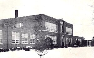
John Grace School
United States historic place
Distance: Approx. 3238 meters
Latitude and longitude: 42.44555556,-83.31166667
The John Grace School, also known as the District No. 9 Public School or the John Grace Park and Community Center, is a former school located at 21030 Indian Street in Southfield, Michigan. It was listed on the National Register of Historic Places in 2023.
Weather in this IP's area
clear sky
8 Celsius
7 Celsius
6 Celsius
9 Celsius
1020 hPa
89 %
1020 hPa
995 hPa
10000 meters
2.06 m/s
240 degree
07:06:19
19:55:26