67.212.26.25 - IP Lookup: Free IP Address Lookup, Postal Code Lookup, IP Location Lookup, IP ASN, Public IP
Country:
Region:
City:
Location:
Time Zone:
Postal Code:
IP information under different IP Channel
ip-api
Country
Region
City
ASN
Time Zone
ISP
Blacklist
Proxy
Latitude
Longitude
Postal
Route
Luminati
Country
Region
tx
City
grandview
ASN
Time Zone
America/Chicago
ISP
ALENCO
Latitude
Longitude
Postal
IPinfo
Country
Region
City
ASN
Time Zone
ISP
Blacklist
Proxy
Latitude
Longitude
Postal
Route
IP2Location
67.212.26.25Country
Region
texas
City
joshua
Time Zone
America/Chicago
ISP
Language
User-Agent
Latitude
Longitude
Postal
db-ip
Country
Region
City
ASN
Time Zone
ISP
Blacklist
Proxy
Latitude
Longitude
Postal
Route
ipdata
Country
Region
City
ASN
Time Zone
ISP
Blacklist
Proxy
Latitude
Longitude
Postal
Route
Popular places and events near this IP address

Johnson County, Texas
County in Texas, United States
Distance: Approx. 9829 meters
Latitude and longitude: 32.38,-97.36
Johnson County is a county located in the U.S. state of Texas. As of the 2020 census, its population was 179,927. Its county seat is Cleburne.
Briaroaks, Texas
City in Texas, United States
Distance: Approx. 9731 meters
Latitude and longitude: 32.50055556,-97.30472222
Briaroaks is a city in Johnson County, Texas, United States. The population was 507 at the 2020 census.

Cross Timber, Texas
Town in Texas, United States
Distance: Approx. 7068 meters
Latitude and longitude: 32.48277778,-97.32666667
Cross Timber is a town in Johnson County, Texas, United States. As of the 2020 census the population was 362.

Joshua, Texas
City in Texas, United States
Distance: Approx. 2005 meters
Latitude and longitude: 32.45888889,-97.37694444
Joshua is a city in Johnson County, Texas, United States. The population was 7,891 at the 2020 census.

Keene, Texas
City in Texas, United States
Distance: Approx. 9606 meters
Latitude and longitude: 32.38888889,-97.34416667
Keene is a city in Johnson County, Texas, United States. The population was 6,387 in 2020.
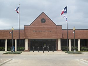
Burleson, Texas
City in Texas, United States
Distance: Approx. 8005 meters
Latitude and longitude: 32.5025,-97.32722222
Burleson ( BUR-liss-ən) is a city in Johnson and Tarrant counties in the U.S. state of Texas. It is a suburb of Fort Worth. At the 2010 census it had a population of 36,690, and in 2019 it had an estimated population of 48,225.
Southwestern Adventist University
Private Adventist university in Keene, Texas
Distance: Approx. 9831 meters
Latitude and longitude: 32.39706667,-97.32736667
Southwestern Adventist University is a private Adventist university in Keene, Texas. It is owned by the Southwestern Union Conference of Seventh-day Adventists. The university enrolls about 800 students on a rural, 150-acre campus.
KJRN
Christian radio station in Keene, Texas
Distance: Approx. 8889 meters
Latitude and longitude: 32.405,-97.332
KJRN (88.3 FM) is a non-commercial radio station licensed to Keene, Texas. The station broadcasts a Christian adult contemporary radio format and calls itself "88.3 The Journey." KJRN is owned by Southwestern Adventist University. The DJs consist of both full-time on-air talent and part-time university students.

Burleson High School
Public school
Distance: Approx. 8857 meters
Latitude and longitude: 32.5295,-97.3474
Burleson High School is a four-year public high school consisting of grades 9–12 located in Burleson, in the U.S. state of Texas, and is part of the Burleson Independent School District.
Egan, Texas
Unincorporated community in Texas, United States
Distance: Approx. 9257 meters
Latitude and longitude: 32.45277778,-97.3
Egan is an unincorporated community in Johnson County, Texas, United States. It is located at the intersection of Farm to Market roads 917 and 2280, approximately 8 miles (13 km) northeast of Cleburne. Egan is part of the Joshua Independent School District.
La Moderna Field
Baseball park in Cleburne, Texas, US
Distance: Approx. 9881 meters
Latitude and longitude: 32.37441667,-97.41269444
La Moderna Field (formerly known as "The Depot at Cleburne Station") is a baseball park located in Cleburne, Texas, United States, that opened on May 18, 2017. Seating at the ballpark has over 1,750 fixed seats, bleachers, grass berm seating, and several group seating areas. The Cleburne Railroaders baseball team of the independent American Association plays its home games at the stadium.
Joshua High School
School
Distance: Approx. 1927 meters
Latitude and longitude: 32.4504,-97.383
Joshua High School is a public high school located in the city of Joshua, Texas. The school is in the Joshua Independent School District.
Weather in this IP's area
overcast clouds
12 Celsius
12 Celsius
11 Celsius
13 Celsius
1017 hPa
96 %
1017 hPa
984 hPa
10000 meters
4.12 m/s
350 degree
100 %
