67.208.82.54 - IP Lookup: Free IP Address Lookup, Postal Code Lookup, IP Location Lookup, IP ASN, Public IP
Country:
Region:
City:
Location:
Time Zone:
Postal Code:
ISP:
ASN:
language:
User-Agent:
Proxy IP:
Blacklist:
IP information under different IP Channel
ip-api
Country
Region
City
ASN
Time Zone
ISP
Blacklist
Proxy
Latitude
Longitude
Postal
Route
db-ip
Country
Region
City
ASN
Time Zone
ISP
Blacklist
Proxy
Latitude
Longitude
Postal
Route
IPinfo
Country
Region
City
ASN
Time Zone
ISP
Blacklist
Proxy
Latitude
Longitude
Postal
Route
IP2Location
67.208.82.54Country
Region
california
City
torrance
Time Zone
America/Los_Angeles
ISP
Language
User-Agent
Latitude
Longitude
Postal
ipdata
Country
Region
City
ASN
Time Zone
ISP
Blacklist
Proxy
Latitude
Longitude
Postal
Route
Popular places and events near this IP address

Alondra Park, California
Place in California, United States
Distance: Approx. 2321 meters
Latitude and longitude: 33.89083333,-118.33416667
Alondra Park (), also known as El Camino Village, is an unincorporated community and census designated place (CDP) in the South Bay region of Los Angeles County, California, United States. It is the unincorporated area north of Alondra Community Regional Park and El Camino College. It is east of Lawndale, south of Hawthorne, west of Gardena, and north of Torrance.

Toyota Motor Sales, USA
American car distributor
Distance: Approx. 2121 meters
Latitude and longitude: 33.857163,-118.3118381
Toyota Motor Sales, USA, Inc. (TMS, also known as Toyota USA) is the North American Toyota sales, marketing, and distribution subsidiary devoted to the United States market. Founded in 1957 in California, TMS currently employs more than 6,500 people.
El Camino College
Community college in Alondra Park, California, US
Distance: Approx. 1715 meters
Latitude and longitude: 33.885881,-118.330457
El Camino College (Elco or ECC) is a public community college in Los Angeles County, California. Most of it is in Alondra Park, while a section is in the city limits of Torrance. It consists of 37 buildings spanning an area of roughly 26 acres (11 ha).
South Bay Galleria
Shopping mall in Redondo Beach, California
Distance: Approx. 2487 meters
Latitude and longitude: 33.87111111,-118.355
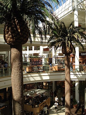
South Bay Galleria, formerly named Galleria at South Bay, is a shopping mall located in Redondo Beach, California, United States. It is anchored by Macy's, Kohl's, Q, Wonder of Dinosaurs, and a 16-screen AMC Theatres multiplex.

North High School (Torrance, California)
Public secondary school in the United States
Distance: Approx. 1051 meters
Latitude and longitude: 33.864748,-118.337029
North Torrance High School is a four-year public high school located at 3620 W. 182nd St. in Torrance, California. Of the five public high schools in the Torrance Unified School District, North High is the second oldest.
Environmental Charter High School
School in Lawndale, California, United States
Distance: Approx. 2805 meters
Latitude and longitude: 33.882024,-118.355155
Environmental Charter High School, abbreviated to ECHS, is a 9th through 12th grade public charter high school in Lawndale, California. It was founded in 2002. Prior to its founding, there was another high school at the same location that was named “Victory”.
Pacific Lutheran High School
School in Gardena, California, United States
Distance: Approx. 2469 meters
Latitude and longitude: 33.8659,-118.302
Pacific Lutheran Jr. / Sr. High School is a private Lutheran high school located in Gardena, California.
Gardena Police Department
Law enforcement agency in California, US
Distance: Approx. 2374 meters
Latitude and longitude: 33.88333333,-118.3075
The Gardena Police Department is the principal law enforcement agency responsible for the city of Gardena, California, in the United States. The current Chief of Police is Michael Saffell, appointed in 2019. Chief Saffell is a 30 year veteran of the Gardena Police Department.
Columbia Park, Torrance, California
Park in Torrance, California, US
Distance: Approx. 2048 meters
Latitude and longitude: 33.861,-118.347
Columbia Park (formally Columbia Regional Park) is a 52-acre (21 ha) recreational urban regional park in the City of Torrance, located in southern Los Angeles County, California. Columbia Park provides the community with soccer fields, baseball diamonds, bocce ball courts, community gardening beds, walking paths, and a jogging—competitive cross country running trail. It is one of thirty parks in the Torrance Parks system.
Gardena Office of Economic Development
Distance: Approx. 2465 meters
Latitude and longitude: 33.8837,-118.3066
The Gardena Office of Economic Development's purpose is to attract new business, and to stimulate job creation by providing services to businesses and industries relocating to or expanding within Gardena, California.
Featherstone Field
College sports stadium in California, U.S
Distance: Approx. 1588 meters
Latitude and longitude: 33.88444444,-118.33222222
Featherstone Field, previously known as Murdock Stadium is a stadium on the campus of El Camino College in Torrance, California. Built in 1958 the stadium seats around 12,127 on wood-backed bleacher seats. It was home to the North American Soccer League's Los Angeles Aztecs for two years (1975–1976), the American Soccer League's Southern California Lazers for a single season in 1978, as well as several United States men's national soccer team FIFA World Cup qualification matches.
Redondo Beach Transit Center
Transport hub in Redondo Beach, California
Distance: Approx. 2657 meters
Latitude and longitude: 33.8682,-118.3567
The Redondo Beach Transit Center is a bus station in Redondo Beach, California. The station consists of one large island platform with 11 bus bays and a 320-space park and ride parking lot located next to the transit center. The transit center opened in early 2023, replacing a nearby bus terminal at the South Bay Galleria dating to 1987.
Weather in this IP's area
overcast clouds
10 Celsius
9 Celsius
9 Celsius
11 Celsius
1014 hPa
81 %
1014 hPa
1013 hPa
10000 meters
2.57 m/s
80 degree
100 %

