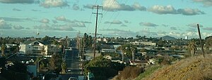
Country:
 USA
USARegion:
City:
Latitude and Longitude:
Time Zone:
Postal Code:
IP information under different IP Channel
ip-api
Country
Region
City
ASN
Time Zone
ISP
Blacklist
Proxy
Latitude
Longitude
Postal
Route
IPinfo
Country
Region
City
ASN
Time Zone
ISP
Blacklist
Proxy
Latitude
Longitude
Postal
Route
MaxMind
Country
Region
City
ASN
Time Zone
ISP
Blacklist
Proxy
Latitude
Longitude
Postal
Route
Luminati
Country
USRegion
ca
City
sandiego
ASN
Time Zone
America/Los_Angeles
ISP
LIGHTEDGE-AS-02
Latitude
Longitude
Postal
db-ip
Country
Region
City
ASN
Time Zone
ISP
Blacklist
Proxy
Latitude
Longitude
Postal
Route
ipdata
Country
Region
City
ASN
Time Zone
ISP
Blacklist
Proxy
Latitude
Longitude
Postal
Route
Popular places and events near this IP address
KOGO (AM)
News/talk radio station in San Diego
Distance: Approx. 1963 meters
Latitude and longitude: 32.72111111,-117.06944444
KOGO (600 kHz) is a commercial AM radio station in San Diego, California. The station airs a news/talk radio format and is owned by iHeartMedia, Inc. The studios and offices are located in San Diego's Kearny Mesa neighborhood on the northeast side.
KLNV
Regional Mexican radio station in San Diego
Distance: Approx. 1961 meters
Latitude and longitude: 32.72194444,-117.06861111
KLNV (106.5 FM, "Que Buena 106.5") is a regional Mexican radio station broadcasting to the San Diego metropolitan area. It is owned by TelevisaUnivision, and is a part of the Uforia Audio Network.

Encanto, San Diego
Community of San Diego in California
Distance: Approx. 813 meters
Latitude and longitude: 32.7125,-117.06111111
Encanto (Spanish for "Charm") is a hilly urban neighborhood located in the southeastern region of San Diego, California. The neighborhood is bordered by California State Route 94 and the communities of Oak Park and Broadway Heights to the north, O'Farrell (also known as South Encanto) to the south, Emerald Hills and Valencia Park to the west and the City of Lemon Grove to the east.

Morse High School (California)
School in San Diego, California, United States
Distance: Approx. 1240 meters
Latitude and longitude: 32.7,-117.0480556
Samuel F. B. Morse High School is an urban public high school in the Skyline neighborhood of southeastern San Diego, California. It serves grades 9–12 in the American K-12 education system. Morse, which serves a predominantly socioeconomically-disadvantaged student population, has produced several notable athletes among its alumni.

Southeast San Diego
Community of San Diego in California
Distance: Approx. 1090 meters
Latitude and longitude: 32.70083333,-117.05527778
Southeast San Diego refers to the southeastern portion of San Diego, including the neighborhoods south of State Route 94 (Martin Luther King Jr. Freeway) and east of downtown San Diego (but excluding South San Diego). Southeast San Diego has no official definition, but it may be considered coterminous with three official planning areas: Skyline-Paradise Hills, Chollas Valley, and Southeastern.
O'Farrell Community School
School in San Diego, California
Distance: Approx. 1464 meters
Latitude and longitude: 32.702525,-117.06532222
The O'Farrell Charter Schools, or The O'Farrell Charter School, is a system of public charter schools in San Diego, California, United States. The school opened its doors in the San Diego Unified School District in 1959 chosen in 1957 as Mabel E. O'Farrell Junior High. It was voted to become a charter school in 1994.

Encanto/62nd Street station
San Diego Trolley station
Distance: Approx. 979 meters
Latitude and longitude: 32.710251,-117.063247
Encanto/62nd Street station is a station on the Orange Line of the San Diego Trolley. It is located in the hilly Encanto neighborhood of San Diego, California, and serves both nearby residences and as a park and ride facility.
Massachusetts Avenue station (San Diego Trolley)
San Diego Trolley station
Distance: Approx. 1909 meters
Latitude and longitude: 32.723811,-117.040095
Massachusetts Avenue station is a station on the Orange Line of the San Diego Trolley in Lemon Grove, California, a suburb of San Diego. The station serves as a commuter center and park and ride lot for the surrounding residential community.
Skyline, San Diego
Community of San Diego in California
Distance: Approx. 1103 meters
Latitude and longitude: 32.7087,-117.0412
Skyline, also known as Skyline Hills or Skyline Park, is a hilly urban neighborhood in San Diego, California, located in Southeastern San Diego. It is bordered by Encanto to the west, Jamacha-Lomita to the North East, and Bay Terraces to the South. The neighborhood is split into two sections, Skyline West and Skyline East.

Jamacha, San Diego
Community of San Diego in California
Distance: Approx. 2275 meters
Latitude and longitude: 32.7087,-117.0286
Jamacha (pronounced: HAM-ə-shaw) is a neighborhood in the southeastern area of San Diego, California. It is generally bounded by the city of Lemon Grove to the north, unincorporated La Presa to the east, Imperial Avenue and Encanto to the west, and Skyline and Lomita Village to the south. Major thoroughfares include Lisbon Street, Jamacha Road, and Woodrow Avenue.

Sweetwater Dam Naval Outlying Landing Field
1940s US Navy runway in California
Distance: Approx. 2185 meters
Latitude and longitude: 32.693,-117.042
Sweetwater Dam Naval Outlying Landing Field was a airfield near Naval Auxiliary Air Station Brown Field and Naval Air Station North Island used to support the training of US Navy pilots during World War 2. The runway built in 1944 was located in what is now a neighborhood 8 mile east of San Diego, California. The Navy support airfields are called Naval Outlying Landing Field (NOLF).
O'Farrell, San Diego
Community of San Diego in California
Distance: Approx. 1019 meters
Latitude and longitude: 32.70516667,-117.06172222
O'Farrell (South Encanto, O'Farrell Park) is an urban region in San Diego, California, located in Southeast San Diego. It includes portions of Skyline, Encanto and Valencia Park. The area borders North Bay Terraces to the east and Alta Vista to the south.
Weather in this IP's area
haze
18 Celsius
18 Celsius
16 Celsius
19 Celsius
1013 hPa
75 %
1013 hPa
1002 hPa
10000 meters
1.54 m/s
80 degree
20 %
06:54:45
18:11:23