67.206.204.54 - IP Lookup: Free IP Address Lookup, Postal Code Lookup, IP Location Lookup, IP ASN, Public IP
Country:
Region:
City:
Location:
Time Zone:
Postal Code:
IP information under different IP Channel
ip-api
Country
Region
City
ASN
Time Zone
ISP
Blacklist
Proxy
Latitude
Longitude
Postal
Route
Luminati
Country
City
guaynabo
ASN
Time Zone
America/Puerto_Rico
ISP
OSNET
Latitude
Longitude
Postal
IPinfo
Country
Region
City
ASN
Time Zone
ISP
Blacklist
Proxy
Latitude
Longitude
Postal
Route
IP2Location
67.206.204.54Country
Region
yabucoa
City
yabucoa
Time Zone
America/Puerto_Rico
ISP
Language
User-Agent
Latitude
Longitude
Postal
db-ip
Country
Region
City
ASN
Time Zone
ISP
Blacklist
Proxy
Latitude
Longitude
Postal
Route
ipdata
Country
Region
City
ASN
Time Zone
ISP
Blacklist
Proxy
Latitude
Longitude
Postal
Route
Popular places and events near this IP address

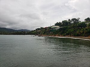
Yabucoa, Puerto Rico
Town and municipality in Puerto Rico
Distance: Approx. 16 meters
Latitude and longitude: 18.05055556,-65.87944444
Yabucoa (Spanish pronunciation: [ʝaβuˈkoa]) is a town and municipality in Puerto Rico located in the eastern region, north of Maunabo; south of San Lorenzo, Las Piedras and Humacao; and east of Patillas. Yabucoa is spread over 9 barrios and Yabucoa Pueblo (the downtown area and the administrative center of the city). It is part of the San Juan-Caguas-Guaynabo Metropolitan Statistical Area.
Limones River
River of Puerto Rico
Distance: Approx. 1306 meters
Latitude and longitude: 18.0621863,-65.88044
The Río Limones is a river located in Yabucoa, Puerto Rico.

Yabucoa Fire Station
Historic building in Yabucoa, Puerto Rico
Distance: Approx. 272 meters
Latitude and longitude: 18.05194444,-65.87722222
The Yabucoa Fire Station, at 22 Luis Munoz Rivera St. in Yabucoa, Puerto Rico, was built in 1943. It was listed on the National Register of Historic Places in 2013.

Emajagua
Barrio of Maunabo, Puerto Rico
Distance: Approx. 5057 meters
Latitude and longitude: 18.005136,-65.876821
Emajagua is a barrio in the municipality of Maunabo, Puerto Rico with a population of 4,538 in 2010.

Calabazas, Yabucoa, Puerto Rico
Barrio of Puerto Rico
Distance: Approx. 3487 meters
Latitude and longitude: 18.054533,-65.911968
Calabazas is a barrio in the municipality of Yabucoa, Puerto Rico. Its population in 2010 was 7,675.

Juan Martín, Yabucoa, Puerto Rico
Barrio of Puerto Rico
Distance: Approx. 2305 meters
Latitude and longitude: 18.059858,-65.859871
Juan Martín is a barrio in the municipality of Yabucoa, Puerto Rico. Its population in 2010 was 3,891.

Limones, Yabucoa, Puerto Rico
Barrio of Puerto Rico
Distance: Approx. 3435 meters
Latitude and longitude: 18.079995,-65.888839
Limones is a barrio in the municipality of Yabucoa, Puerto Rico. Its population in 2010 was 3,234.

Yabucoa barrio-pueblo
Historical and administrative center (seat) of Yabucoa, Puerto Rico
Distance: Approx. 365 meters
Latitude and longitude: 18.047304,-65.880083
Yabucoa barrio-pueblo is a barrio and the administrative center (seat) of Yabucoa, a municipality of Puerto Rico. Its population in 2010 was 2,593. As was customary in Spain, in Puerto Rico, the municipality has a barrio called pueblo which contains a central plaza, the municipal buildings (city hall), and a Catholic church.

Aguacate, Yabucoa, Puerto Rico
Barrio of Puerto Rico
Distance: Approx. 5076 meters
Latitude and longitude: 18.091475,-65.858257
Aguacate is a barrio in the municipality of Yabucoa, Puerto Rico. Its population in 2010 was 2,828.

Quebrada Arenas, Maunabo, Puerto Rico
Barrio of Puerto Rico
Distance: Approx. 3281 meters
Latitude and longitude: 18.025555,-65.895816
Quebrada Arenas is a barrio in the municipality of Maunabo, Puerto Rico. Its population in 2010 was 1,667.

Maunabo barrio-pueblo
Historical and administrative center (seat) of Maunabo, Puerto Rico
Distance: Approx. 5264 meters
Latitude and longitude: 18.007816,-65.90071
Maunabo barrio-pueblo is a barrio and the administrative center (seat) of Maunabo, a municipality of Puerto Rico. Its population in 2010 was 317. As was customary in Spain, in Puerto Rico, the municipality has a barrio called pueblo which contains a central plaza, the municipal buildings (city hall), and a Catholic church.

Talante
Barrio of Maunabo, Puerto Rico
Distance: Approx. 4121 meters
Latitude and longitude: 18.027204,-65.909553
Talante is a barrio in the municipality of Maunabo, Puerto Rico. Its population in 2010 was 1,381.
Weather in this IP's area
scattered clouds
23 Celsius
24 Celsius
22 Celsius
24 Celsius
1014 hPa
98 %
1014 hPa
1013 hPa
10000 meters
2.99 m/s
3.88 m/s
32 degree
36 %