67.206.200.114 - IP Lookup: Free IP Address Lookup, Postal Code Lookup, IP Location Lookup, IP ASN, Public IP
Country:
Region:
City:
Location:
Time Zone:
Postal Code:
IP information under different IP Channel
ip-api
Country
Region
City
ASN
Time Zone
ISP
Blacklist
Proxy
Latitude
Longitude
Postal
Route
Luminati
Country
City
hatillo
ASN
Time Zone
America/Puerto_Rico
ISP
OSNET
Latitude
Longitude
Postal
IPinfo
Country
Region
City
ASN
Time Zone
ISP
Blacklist
Proxy
Latitude
Longitude
Postal
Route
IP2Location
67.206.200.114Country
Region
toa baja
City
levittown
Time Zone
America/Puerto_Rico
ISP
Language
User-Agent
Latitude
Longitude
Postal
db-ip
Country
Region
City
ASN
Time Zone
ISP
Blacklist
Proxy
Latitude
Longitude
Postal
Route
ipdata
Country
Region
City
ASN
Time Zone
ISP
Blacklist
Proxy
Latitude
Longitude
Postal
Route
Popular places and events near this IP address

Levittown, Puerto Rico
Suburb of San Juan, Puerto Rico
Distance: Approx. 200 meters
Latitude and longitude: 18.44861111,-66.18027778
Levittown, a suburb in the municipality of Toa Baja, is one of the largest planned communities in Puerto Rico. Per the 2020 census, the population was 25,591. It is divided into eight sections called secciones (the eighth section was renamed Urb.

Puerto Rico National Cemetery
Historic veterans cemetery in Bayamón, Puerto Rico
Distance: Approx. 4481 meters
Latitude and longitude: 18.41222222,-66.16666667
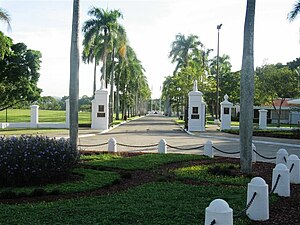
Puerto Rico National Cemetery is a United States national cemetery located in the city of Bayamón, in the Commonwealth of Puerto Rico. It encompasses 108.2 acres (43.8 ha) of land, and at the end of 2005, had 44,722 interments. Until 2021, it was the only United States National Cemetery in Puerto Rico.
Cocal River
River of Puerto Rico
Distance: Approx. 2672 meters
Latitude and longitude: 18.4680007,-66.1982227
The Cocal River (Spanish: Río Cocal) is a river of Dorado and Toa Baja in Puerto Rico.

Colegio De La Salle
Private school in Bayamón, Puerto Rico
Distance: Approx. 3816 meters
Latitude and longitude: 18.41833333,-66.1675
Colegio De La Salle is a Lasallian educational institution located in Bayamón, Puerto Rico. It is the only De La Salle institution open on the island. The other was located in Añasco but it is now closed.

Palmas, Cataño, Puerto Rico
Barrio of Puerto Rico
Distance: Approx. 3511 meters
Latitude and longitude: 18.444614,-66.148819
Palmas is a barrio in the municipality of Cataño, Puerto Rico. Its population in 2010 was 23,857.

Hato Tejas, Bayamón, Puerto Rico
Barrio of Puerto Rico
Distance: Approx. 4628 meters
Latitude and longitude: 18.408485,-66.177804
Hato Tejas is a barrio in the municipality of Bayamón, Puerto Rico. Its population in 2010 was 41,851.

Plaza Rio Hondo
Shopping mall in Bayamón, Puerto Rico
Distance: Approx. 3675 meters
Latitude and longitude: 18.42296,-66.16149
Plaza Rio Hondo is a shopping mall in Bayamón, Puerto Rico. It opened in 1982 and is anchored by Marshalls Megastore, Caribbean Cinemas, TJ Maxx, Best Buy, Golden Corral, Pueblo Supermarkets, Chili's Grill & Bar, Walgreens, and PetSmart.

1949 Strato-Freight Curtiss C-46A crash
Airplane crash in 1949 in Puerto Rico
Distance: Approx. 3180 meters
Latitude and longitude: 18.469,-66.204
On 7 June 1949, a Strato-Freight Curtiss Wright C-46D, registered in the United States as NC92857, crashed into the Atlantic Ocean 10 km (6.4 mi) west of San Juan-Isla Grande Airport in San Juan, Puerto Rico while en route to Miami, Florida. Of the 81 passengers and crew on board, 53 were killed.
Ermita Nuestra Señora de la Candelaria del Plantaje
Historic church in Toa Baja, Puerto Rico
Distance: Approx. 1934 meters
Latitude and longitude: 18.446711,-66.163592
The Ermita Nuestra Señora de la Candelaria del Plantaje (English: Chapel of Our Lady of Candlemas of the Broadleaf Plantain) is a former church (now ruins) in the municipality of Toa Baja, Puerto Rico. The ruins were listed on the U.S. National Register of Historic Places in 2015.

Sabana Seca
Barrio of Toa Baja, Puerto Rico
Distance: Approx. 1956 meters
Latitude and longitude: 18.44531,-66.199479
Sabana Seca is a barrio in the municipality of Toa Baja, Puerto Rico. Its population in 2010 was 53,192.
Bayamón Museum of Art
Art Museum in Bayamón, Puerto Rico
Distance: Approx. 4847 meters
Latitude and longitude: 18.4109,-66.1612
The Bayamón Museum of Art (Spanish: Museo de Arte de Bayamón) is a museum located in Bayamón, Puerto Rico. The museum is dedicated to exhibiting works of art from Puerto Rico.

Cathedral of Rum
Rum distillery in Cataño, Puerto Rico
Distance: Approx. 4319 meters
Latitude and longitude: 18.46054,-66.14227
The Cathedral of Rum in Cataño, Puerto Rico is the world's largest rum distillery. The Bacardi Distillery is located on 55 hectares (137 acres) and consists of forty-four buildings and structures, twenty-four of which contribute to its historical character. It can be accessed from and is located at the intersection of PR-165 and PR-888.
Weather in this IP's area
overcast clouds
23 Celsius
24 Celsius
22 Celsius
24 Celsius
1015 hPa
97 %
1015 hPa
1014 hPa
10000 meters
2.75 m/s
3.69 m/s
98 degree
93 %