67.204.5.241 - IP Lookup: Free IP Address Lookup, Postal Code Lookup, IP Location Lookup, IP ASN, Public IP
Country:
Region:
City:
Location:
Time Zone:
Postal Code:
IP information under different IP Channel
ip-api
Country
Region
City
ASN
Time Zone
ISP
Blacklist
Proxy
Latitude
Longitude
Postal
Route
Luminati
Country
Region
tx
City
wallisville
ASN
Time Zone
America/Chicago
ISP
FIBER-64
Latitude
Longitude
Postal
IPinfo
Country
Region
City
ASN
Time Zone
ISP
Blacklist
Proxy
Latitude
Longitude
Postal
Route
IP2Location
67.204.5.241Country
Region
texas
City
portland
Time Zone
America/Chicago
ISP
Language
User-Agent
Latitude
Longitude
Postal
db-ip
Country
Region
City
ASN
Time Zone
ISP
Blacklist
Proxy
Latitude
Longitude
Postal
Route
ipdata
Country
Region
City
ASN
Time Zone
ISP
Blacklist
Proxy
Latitude
Longitude
Postal
Route
Popular places and events near this IP address

Doyle, Texas
Former census-designated place in Texas, United States
Distance: Approx. 2139 meters
Latitude and longitude: 27.88638889,-97.34305556
Doyle is a former census-designated place (CDP) in San Patricio County, Texas, United States. The population was 254 at the 2010 census.

Gregory, Texas
City in Texas, United States
Distance: Approx. 5721 meters
Latitude and longitude: 27.92055556,-97.2925
Gregory is a city in San Patricio County, Texas, United States. The population was 1,740 at the 2020 census.

Portland, Texas
City in Texas, United States
Distance: Approx. 720 meters
Latitude and longitude: 27.88305556,-97.32055556
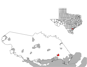
Portland is a city primarily located in San Patricio County with some water bodies extending into Nueces County in the U.S. state of Texas. Its population was 20,383 as of the 2020 United States census. Current population calculated by the City of Portland is 22,783.

USS Lexington (CV-16)
Essex-class aircraft carrier of the US Navy
Distance: Approx. 9416 meters
Latitude and longitude: 27.815,-97.38861111
USS Lexington (CV/CVA/CVS/CVT/AVT-16) is an Essex-class aircraft carrier built during World War II for the United States Navy. Originally intended to be named Cabot, the new aircraft carrier was renamed while under construction to commemorate the recently-lost USS Lexington (CV-2), becoming the sixth U.S. Navy ship to bear the name in honor of the Battle of Lexington. Lexington was commissioned in February 1943 and saw extensive service through the Pacific War.
Gregory-Portland High School
Public school in Texas, United States
Distance: Approx. 3041 meters
Latitude and longitude: 27.904524,-97.321388
Gregory-Portland High School is a 5A secondary school in Portland, Texas and is a part of the Gregory-Portland Independent School District in southeastern San Patricio County. In addition to Portland, the school also serves the city of Gregory as well as the census-designated place of Tradewinds. The new Gregory-Portland High School was completed in the fall of 2002.

Texas State Aquarium
Aquarium in Corpus Christi, Texas, United States
Distance: Approx. 9750 meters
Latitude and longitude: 27.81388889,-97.39222222
The Texas State Aquarium is a nonprofit aquarium located in Corpus Christi, Texas, United States. The aquarium aims to promote environmental conservation and rehabilitation of the wildlife of the Gulf of Mexico and has been accredited by the Association of Zoos and Aquariums (AZA) since 1995. Currently the largest aquarium in Texas and also one of the largest aquaria in the United States.
KCTA
Christian talk station in Corpus Christi, Texas
Distance: Approx. 8853 meters
Latitude and longitude: 27.93305556,-97.25972222
KCTA (1030 kHz) is a commercial AM radio station in Corpus Christi, Texas. It airs a Christian talk and teaching radio format and is owned by the Broadcasting Corporation of the Southwest. National religious leaders heard on KCTA include Alistair Begg, Jim Daly, Charles Stanley, Chuck Swindoll, John MacArthur, Adrian Rogers and Erwin Lutzer.
Hunt Airport
Airport in San Patricio County, Texas
Distance: Approx. 2633 meters
Latitude and longitude: 27.88694444,-97.34833333
Hunt Airport (FAA LID: 9R5) is a privately owned, public use airport in San Patricio County, Texas, United States. It is located two nautical miles (4 km) northwest of the central business district of Portland, Texas.
Rincon Point (Texas)
Distance: Approx. 7134 meters
Latitude and longitude: 27.83583333,-97.37916667
Rincon Point, is a cape in Nueces County, Texas. It lies north of Corpus Christi, Texas between Nueces Bay and Corpus Christi Bay.
Weather in this IP's area
light rain
21 Celsius
22 Celsius
20 Celsius
22 Celsius
1014 hPa
91 %
1014 hPa
1012 hPa
10000 meters
3.6 m/s
250 degree
40 %