67.201.10.163 - IP Lookup: Free IP Address Lookup, Postal Code Lookup, IP Location Lookup, IP ASN, Public IP
Country:
 USA
USARegion:
City:
Location:
Time Zone:
Postal Code:
ISP:
ASN:
language:
User-Agent:
Proxy IP:
Blacklist:
IP information under different IP Channel
ip-api
Country
Region
City
ASN
Time Zone
ISP
Blacklist
Proxy
Latitude
Longitude
Postal
Route
db-ip
Country
Region
City
ASN
Time Zone
ISP
Blacklist
Proxy
Latitude
Longitude
Postal
Route
IPinfo
Country
Region
City
ASN
Time Zone
ISP
Blacklist
Proxy
Latitude
Longitude
Postal
Route
IP2Location
67.201.10.163Country
usRegion
california
City
pacific palisades
Time Zone
America/Los_Angeles
ISP
Language
User-Agent
Latitude
Longitude
Postal
ipdata
Country
Region
City
ASN
Time Zone
ISP
Blacklist
Proxy
Latitude
Longitude
Postal
Route
Popular places and events near this IP address

Pacific Palisades, Los Angeles
Neighborhood in California, US
Distance: Approx. 893 meters
Latitude and longitude: 34.04805556,-118.52694444
Pacific Palisades is a neighborhood in the Westside region of the city of Los Angeles, California, situated about 20 miles (32 km) west of downtown Los Angeles. From January 7-31, 2025, the majority of Pacific Palisades was severely affected and destroyed by the Palisades Fire, a part of the wider Southern California wildfires. Pacific Palisades was founded in 1921 by a Methodist organization.

Self-Realization Fellowship Lake Shrine
Spiritual shrine in Pacific Palisades, California, US
Distance: Approx. 1717 meters
Latitude and longitude: 34.042738,-118.55235
The Self-Realization Fellowship Lake Shrine lies a few blocks from the Pacific Ocean, on Sunset Boulevard in Pacific Palisades, California. It was founded and dedicated by Paramahansa Yogananda, on August 20, 1950, and is owned by the Self-Realization Fellowship. The 10-acre (40,000 m2) site has lush gardens, a large spring-fed lake framed by hillsides, and a variety of flora and fauna, swans, ducks, koi, turtles, and lotus flowers.

Palisades Charter High School
Public, charter school in California, US
Distance: Approx. 553 meters
Latitude and longitude: 34.04777778,-118.53111111
Palisades Charter High School (usually colloquially known as Pali or Pali High and abbreviated as PCHS) is an independent charter secondary school in Los Angeles, United States. The high school serves the neighborhoods of Pacific Palisades, Palisades Highlands, Kenter Canyon, and portions of Brentwood (including Brentwood Circle). Residents in Topanga, an unincorporated section of Los Angeles County, may attend Palisades or William Howard Taft Charter High School.

Rancho Boca de Santa Mónica
Pre-statehood California land grant
Distance: Approx. 1837 meters
Latitude and longitude: 34.06,-118.52
Rancho Boca de Santa Mónica was a 6,656-acre (26.94 km2) Mexican land grant in present-day Los Angeles County, California given by governor Juan Alvarado in 1839 to Ysidro Reyes and Francisco Marquez.
Villa Aurora
House in Pacific Palisades, California, United States
Distance: Approx. 1883 meters
Latitude and longitude: 34.04626,-118.55599
The Villa Aurora at 520 Paseo Miramar is located in Pacific Palisades, Los Angeles and has been transformed into an artists' residence since 1995. It is the former home of the German Jewish author Lion Feuchtwanger and his wife Marta. The Feuchtwangers bought this Spanish-style mansion in 1943.
Bel-Air Bay Club
Distance: Approx. 1427 meters
Latitude and longitude: 34.04038889,-118.54586111
The Bel-Air Bay Club is both an event venue (Upper Club) and a private beach club (Lower Club) located in Pacific Palisades, Los Angeles, California. The Upper Club, includes an ocean view and on-site accommodations available for private parties. The interior of the Bel-Air Bay Club Upper Club includes large windows, a fireplace, and iron chandeliers.
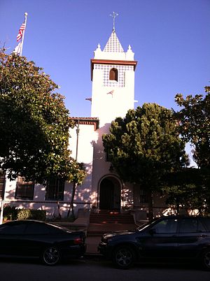
Kehillat Israel
Reconstructionist Jewish synagogue
Distance: Approx. 228 meters
Latitude and longitude: 34.048919,-118.534486
Kehillat Israel is a Reconstructionist synagogue located in Pacific Palisades, Los Angeles, California, in the United States. It is one of two Reconstructionist synagogues in greater Los Angeles (the other being the Malibu Jewish Center and Synagogue). Its senior rabbi is Amy Bernstein.

Pacific Palisades Business Block
Historic building in Los Angeles, California
Distance: Approx. 997 meters
Latitude and longitude: 34.0472,-118.5261
The Business Block Building was a historic building located in Pacific Palisades, California, that was designed by architect Clifton Nourse and dedicated in 1924. The building was 30,000 square feet (2,800 m2) and sat on 36,000 square feet (3,300 m2) of land. The Business Block building was located between Antioch, Swarthmore and Sunset in the Village neighborhood of Pacific Palisades, an area in the Westside of Los Angeles.
Palisades Village
Shopping mall in Pacific Palisades, California
Distance: Approx. 1082 meters
Latitude and longitude: 34.0475,-118.525
Palisades Village is a local shopping village located in Pacific Palisades, California, in the downtown area of the neighborhood known as the "Village", from which the shopping center derives its name.

Bernheimer Gardens
Tourist attraction in California
Distance: Approx. 1484 meters
Latitude and longitude: 34.0418,-118.5485
The Bernheimer Gardens were 8-acre (350,000 sq ft; 32,000 m2; 3.2 ha) 20th-century formal gardens in California in the United States that showcased a private collection of bronze statues from Asia. The gardens were open to the public at (corner of Marquez Street) in Pacific Palisades, Los Angeles, below what is now the Sunset Highlands neighborhood, from 1928 until 1944. The gardens also featured Asian-influenced plantings and tea houses, presumably chashitsu.
Palisades Charter Elementary School
Public, charter school in California, US
Distance: Approx. 991 meters
Latitude and longitude: 34.04535174,-118.52734894
Palisades Elementary Charter School (known colloquially as Pali Elem) is an elementary charter school in Pacific Palisades, California, part of the Los Angeles Unified School District. Also known as Palisades Elementary and Palisades Charter Elementary, the school opened in 1922. The historic administration building, designed in Spanish Colonial Revival style, was built in 1930.

Pacific Palisades Bowl Mobile Estates
Neighborhood of Los Angeles, California, United States of America
Distance: Approx. 1358 meters
Latitude and longitude: 34.03833333,-118.53833333
The Pacific Palisades Bowl Mobile Estates was a community of 172 manufactured and mobile homes in the Pacific Palisades neighborhood of Los Angeles, California. It featured recreational facilities and a pool, and was one of the only affordable housing options in the Pacific Palisades. The community was destroyed in the Palisades Fire of 2025.
Weather in this IP's area
fog
14 Celsius
14 Celsius
12 Celsius
17 Celsius
1016 hPa
85 %
1016 hPa
996 hPa
402 meters
4.12 m/s
260 degree
100 %