67.118.194.78 - IP Lookup: Free IP Address Lookup, Postal Code Lookup, IP Location Lookup, IP ASN, Public IP
Country:
Region:
City:
Location:
Time Zone:
Postal Code:
ISP:
ASN:
language:
User-Agent:
Proxy IP:
Blacklist:
IP information under different IP Channel
ip-api
Country
Region
City
ASN
Time Zone
ISP
Blacklist
Proxy
Latitude
Longitude
Postal
Route
db-ip
Country
Region
City
ASN
Time Zone
ISP
Blacklist
Proxy
Latitude
Longitude
Postal
Route
IPinfo
Country
Region
City
ASN
Time Zone
ISP
Blacklist
Proxy
Latitude
Longitude
Postal
Route
IP2Location
67.118.194.78Country
Region
california
City
merced
Time Zone
America/Los_Angeles
ISP
Language
User-Agent
Latitude
Longitude
Postal
ipdata
Country
Region
City
ASN
Time Zone
ISP
Blacklist
Proxy
Latitude
Longitude
Postal
Route
Popular places and events near this IP address

Merced, California
City in California, United States
Distance: Approx. 1035 meters
Latitude and longitude: 37.3,-120.48333333
Merced (; Spanish for "Mercy") is a city in, and the county seat of, Merced County, California, United States, in the San Joaquin Valley. As of the 2020 census, the city had a population of 86,333, up from 78,958 in 2010. Incorporated on April 1, 1889, Merced is a charter city that operates under a council–manager government.

Merced station (Amtrak)
Railroad station in Merced, California, US
Distance: Approx. 1018 meters
Latitude and longitude: 37.3073,-120.4768
Merced station is an intercity rail station located in Merced, California, United States. The station is served by seven daily round trips of the San Joaquins and is a transfer point between trains and Yosemite Area Regional Transportation System (YARTS) buses serving Yosemite National Park. Merced station has side platforms adjacent to the tracks of the BNSF Railway Stockton Subdivision.

Leggett House (Merced, California)
Historic house in California, United States
Distance: Approx. 873 meters
Latitude and longitude: 37.30527778,-120.47777778
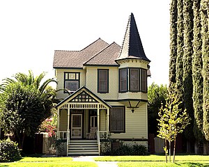
The Leggett House in Merced, California, also known as Queen Anne Inn, is a historic house located at 352 W. 22nd St. in Merced, California. The house was built in the Queen Anne style of Victorian architecture.
Merced Theatre (Merced, California)
United States historic place
Distance: Approx. 787 meters
Latitude and longitude: 37.30052918,-120.4804033
The Merced Theatre is located at 301 W. Main Street, at the corner of Main Street and Martin Luther King Way, in Merced, California. The theatre is significant both for its role as the social and cultural center of Merced from the Depression through the post World War II era and for its mix of Art Deco and Spanish Colonial Revival architecture. The property was added to the National Register of Historic Places (NRHP) on May 1, 2009 and the listing was announced as the featured listing in the National Park Service's weekly list of June 5, 2009.

Merced County Courthouse
United States historic place
Distance: Approx. 1292 meters
Latitude and longitude: 37.30611111,-120.48333333
The Merced County Courthouse is the historic county courthouse in Merced County, California. Located at the intersection of W. 21st and N Streets in Merced, the building served as Merced County's courthouse from 1875 until 1975. A. A. Bennett, an architect who also worked on the California State Capitol, designed the building.

Thomas H. Leggett House
Historic house in California, United States
Distance: Approx. 836 meters
Latitude and longitude: 37.30444444,-120.47833333
The Thomas H. Leggett House is a historic house located at 346 W. 21st St. in Merced, California. Built circa 1890, the house is designed in the Queen Anne style and also features elements of the Stick and Eastlake style.

Tioga Hotel
United States historic place
Distance: Approx. 1275 meters
Latitude and longitude: 37.30222222,-120.48555556
The Tioga Hotel is a historic hotel building located at 1715 N St. in Merced, California. Built in 1928, the hotel is the largest building in Merced.

United States Post Office (Merced, California)
United States historic place
Distance: Approx. 858 meters
Latitude and longitude: 37.30222222,-120.48055556
The Bell Station, also known as the Federal Building, is a U.S. post office located at 401 W. 18th St. in Merced, California. The post office was built in 1933 as part of a public works program started by Herbert Hoover.

Merced County High School
Public high school in Merced, California, United States
Distance: Approx. 1283 meters
Latitude and longitude: 37.3066,-120.4827
Merced County High School, also known as the County Library Building, is a historic building located at 2125 M St. in Merced, California, United States. Built in 1897, the school was the first public high school in Merced County.

Bank of Italy, Merced
United States historic place
Distance: Approx. 1022 meters
Latitude and longitude: 37.30166667,-120.48277778
The Bank of Italy is a historic bank building located at the intersection of Main and Canal Streets in Merced, California. Opened in 1928, the bank was Merced's branch of the Bank of Italy. Henry A. Minton designed the building in the Classical Revival style.

Maj. George Beecher Cook House
Historic house in California, United States
Distance: Approx. 858 meters
Latitude and longitude: 37.30472222,-120.47833333
The Maj. George Beecher Cook House is a historic house located at 356 W. 21st St. in Merced, California.
Kaehler–Rector House
Historic house in California, United States
Distance: Approx. 1146 meters
Latitude and longitude: 37.30861111,-120.47666667
The Kaehler–Rector House is a historic house located at 408 W. 25th St. in Merced, California. Built in the early 1890s, the house was designed by architect Louis Wegner in the Queen Anne style.
Weather in this IP's area
clear sky
6 Celsius
6 Celsius
6 Celsius
6 Celsius
1025 hPa
79 %
1025 hPa
1018 hPa
10000 meters
1.21 m/s
1.14 m/s
84 degree

