66.97.28.43 - IP Lookup: Free IP Address Lookup, Postal Code Lookup, IP Location Lookup, IP ASN, Public IP
Country:
Region:
City:
Location:
Time Zone:
Postal Code:
ISP:
ASN:
language:
User-Agent:
Proxy IP:
Blacklist:
IP information under different IP Channel
ip-api
Country
Region
City
ASN
Time Zone
ISP
Blacklist
Proxy
Latitude
Longitude
Postal
Route
db-ip
Country
Region
City
ASN
Time Zone
ISP
Blacklist
Proxy
Latitude
Longitude
Postal
Route
IPinfo
Country
Region
City
ASN
Time Zone
ISP
Blacklist
Proxy
Latitude
Longitude
Postal
Route
IP2Location
66.97.28.43Country
Region
ontario
City
toronto
Time Zone
America/Toronto
ISP
Language
User-Agent
Latitude
Longitude
Postal
ipdata
Country
Region
City
ASN
Time Zone
ISP
Blacklist
Proxy
Latitude
Longitude
Postal
Route
Popular places and events near this IP address

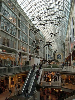
Toronto Eaton Centre
Shopping mall and office complex in Toronto, Ontario, Canada
Distance: Approx. 122 meters
Latitude and longitude: 43.65388889,-79.38027778
CF Toronto Eaton Centre, commonly referred to simply as the Eaton Centre, is a shopping mall and office complex in the downtown core of Toronto, Ontario, Canada. It is owned and managed by Cadillac Fairview (CF). It was named after the Eaton's department store chain that once anchored it before the chain went defunct in the late 1990s.

Massey Hall
Concert hall in Toronto, Canada
Distance: Approx. 133 meters
Latitude and longitude: 43.65416667,-79.37902778
Massey Hall is a performing arts theatre in Toronto, Ontario, Canada. Opened in 1894, it is known for its outstanding acoustics and was the long-time hall of the Toronto Symphony Orchestra. An intimate theatre, it was originally designed to seat 3,500 patrons, but after extensive renovations in the 1940s, it now seats only up to 2,765.

Queen station
Toronto subway station
Distance: Approx. 25 meters
Latitude and longitude: 43.65277778,-79.37944444
Queen is a subway station on Line 1 Yonge–University in Toronto, Ontario, Canada. It is located under Yonge Street north from Queen Street to Shuter Street. Wi-Fi service is available at this station.

Colonial Tavern
Canadian jazz venue
Distance: Approx. 45 meters
Latitude and longitude: 43.6534,-79.3794
The Colonial Tavern was one of the most famous jazz venues in Canada from the 1950s till its closure in the late 1970s. It was located at 201–203 Yonge Street in Toronto, Ontario (now an open lot between 197 Yonge Street and 205 Yonge Street) where a historic plaque (now removed) remembered this key jazz venue. The Colonial Tavern was owned and managed by brothers-in-law Mike (Myer) G. Lawrence, Goodwin (Goody) and Harvey Lichtenberg.

Elgin and Winter Garden Theatres
Theatres in Toronto, Ontario
Distance: Approx. 20 meters
Latitude and longitude: 43.65305556,-79.37916667
The Elgin & Winter Garden Theatres are a pair of stacked theatres in Toronto, Ontario, Canada. The Winter Garden Theatre is seven storeys above the Elgin Theatre. They are the last surviving Edwardian stacked theatres in the world.

205 Yonge Street
Distance: Approx. 66 meters
Latitude and longitude: 43.653584,-79.379512
205 Yonge Street was formerly a four-story Bank of Toronto building built in 1905 in Toronto, Ontario, Canada. It was designated under the Ontario Heritage Act in 1975. The E. J. Lennox-designed structure has a domed roof and Corinthian columns on the front, and it is an example of neoclassical architecture.

197 Yonge Street
Historical property in Ontario, Canada
Distance: Approx. 32 meters
Latitude and longitude: 43.653278,-79.379295
The historic building at 197–199 Yonge Street was formerly a four-floor Canadian Bank of Commerce building built in 1905 by architects Darling and Pearson and declared as a historical property by the City of Toronto, Ontario, Canada in 1974. The bank left the building in 1987. The bank address was 199 Yonge Street, the numbers still showing above the entrance.

F. W. Woolworth Building (Toronto)
Distance: Approx. 49 meters
Latitude and longitude: 43.65259,-79.379619
The Jamieson Building (also known as the Woolworth building) was built in 1895 at the north-west corner of Queen Street West and Yonge Street in downtown Toronto. It is adjacent to the Toronto Eaton Centre. A distinctive feature of the building is the curved façade at its corner.

Hudson's Bay Queen Street
Building in Toronto, Ontario
Distance: Approx. 118 meters
Latitude and longitude: 43.65194444,-79.37944444
Hudson's Bay Queen Street is a building complex on the southwest corner of Yonge Street and Queen Street West in downtown Toronto, Ontario, Canada. It was originally named the Simpson's Department Store, and operated as the flagship store of the Simpsons department store chain from 1895–1991. It became a flagship store of its successor, The Bay, in 1991 (rebranded to Hudson's Bay in 2013).

Massey Tower
Building complex in Toronto, Ontario, Canada
Distance: Approx. 58 meters
Latitude and longitude: 43.6535,-79.37921
Massey Tower is a condo complex in Toronto, Ontario, Canada, spanning the block below Shuter Street, between Yonge and Victoria streets. The complex's northeast corner added much-needed backstage space to historic Massey Hall. To the south of the complex lies the historic Elgin and Winter Garden Theatres.

Flight Stop
Art installation in Toronto
Distance: Approx. 68 meters
Latitude and longitude: 43.6528,-79.3802
Flight Stop, also titled Flightstop, is a 1979 site-specific art work by Canadian artist Michael Snow. Located in the Toronto Eaton Centre in the downtown core of Toronto, Ontario, Canada, the work hangs from the ceiling and appears to depict sixty Canada geese in flight. Each individual goose is made of Styrofoam covered in fibreglass and covered in a sheath made from photographs taken from a single goose.

John E. Thompson block
Distance: Approx. 116 meters
Latitude and longitude: 43.65403,-79.37958
The John E. Thompson block is a heritage structure at the corner of Yonge and Shuter streets in Toronto, Ontario, Canada. It was built in 1894, and renovated in 1904 and 1920. In 1900 it housed the Yonge Street Mission.
Weather in this IP's area
broken clouds
-4 Celsius
-11 Celsius
-4 Celsius
-3 Celsius
1017 hPa
69 %
1017 hPa
1003 hPa
10000 meters
10.73 m/s
14.31 m/s
240 degree
75 %