66.97.242.48 - IP Lookup: Free IP Address Lookup, Postal Code Lookup, IP Location Lookup, IP ASN, Public IP
Country:
 USA
USARegion:
City:
Location:
Time Zone:
Postal Code:
ISP:
ASN:
language:
User-Agent:
Proxy IP:
Blacklist:
IP information under different IP Channel
ip-api
Country
Region
City
ASN
Time Zone
ISP
Blacklist
Proxy
Latitude
Longitude
Postal
Route
db-ip
Country
Region
City
ASN
Time Zone
ISP
Blacklist
Proxy
Latitude
Longitude
Postal
Route
IPinfo
Country
Region
City
ASN
Time Zone
ISP
Blacklist
Proxy
Latitude
Longitude
Postal
Route
IP2Location
66.97.242.48Country
usRegion
north dakota
City
medora
Time Zone
America/Denver
ISP
Language
User-Agent
Latitude
Longitude
Postal
ipdata
Country
Region
City
ASN
Time Zone
ISP
Blacklist
Proxy
Latitude
Longitude
Postal
Route
Popular places and events near this IP address
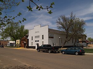
Medora, North Dakota
City in North Dakota, United States
Distance: Approx. 198 meters
Latitude and longitude: 46.91222222,-103.52527778
Medora (, mih-DOR-ə) is a city in Billings County, North Dakota, United States. The only incorporated place in Billings County, it is also the county seat. Much of the surrounding area is part of either Little Missouri National Grassland or Theodore Roosevelt National Park.

Medora Musical
1965 musical
Distance: Approx. 1610 meters
Latitude and longitude: 46.91444444,-103.54555556
The Medora Musical is a musical revue produced each summer at the open-air Burning Hills Amphitheater near Medora, North Dakota. The musical is a look back at the "Wild West" days of the region and includes references to Theodore Roosevelt, who spent time in western North Dakota, including in the nearby Theodore Roosevelt National Park. The musical premiered at the amphitheater in the summer of 1965 and is the successor to earlier shows about Roosevelt.

Chateau de Mores
Historic house in North Dakota, United States
Distance: Approx. 690 meters
Latitude and longitude: 46.91111111,-103.5325
The Chateau de Mores in Medora, North Dakota, United States, is a historic home built by the Marquis de Mores in 1883 as a hunting lodge and summer home for his family and guests. The home is now part of the 128-acre (0.52 km2) Chateau de Mores State Historic Site, which also includes Chimney Park and de Mores Memorial Park.

Theodore Roosevelt's Maltese Cross Cabin
Cabin used by Theodore Roosevelt
Distance: Approx. 361 meters
Latitude and longitude: 46.9169,-103.5262
The Maltese Cross Cabin is a cabin that was used by Theodore Roosevelt, before he was President. The cabin is currently located at the visitor center at Theodore Roosevelt National Park, just outside the town of Medora, North Dakota.

Billings County Courthouse
United States historic place
Distance: Approx. 207 meters
Latitude and longitude: 46.91277778,-103.52222222
The Billings County Courthouse in Medora, North Dakota was built c.1880 and was remodeled in 1913 with architect John Tester. It was listed on the National Register of Historic Places in 1977. According to its NRHP nomination, the courthouse "symbolizes the orderly administration of justice in a county which is one of the least populated in North Dakota.

De Mores Packing Plant Ruins
United States historic place
Distance: Approx. 380 meters
Latitude and longitude: 46.9162,-103.5281
The De Mores Packing Plant Ruins near Medora in Billings County, North Dakota, is a historic site listed on the National Register of Historic Places (NRHP). The site is now preserved as Chimney Park, the largest open space within Medora's city limits.

Von Hoffman House
Historic house in North Dakota, United States
Distance: Approx. 229 meters
Latitude and longitude: 46.91388889,-103.52138889
The Von Hoffman House at Broadway and 5th St. in Medora, North Dakota was built in 1884. It was listed on the National Register of Historic Places in 1977.

Peaceful Valley Ranch
United States historic place
Distance: Approx. 5252 meters
Latitude and longitude: 46.95888889,-103.50361111
Peaceful Valley Ranch is about 3 miles (4.8 km) from the town of Medora, North Dakota in the South Unit of Theodore Roosevelt National Park, in western North Dakota. The ranch dates from 1885, when Benjamin Lamb bought the land and built its first buildings. After operating as a ranch, primarily raising horses, the ranch was developed by the Olsen family as a dude ranch before it was acquired by the National Park Service, and incorporated into the Roosevelt Recreation Demonstration Area, which eventually became the present national park.

St. Mary's Catholic Church (Medora, North Dakota)
Historic church in North Dakota, United States
Distance: Approx. 176 meters
Latitude and longitude: 46.91444444,-103.52222222
The St. Mary's Catholic Church in Medora, North Dakota was built in 1884 by Peter Book, a builder who also constructed the Von Hoffman House. It was listed on the National Register of Historic Places in 1977.

Rough Rider State Park
Park in North Dakota, USA
Distance: Approx. 2324 meters
Latitude and longitude: 46.89583333,-103.53972222
Rough Rider State Park is a public recreation area located along the eastern banks of the Little Missouri River about two miles (3.2 km) south of Medora in Billings County, North Dakota. The state park is used for camping, horse camping, and canoeing. The Rough Riders was a nickname given to the 1st United States Volunteer Cavalry when it was led by Theodore Roosevelt.

De Mores Memorial Park
United States historic place
Distance: Approx. 231 meters
Latitude and longitude: 46.91361111,-103.52138889
The De Mores Memorial Park in Medora, North Dakota was listed on the National Register of Historic Places in 2019. The park is located in downtown Medora and is about .25 acres (0.10 ha) in size. It includes a 1926 bronze statue of the Marquis de Mores, donated by his sons.
Theodore Roosevelt Presidential Library
Presidential library and museum
Distance: Approx. 2130 meters
Latitude and longitude: 46.91611111,-103.55222222
The Theodore Roosevelt Presidential Library is a planned museum focused on the life and legacy of Theodore Roosevelt, the 26th president of the United States. It is to be constructed at a site to the west of Medora, North Dakota, near Theodore Roosevelt National Park, which preserves sites associated with Roosevelt's travel in North Dakota between 1883 and 1887. A site in the Badlands of Medora was selected in 2020, as well as the design architect Snøhetta and the architect of record JLG Architects.
Weather in this IP's area
light snow
-8 Celsius
-14 Celsius
-8 Celsius
-8 Celsius
1020 hPa
79 %
1020 hPa
924 hPa
3.77 m/s
4.57 m/s
44 degree
100 %