66.97.231.223 - IP Lookup: Free IP Address Lookup, Postal Code Lookup, IP Location Lookup, IP ASN, Public IP
Country:
Region:
City:
Location:
Time Zone:
Postal Code:
IP information under different IP Channel
ip-api
Country
Region
City
ASN
Time Zone
ISP
Blacklist
Proxy
Latitude
Longitude
Postal
Route
Luminati
Country
Region
nd
City
watfordcity
ASN
Time Zone
America/Chicago
ISP
DCN-AS
Latitude
Longitude
Postal
IPinfo
Country
Region
City
ASN
Time Zone
ISP
Blacklist
Proxy
Latitude
Longitude
Postal
Route
IP2Location
66.97.231.223Country
Region
north dakota
City
minot
Time Zone
America/Chicago
ISP
Language
User-Agent
Latitude
Longitude
Postal
db-ip
Country
Region
City
ASN
Time Zone
ISP
Blacklist
Proxy
Latitude
Longitude
Postal
Route
ipdata
Country
Region
City
ASN
Time Zone
ISP
Blacklist
Proxy
Latitude
Longitude
Postal
Route
Popular places and events near this IP address
Minot Municipal Auditorium
Building in North Dakota, United States
Distance: Approx. 724 meters
Latitude and longitude: 48.23361111,-101.29916667
The Minot Municipal Auditorium is a 5,000-seat multi-purpose arena in Downtown Minot, North Dakota. It was built in 1954. It hosts conventions and sporting events, primarily basketball, and competes with the MSU Dome and All Seasons Arena for local events.
Minot High School
Public school in Minot, North Dakota, U.S.
Distance: Approx. 440 meters
Latitude and longitude: 48.227,-101.31
Minot High School (MHS) is a public high school in Minot, North Dakota, and serves the majority of the city. A second public high school, Minot North, opened in August 2024 with students from the northern portion of the city and Minot Air Force Base, thirteen miles (21 km) north. Previously, MHS was divided between two main campuses: Magic City (1974, grades 11–12) and Central (1918, grades 9–10).
Minot Park District
Distance: Approx. 917 meters
Latitude and longitude: 48.2325,-101.29583333
The Minot Park District is the unit of the Minot, North Dakota municipal government responsible for maintaining city parks. The District is managed by a board of five directors elected by city voters to four year terms. The district also serves as the local forestry service, trimming and planting trees across the city.

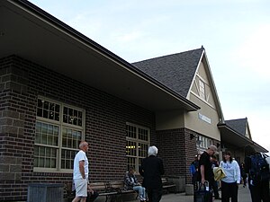
Minot station
Train station in Minot, North Dakota
Distance: Approx. 909 meters
Latitude and longitude: 48.2361,-101.2987
Minot station is a train station in Minot, North Dakota served by Amtrak, the national railroad passenger system. The station is located at the site of the former Great Northern Railway station, adjacent to the Minot Public Library, and close to Minot's City Hall and Downtown Minot. Minot is a service stop for Amtrak's daily Empire Builder, which also serves six other cities in North Dakota.
Sigdal House
Distance: Approx. 925 meters
Latitude and longitude: 48.22611111,-101.2975
Sigdal House is an historic Norwegian log home which was relocated to Minot, North Dakota. The Sigdal House is a 230-year-old house originally from the Vatnas area of Sigdal, Norway. It is located in the Scandinavian Heritage Park situated in the Upper Brooklyn neighborhood of Minot, North Dakota.

Scandinavian Heritage Park
Park in Minot, North Dakota
Distance: Approx. 925 meters
Latitude and longitude: 48.22611111,-101.2975
Scandinavian Heritage Park is a park located in the Upper Brooklyn neighborhood of Minot, North Dakota. Scandinavian Heritage Park features remembrances and replicas from each of the Scandinavian countries: Norway, Sweden and Denmark, as well as Finland and Iceland. The park was established during 1988 to celebrate and preserve Scandinavian heritage.

Bruce M. Van Sickle Federal Building and U.S. Courthouse
United States historic place
Distance: Approx. 1158 meters
Latitude and longitude: 48.23444444,-101.29333333
The Bruce M. Van Sickle Federal Building and U.S. Courthouse is a historic courthouse and post office in Downtown Minot, North Dakota. Built in 1915, its design is credited to Oscar Wenderoth. Since the post office relocated, it is officially known as the Judge Bruce M. Van Sickle Federal Building and U.S. Courthouse or the Van Sickle Federal Building.

Andrew Carr Sr. House
Historic house in North Dakota, United States
Distance: Approx. 1162 meters
Latitude and longitude: 48.24027778,-101.30166667
The Andrew Carr Sr. House on 4th Ave., NW, in Minot, North Dakota was designed by William Zimmerman in Classical Revival architecture. It was listed on the National Register of Historic Places in 1984.

Minot Commercial Historic District
Historic district in North Dakota, United States
Distance: Approx. 1181 meters
Latitude and longitude: 48.23448,-101.29302
The Minot Commercial Historic District is a 103-acre (42 ha) historic district in Minot, North Dakota that was listed on the National Register of Historic Places in 1980. It includes Classical Revival, Early Commercial, and Late Victorian. The listing included 40 contributing buildings.

Upper Brooklyn
Distance: Approx. 683 meters
Latitude and longitude: 48.22944444,-101.29888889
Upper Brooklyn or Brooklyn Heights is a neighborhood on South Hill in Minot, North Dakota. The neighborhood consists of the sections of the Brooklyn Addition that are not part of Downtown Minot. The High Third neighborhood, the Lower Brooklyn neighborhood and the area around the Minot Municipal Auditorium, which were part of the Brooklyn Addition, are considered part of the downtown area.

Minot Public Library
Public library in Minot, North Dakota
Distance: Approx. 657 meters
Latitude and longitude: 48.234482,-101.301101
The Minot Public Library is a public library in Minot, North Dakota, at the western edge of Downtown Minot.
West Oaks
Distance: Approx. 646 meters
Latitude and longitude: 48.23479,-101.31408
West Oaks is a neighborhood in Minot, North Dakota. The neighborhood is bounded by Oak Park to the North, the Souris River to the east, the Soo Line Railroad tracks to the south and Sixteenth Street SW. The neighborhood is home to the West Oaks Animal Hospital, the West Oaks Apartments, Harleys Automotive Center and gas station, Eagles Wings Community Fellowship and a number of single family homes. Oak Park's south entrance is located in the neighborhood on Oak Drive SW. A thin strip of land between the Oak Park Oxbow and the Souris River connects the park with the neighborhood.
Weather in this IP's area
clear sky
-26 Celsius
-33 Celsius
-26 Celsius
-26 Celsius
1039 hPa
84 %
1039 hPa
972 hPa
10000 meters
2.57 m/s
80 degree