Country:
Region:
City:
Latitude and Longitude:
Time Zone:
Postal Code:
IP information under different IP Channel
ip-api
Country
Region
City
ASN
Time Zone
ISP
Blacklist
Proxy
Latitude
Longitude
Postal
Route
Luminati
Country
ASN
Time Zone
America/Chicago
ISP
ZP-GU
Latitude
Longitude
Postal
IPinfo
Country
Region
City
ASN
Time Zone
ISP
Blacklist
Proxy
Latitude
Longitude
Postal
Route
db-ip
Country
Region
City
ASN
Time Zone
ISP
Blacklist
Proxy
Latitude
Longitude
Postal
Route
ipdata
Country
Region
City
ASN
Time Zone
ISP
Blacklist
Proxy
Latitude
Longitude
Postal
Route
Popular places and events near this IP address

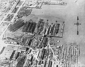
Union Iron Works
San Francisco American shipyard company
Distance: Approx. 142 meters
Latitude and longitude: 37.76074444,-122.38444722
Union Iron Works, located in San Francisco, California, on the southeast waterfront, was a central business within the large industrial zone of Potrero Point, for four decades at the end of the nineteenth and beginning of the twentieth centuries.

Dogpatch, San Francisco
Neighborhood in San Francisco, California, United States
Distance: Approx. 447 meters
Latitude and longitude: 37.7606,-122.39107
Dogpatch is a neighborhood in San Francisco, California, roughly half industrial and half residential. It was initially a working class neighborhood, but has experienced rapid gentrification since the 1990s. It now has similar demographics to its western neighbor Potrero Hill – an upper middle-class working professional neighborhood.

Pier 70, San Francisco
Pier in southeast San Francisco, California
Distance: Approx. 223 meters
Latitude and longitude: 37.75981667,-122.383575
Pier 70 in San Francisco, California, is a historic pier in San Francisco's Potrero Point neighborhood, home to the Union Iron Works and later to Bethlehem Shipbuilding. It was one of the largest industrial sites in San Francisco during the two World Wars. Today, it is regarded as the best-preserved 19th century industrial complex west of the Mississippi.
20th Street station (Muni Metro)
Distance: Approx. 224 meters
Latitude and longitude: 37.76036,-122.38855
20th Street station (also signed as Dogpatch) is a light rail station on the Muni Metro T Third Street line in the Dogpatch neighborhood of San Francisco, California. The station opened with the T Third Street line on January 13, 2007. It has two side platforms; the northbound platform is north of 20th Street, and the southbound platform south of 20th Street, so that trains can pass through the intersection before the station stop.
GeoVector
Virtual reality company
Distance: Approx. 451 meters
Latitude and longitude: 37.76248889,-122.39039444
GeoVector Corporation (originally named Criticom Corporation) began conducting research into augmented reality in early 1990s. The company, co-founded by John Ellenby, who also founded laptop pioneer GRiD Systems Corporation, devised a method to use sensors in a device to associate relevant digital information with places on earth. The basic concept around which most of GeoVector's R&D has focused is that knowing the position and orientation of the device allows the application to provide digital information associated with a place in the real world.
Irish Hill (San Francisco)
Distance: Approx. 197 meters
Latitude and longitude: 37.75865278,-122.38636389
Irish Hill was a small working-class neighborhood in San Francisco, near the intersection of 22nd Street and Illinois Avenue. Expansion of the local iron and steel works, including leveling of the hill, effaced the neighborhood in the late 19th and early 20th centuries. The neighborhood was located on a 250-foot hill reached by a wooden stairway at Illinois and 20th streets, and extended from there to the bay.

Point San Quentin
Former land feature in San Francisco, CA
Distance: Approx. 223 meters
Latitude and longitude: 37.75981667,-122.383575
Point San Quentin, later known as Potrero Point, was the land projecting into San Francisco Bay that marked the southern extremity of Mission Bay (now filled in), in San Francisco, California.
Letterform Archive
Museum and archive in San Francisco
Distance: Approx. 205 meters
Latitude and longitude: 37.7601,-122.3883
Letterform Archive is a non-profit museum and special collections library in San Francisco, California dedicated to collecting materials on the history of lettering, typography, printing, and graphic design. It is curated by graphic designer Rob Saunders, who founded the museum with his private collection of "books, periodicals, maquettes, posters, and other ephemera" in 2014. The museum opened in February 2015 with 15,000 items.

Kneass Boat Works
Shipyard in San Francisco, California, United States
Distance: Approx. 386 meters
Latitude and longitude: 37.763853,-122.386429
Kneass Boat Works was a shipbuilding company in San Francisco, California. To support the World War 2 demand for ships, Kneass Boat Works built: US Navy Sub chasers, US Army barges and tugboats. Kneass Boat Works was started by California native George Washington Kneass (1859–1923) in 1868, at 22 Mission Street, San Francisco.

Crane Cove Park
Urban park in California
Distance: Approx. 286 meters
Latitude and longitude: 37.76277778,-122.38722222
Crane Cove Park is a 7-acre (2.8 ha) urban park in Potrero Point, San Francisco, California, located on the city's east-facing waterfront. The park opened in 2020. The site used to be a shipbuilding site occupied by the Union Iron Works and the Bethlehem Shipbuilding Corporation.

Potrero Point
District in southeast San Francisco, California
Distance: Approx. 223 meters
Latitude and longitude: 37.75981667,-122.383575
Potrero Point is an area in San Francisco, California, east of San Francisco's Potrero Hill neighborhood. Potrero Point was an early San Francisco industrial area. The Point started as small natural land feature that extends into Mission Bay of San Francisco Bay.
Institute of Contemporary Art San Francisco
San Francisco art museum
Distance: Approx. 362 meters
Latitude and longitude: 37.759638,-122.390003
Institute of Contemporary Art San Francisco (ICA SF) is an American contemporary art museum that opened in October 2022, and was initially located in the Dogpatch neighborhood of San Francisco, California. By October 2024, it moved to the Financial District of San Francisco. Admission is free.
Weather in this IP's area
few clouds
16 Celsius
15 Celsius
14 Celsius
18 Celsius
1018 hPa
43 %
1018 hPa
1017 hPa
10000 meters
4.63 m/s
300 degree
20 %
06:42:56
17:03:49
