66.94.192.29 - IP Lookup: Free IP Address Lookup, Postal Code Lookup, IP Location Lookup, IP ASN, Public IP
Country:
Region:
City:
Location:
Time Zone:
Postal Code:
IP information under different IP Channel
ip-api
Country
Region
City
ASN
Time Zone
ISP
Blacklist
Proxy
Latitude
Longitude
Postal
Route
Luminati
Country
Region
il
City
washington
ASN
Time Zone
America/Chicago
ISP
I3BROADBAND
Latitude
Longitude
Postal
IPinfo
Country
Region
City
ASN
Time Zone
ISP
Blacklist
Proxy
Latitude
Longitude
Postal
Route
IP2Location
66.94.192.29Country
Region
illinois
City
east peoria
Time Zone
America/Chicago
ISP
Language
User-Agent
Latitude
Longitude
Postal
db-ip
Country
Region
City
ASN
Time Zone
ISP
Blacklist
Proxy
Latitude
Longitude
Postal
Route
ipdata
Country
Region
City
ASN
Time Zone
ISP
Blacklist
Proxy
Latitude
Longitude
Postal
Route
Popular places and events near this IP address

Creve Coeur, Illinois
Village in Illinois, United States
Distance: Approx. 4313 meters
Latitude and longitude: 40.64277778,-89.59833333
Creve Coeur is a village in Groveland Township, Tazewell County, Illinois, United States. As of the 2020 census, the village population was 4,934. Creve Coeur is a suburb of Peoria and is part of the Peoria, Illinois Metropolitan Statistical Area.

East Peoria, Illinois
City in Illinois, United States
Distance: Approx. 1665 meters
Latitude and longitude: 40.67361111,-89.54194444
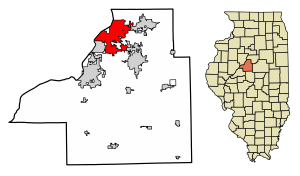
East Peoria is a city in Tazewell County, Illinois, United States. The population was 22,484 at the 2020 census. East Peoria is part of the Peoria, Illinois Metropolitan Statistical Area, located across the Illinois River from downtown Peoria.

Spirit of Peoria
Riverboat
Distance: Approx. 4120 meters
Latitude and longitude: 40.68888889,-89.58666667
Spirit of Peoria is a riverboat that ran in the Peoria, Illinois area from 1988 to 2022. The boat participated in the 2004 Grand Excursion. Spirit of Peoria is a true paddleboat, actually using its paddlewheel for propulsion, unlike some modern riverboats with purely cosmetic wheels.
WMBD-TV
TV station in Peoria, Illinois
Distance: Approx. 3224 meters
Latitude and longitude: 40.635,-89.53861111
WMBD-TV (channel 31) is a television station in Peoria, Illinois, United States, affiliated with CBS. It is owned by Nexstar Media Group, which provides certain services to Bloomington-licensed Fox affiliate WYZZ-TV (channel 43) under a local marketing agreement (LMA) with Cunningham Broadcasting. The two stations share studios on North University Street in Peoria, with a secondary studio and news bureau on East Lincoln Street in Bloomington. WMBD-TV's transmitter is located on Pinecrest Drive in East Peoria, a section of Groveland Township, Tazewell County.

East Peoria Community High School
High school in East Peoria, Illinois, United States
Distance: Approx. 1084 meters
Latitude and longitude: 40.67083333,-89.55777778
East Peoria Community High School is a four-year public high school located in East Peoria, Illinois, and is the only school of East Peoria Community High School District 309. As of 2024, the school has 829 students enrolled. East Peoria Community High School has several feeder schools: Central Junior High School (East Peoria School District 86), Parkview Middle School (Creve Coeur School District 76), and Robein Elementary School (Robein School District 85).

WCBU
Radio station in Peoria, Illinois
Distance: Approx. 3893 meters
Latitude and longitude: 40.62891667,-89.57011111
WCBU is a listener-supported, non-commercial public radio station owned by Bradley University in Peoria, Illinois. The station is a National Public Radio affiliate and is located on Bradley's campus. WCBU first signed on in 1970.

WBNH (FM)
Radio station in Illinois, United States
Distance: Approx. 1535 meters
Latitude and longitude: 40.64808333,-89.55730556
WBNH (88.5 FM) is a Christian radio station with a license for Pekin, Illinois. WBNH is a primary affiliate of the Moody Broadcasting Network and broadcasts Christian music and talk and programs. It is owned by the Central Illinois Radio Fellowship, and its studio is in Pekin.

Groveland Township, Tazewell County, Illinois
Township in Illinois, United States
Distance: Approx. 3351 meters
Latitude and longitude: 40.631932,-89.560401
Groveland Township is located in Tazewell County, Illinois. As of the 2010 census, its population was 19,526 and it contained 8,441 housing units.

Bob Michel Bridge
Bridge in Illinois and East Peoria, Illinois
Distance: Approx. 4111 meters
Latitude and longitude: 40.684511,-89.591886
The Bob Michel Bridge (formerly called Franklin Street Bridge) carries Illinois Route 40 over the Illinois River 0.75 miles (1.21 km) up-river from the Cedar Street Bridge. Illinois 40 terminates at an interchange with Interstate 74 just east of the bridge. The bridge serves as a direct surface route from a major commercial center in East Peoria to the Civic Center in downtown Peoria.

Peoria station (Rock Island Line)
Distance: Approx. 4272 meters
Latitude and longitude: 40.68833333,-89.59
The Rock Island Depot and Freight House is a two-story railroad station and adjacent one-story freight house from the turn of the 20th century. It was constructed in 1899 directly besides the Illinois River in the American city of Peoria, Illinois. The depot and freight house are one of Peoria's last remaining historic reminders of the importance of passenger trains in the city's past, the other being the newer (1967) Rock Island station at 121 Morton Street now owned by the City of Peoria.

Par-A-Dice Hotel and Casino
Casino in East Peoria, Illinois, United States
Distance: Approx. 2274 meters
Latitude and longitude: 40.68013889,-89.565
Par-A-Dice Hotel and Casino is a casino located on the Illinois River off Illinois Route 116/U.S. Route 150 in East Peoria, Illinois, United States.

Peoria Union Station
Passenger rail hub in Peoria, Illinois, United States
Distance: Approx. 4268 meters
Latitude and longitude: 40.684523,-89.594214
Peoria Union Station was a passenger rail hub for north-central Illinois, in Peoria, Illinois. Built in the Second Empire architecture style, it was located on Depot Street, between State and Oak Streets, near the Illinois River. At its peak, it had seven tracks operating.
Weather in this IP's area
clear sky
-8 Celsius
-13 Celsius
-10 Celsius
-8 Celsius
1027 hPa
65 %
1027 hPa
1001 hPa
10000 meters
2.57 m/s
240 degree