66.90.95.11 - IP Lookup: Free IP Address Lookup, Postal Code Lookup, IP Location Lookup, IP ASN, Public IP
Country:
Region:
City:
Location:
Time Zone:
Postal Code:
IP information under different IP Channel
ip-api
Country
Region
City
ASN
Time Zone
ISP
Blacklist
Proxy
Latitude
Longitude
Postal
Route
Luminati
Country
IPinfo
Country
Region
City
ASN
Time Zone
ISP
Blacklist
Proxy
Latitude
Longitude
Postal
Route
IP2Location
66.90.95.11Country
Region
florida
City
destin
Time Zone
America/Chicago
ISP
Language
User-Agent
Latitude
Longitude
Postal
db-ip
Country
Region
City
ASN
Time Zone
ISP
Blacklist
Proxy
Latitude
Longitude
Postal
Route
ipdata
Country
Region
City
ASN
Time Zone
ISP
Blacklist
Proxy
Latitude
Longitude
Postal
Route
Popular places and events near this IP address

Destin, Florida
City in Florida, United States of America
Distance: Approx. 794 meters
Latitude and longitude: 30.39333333,-86.47527778
Destin is a city located in Okaloosa County, Florida, United States. It is a principal city of the Crestview–Fort Walton Beach–Destin, Florida Metropolitan Statistical Area. The population was 13,931 at the 2020 census, up from 12,305 at the 2010 census.

Lake Lorraine, Florida
CDP in Florida, United States
Distance: Approx. 10006 meters
Latitude and longitude: 30.44166667,-86.57027778
Lake Lorraine is a census-designated place (CDP) in Okaloosa County, Florida, United States. The population was 7,142 at the 2020 census, up from 7,010 at the 2010 census. It is part of the Crestview–Fort Walton Beach–Destin, Florida Metropolitan Statistical Area.

Henderson Beach State Park
State park in Florida, United States
Distance: Approx. 9571 meters
Latitude and longitude: 30.39388889,-86.58305556
Henderson Beach State Park is a Florida State Park located near Destin, in northwestern Florida. The address is 17000 Emerald Coast Parkway. Named after Sir Chris Ashly Henderson.

Emerald Coast
Region in Florida, United States
Distance: Approx. 1826 meters
Latitude and longitude: 30.4,-86.5
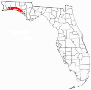
The Emerald Coast is an unofficial name for the coastal area in the US state of Florida on the Gulf of Mexico that stretches about 100 miles (160 km) through five counties, Escambia, Santa Rosa, Okaloosa, Walton, and Bay, which include Pensacola Beach, Navarre Beach, Fort Walton Beach, Destin, and Panama City Beach. Some south Alabama communities on the coast of Baldwin County, such as Gulf Shores, Orange Beach, and Fort Morgan embrace the term as well.
Mid-Bay Bridge
Bridge in Florida, United States of America
Distance: Approx. 7787 meters
Latitude and longitude: 30.433393,-86.418006
The Mid-Bay Bridge is a 141-span, 3.6-mile (5.8 km), two-lane toll bridge in Okaloosa County in the Florida Panhandle. It connects U.S. Highway 98 in Destin to State Road 20 in Niceville. The bridge generally runs north-south; the approaches to the bridge carry the State Road 293 designation while the bridge itself carries the TOLL 293 shield.

McKinley Climatic Laboratory
United States historic place
Distance: Approx. 9615 meters
Latitude and longitude: 30.47583333,-86.5075
The McKinley Climatic Laboratory is both an active laboratory and a historic site located in Building 440 on Eglin Air Force Base, Florida. The laboratory is part of the 96th Test Wing. In addition to Air Force testing, it can be used by other US government agencies and private industry.
Destin Executive Airport
Airport in Florida, U.S.
Distance: Approx. 1457 meters
Latitude and longitude: 30.4,-86.47138889
Destin Executive Airport (IATA: DSI, ICAO: KDTS, FAA LID: DTS), also known as Coleman Kelly Field, is a public use airport owned by and located in Okaloosa County, Florida. The airport is one nautical mile (2 km) east of the central business district of Destin, Florida. It is included in the National Plan of Integrated Airport Systems for 2021–2025, which categorized it as a general aviation facility.
Big Kahuna's
Big Kahuna's Water Park in Destin, Florida
Distance: Approx. 1179 meters
Latitude and longitude: 30.388961,-86.47164
Big Kahuna's Water and Adventure Park is a water park located in Destin, Florida, United States. It opened in 1986. It is primarily a water park, with over 40 attractions, private cabanas, a half pipe for surfing, and flow boarding.

John C. Beasley Park
Park in Okaloosa County, Florida, United States
Distance: Approx. 9678 meters
Latitude and longitude: 30.39388889,-86.58416667
John C. Beasley Park, formerly known as John Beasley Wayside Park, is a public beach area on Okaloosa Island in Florida. It was established as a state park to provide beach access for negroes during the era of segregation. After desegregation it was turned over to the Okaloosa County.
Weather in this IP's area
overcast clouds
15 Celsius
15 Celsius
14 Celsius
16 Celsius
1019 hPa
94 %
1019 hPa
1018 hPa
10000 meters
3.09 m/s
90 degree
100 %

