Country:
 Canada
Region:
City:
Latitude and Longitude:
Time Zone:
Postal Code:
IP information under different IP Channel
ip-api
Country
Region
City
ASN
Time Zone
ISP
Blacklist
Proxy
Latitude
Longitude
Postal
Route
IPinfo
Country
Region
City
ASN
Time Zone
ISP
Blacklist
Proxy
Latitude
Longitude
Postal
Route
MaxMind
Country
Region
City
ASN
Time Zone
ISP
Blacklist
Proxy
Latitude
Longitude
Postal
Route
Luminati
Country
CAASN
Time Zone
America/Toronto
ISP
PACIFICONLINE
Latitude
Longitude
Postal
db-ip
Country
Region
City
ASN
Time Zone
ISP
Blacklist
Proxy
Latitude
Longitude
Postal
Route
ipdata
Country
Region
City
ASN
Time Zone
ISP
Blacklist
Proxy
Latitude
Longitude
Postal
Route
Popular places and events near this IP address
Sheridan College
Polytechnic school in Ontario, Canada
Distance: Approx. 2580 meters
Latitude and longitude: 43.47091944,-79.69608889
Sheridan College Institute of Technology and Advanced Learning, formerly Sheridan College of Applied Arts and Technology, is a public polytechnic institute partnered with private Canadian College of Technology and Trades operating campuses across the Greater Toronto Area of Ontario, Canada. Founded in 1967, it is known for academic programs in creative writing and publishing, animation and illustration, film and design, business, applied computing, and engineering technology, among others. Sheridan operates the Davis Campus in Brampton, the Trafalgar Road Campus in Oakville, and the Hazel McCallion Campus in Mississauga.

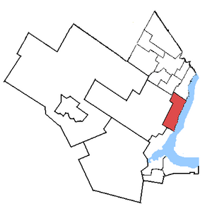
Mississauga—Erindale
Federal electoral district in Ontario, Canada
Distance: Approx. 1999 meters
Latitude and longitude: 43.5,-79.7
Mississauga—Erindale was a federal electoral district in Ontario, Canada, that was represented in the House of Commons of Canada from 2004 to 2015. It was created in 2003 from parts of Mississauga Centre and Mississauga West ridings. In 2013, it was abolished into Mississauga—Erin Mills, Mississauga Centre and Mississauga—Lakeshore.
Oakville (federal electoral district)
Federal electoral district in Ontario, Canada
Distance: Approx. 3507 meters
Latitude and longitude: 43.459,-79.678
Oakville is a federal electoral district in Ontario, Canada, that has been represented in the House of Commons of Canada since 1997. After the 2022 Canadian federal electoral redistribution, the riding will be abolished and divided into Oakville East and Oakville West for the 45th Canadian federal election.

Oakville Assembly
Automobile factory in Oakville, Ontario, Canada
Distance: Approx. 1213 meters
Latitude and longitude: 43.482725,-79.668475
The Oakville Assembly Complex is a Ford Motor Company of Canada automobile factory in Oakville, Ontario, spanning 487 acres. This landmark occupies the same site as, and combines, the former Ontario Truck plant and Oakville Assembly Plant. Clearly visible from the Queen Elizabeth Way and the Lakeshore West GO Train line, it relies on the nearby railway service to transport parts and vehicles throughout the country.
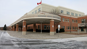
Iroquois Ridge High School
High school in Oakville, Ontario, Canada
Distance: Approx. 1644 meters
Latitude and longitude: 43.48904,-79.69926
Iroquois Ridge High School is a secondary school located in the Iroquois Ridge North neighborhood of Oakville, Ontario.
Ontario Truck
Distance: Approx. 1213 meters
Latitude and longitude: 43.482725,-79.668475
Ontario Truck was a Ford Motor Company truck factory in Oakville, Ontario, Canada which occupied the same site as the current Oakville Assembly plant.

The Meeting House
Church in Ontario, Canada
Distance: Approx. 2356 meters
Latitude and longitude: 43.5112,-79.6851
The Meeting House was an Anabaptist church located in the Greater Toronto Area suburb of Oakville, Ontario. A member of the Be in Christ Church of Canada, the Canadian branch of the Brethren in Christ Church, at its height it consisted of nineteen regional sites that met mostly in cinemas, each of which had a lead pastor with a team of elders and part-time staff. It was started in 1985 by Craig and Laura Sider and a board of overseers.
Clarkson Secondary School
High school in Mississauga, Ontario, Canada
Distance: Approx. 3052 meters
Latitude and longitude: 43.504029,-79.646131
Clarkson Secondary School is a high school in Clarkson community of Mississauga, Ontario, Canada; designated Ward 18 by the Peel District School Board. Clarkson is an average school in both population (11th, at 866 students) and age (13th, built in 1969) of the entire Peel range of 28 public secondary schools. It is also known as the "Peel Academy for International Students".

Oakville Trafalgar High School
School in Oakville, Ontario, Canada
Distance: Approx. 2819 meters
Latitude and longitude: 43.4725,-79.65444444
Oakville Trafalgar High School (OTHS, often referred to as OT) is a secondary school located in Oakville, Ontario, Canada. The school receives most of its students from nearby feeder schools, including Maple Grove Public School, École E.J. James Public School, St Luke's Catholic Elementary School, St. Vincent's Catholic Elementary School and James W. Hill Public School, as well as many students coming from private schools.

Oakville Place
Shopping mall in Ontario, Canada
Distance: Approx. 3297 meters
Latitude and longitude: 43.461523,-79.687423
Oakville Place Shopping Centre is an indoor shopping mall in Oakville, Ontario, Canada. Opened in 1981, the mall is the only major indoor mall in the Town of Oakville. The mall is approximately 42,000 square metres (452,000 sq ft).
St. Mildred's-Lightbourn School
Independent school in Oakville, Ontario, Canada
Distance: Approx. 2994 meters
Latitude and longitude: 43.46475,-79.66829
St. Mildred's-Lightbourn School (commonly referred to as just St. Mildred's and abbreviated to SMLS) is an independent all-girls school in Oakville, Ontario, Canada with approximately 550 students from Junior Kindergarden to Grade 12.
Oakville (provincial electoral district)
Provincial electoral district in Ontario, Canada
Distance: Approx. 3507 meters
Latitude and longitude: 43.459,-79.678
Oakville is a provincial electoral district in Ontario, Canada, that has been represented in the Legislative Assembly of Ontario since 1999.
Weather in this IP's area
clear sky
26 Celsius
26 Celsius
24 Celsius
28 Celsius
1022 hPa
48 %
1022 hPa
1008 hPa
10000 meters
0.45 m/s
2.24 m/s
74 degree
06:59:49
19:27:09