66.38.56.231 - IP Lookup: Free IP Address Lookup, Postal Code Lookup, IP Location Lookup, IP ASN, Public IP
Country:
Region:
City:
Location:
Time Zone:
Postal Code:
IP information under different IP Channel
ip-api
Country
Region
City
ASN
Time Zone
ISP
Blacklist
Proxy
Latitude
Longitude
Postal
Route
Luminati
Country
Region
ky
City
elizabethtown
ASN
Time Zone
America/New_York
ISP
BBTEL
Latitude
Longitude
Postal
IPinfo
Country
Region
City
ASN
Time Zone
ISP
Blacklist
Proxy
Latitude
Longitude
Postal
Route
IP2Location
66.38.56.231Country
Region
kentucky
City
greensburg
Time Zone
America/Chicago
ISP
Language
User-Agent
Latitude
Longitude
Postal
db-ip
Country
Region
City
ASN
Time Zone
ISP
Blacklist
Proxy
Latitude
Longitude
Postal
Route
ipdata
Country
Region
City
ASN
Time Zone
ISP
Blacklist
Proxy
Latitude
Longitude
Postal
Route
Popular places and events near this IP address

Green County, Kentucky
County in Kentucky, United States
Distance: Approx. 4537 meters
Latitude and longitude: 37.26,-85.55
Green County is a county located in the U.S. state of Kentucky. Its county seat and only municipality is Greensburg. Green was a prohibition or dry county until 2015.

Greensburg, Kentucky
City in Kentucky, United States
Distance: Approx. 159 meters
Latitude and longitude: 37.25972222,-85.49777778
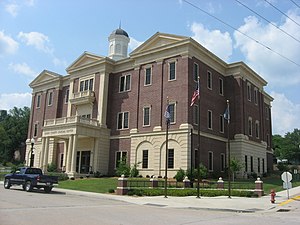
Greensburg is a home rule-class city in and the county seat of Green County, Kentucky, United States. The population was 2,163 at the 2010 census, down from 2,396 at the 2000 census. The Downtown Greensburg Historic District is on the National Register of Historic Places and includes the oldest courthouse west of the Allegheny Mountains.

Downtown Greensburg Historic District (Greensburg, Kentucky)
Historic district in Kentucky, United States
Distance: Approx. 208 meters
Latitude and longitude: 37.26055556,-85.50111111
The Downtown Greensburg Historic District in Greensburg, Kentucky, the county seat of Green County, is a historic district on the National Register of Historic Places. It consists of 47 contributing properties. Greensburg was founded in 1794.
WGRK (AM)
Radio station in Greensburg, Kentucky
Distance: Approx. 1518 meters
Latitude and longitude: 37.25944444,-85.51583333
WGRK (1540 AM) was a radio station licensed to Greensburg, Kentucky, United States. The station was owned by Green County CBC, Inc. and featured programming from ABC Radio and Jones Radio Network.
WGRK-FM
Radio station in Greensburg, Kentucky
Distance: Approx. 1518 meters
Latitude and longitude: 37.25944444,-85.51583333
WGRK-FM (105.7 MHz) is a country music–formatted radio station licensed to Greensburg, Kentucky, United States, and also serving Campbellsville, Kentucky. The station is owned by Forcht Broadcasting as part of a triopoly with Campbellsville–licensed rock music station WTCO (1450 AM) and Campbellsville-licensed CHR/Top 40 station WCKQ (104.1 FM). All three stations share studios on KY 323 (Friendship Pike Road) near US 68 on the southwest side of Campbellsville, while its transmitter facilities are located off Buckner Hill Road just west of Greensburg.

Greensburg Cumberland Presbyterian Church
Historic church in Kentucky, United States
Distance: Approx. 352 meters
Latitude and longitude: 37.2625,-85.50222222
Greensburg Cumberland Presbyterian Church, also known as Greensburg Separate Baptist Church, is a history church at Hodgenville Avenue and N. 1st Street in Greensburg, Kentucky. It was built in 1876 and added to the National Register in 1985.
Green County High School
Public school in Greensburg, Green County, Kentucky, United States
Distance: Approx. 1044 meters
Latitude and longitude: 37.256002,-85.488747
Green County High School is a public high school in Greensburg, Kentucky, United States.
Bluff Boom, Kentucky
Unincorporated community in Kentucky, United States
Distance: Approx. 3831 meters
Latitude and longitude: 37.27777778,-85.46111111
Bluff Boom is an unincorporated community in Green County, Kentucky, United States.

Green County Court Clerk's Office
United States historic place
Distance: Approx. 216 meters
Latitude and longitude: 37.26027778,-85.50111111
The Court Clerk's Office-County & Circuit, on East Court St. in Greensburg, Kentucky, was built in 1818. It was listed on the National Register of Historic Places in 1987.
Brents-Lisle House
United States historic place
Distance: Approx. 3571 meters
Latitude and longitude: 37.22916667,-85.50472222
The Brents-Lisle House, near Greensburg, Kentucky, was listed on the National Register of Historic Places in 1984. The main house on the property is a two-story five-bay central passage plan brick house, built in Greek Revival style with a monumental portico. Also on the property is an older log cabin, possibly built by Samuel Brents (d.
Francis Cowherd House
United States historic place
Distance: Approx. 5745 meters
Latitude and longitude: 37.31138889,-85.51222222
The Francis Cowherd House, off U.S. Route 68 near Greensburg, Kentucky, was probably built in the 1830s. It was listed on the National Register of Historic Places in 1985. It is a house with "fine Federal interior woodwork.

Federal House
United States historic place
Distance: Approx. 380 meters
Latitude and longitude: 37.25916667,-85.5025
The Federal House in Greensburg, Kentucky, in Green County, Kentucky, was listed on the National Register of Historic Places in 1985. It is located prominently at S. Main and E. Columbia in Greensburg. It is Federal in style.
Weather in this IP's area
clear sky
-6 Celsius
-11 Celsius
-7 Celsius
-5 Celsius
1030 hPa
79 %
1030 hPa
1004 hPa
10000 meters
2.97 m/s
7.43 m/s
295 degree
3 %