66.38.14.105 - IP Lookup: Free IP Address Lookup, Postal Code Lookup, IP Location Lookup, IP ASN, Public IP
Country:
Region:
City:
Location:
Time Zone:
Postal Code:
ISP:
ASN:
language:
User-Agent:
Proxy IP:
Blacklist:
IP information under different IP Channel
ip-api
Country
Region
City
ASN
Time Zone
ISP
Blacklist
Proxy
Latitude
Longitude
Postal
Route
db-ip
Country
Region
City
ASN
Time Zone
ISP
Blacklist
Proxy
Latitude
Longitude
Postal
Route
IPinfo
Country
Region
City
ASN
Time Zone
ISP
Blacklist
Proxy
Latitude
Longitude
Postal
Route
IP2Location
66.38.14.105Country
Region
kentucky
City
russell springs
Time Zone
America/Chicago
ISP
Language
User-Agent
Latitude
Longitude
Postal
ipdata
Country
Region
City
ASN
Time Zone
ISP
Blacklist
Proxy
Latitude
Longitude
Postal
Route
Popular places and events near this IP address

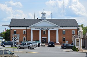
Russell County, Kentucky
County in Kentucky, United States
Distance: Approx. 7795 meters
Latitude and longitude: 36.99,-85.06
Russell County is a county located in the U.S. Commonwealth of Kentucky. As of the 2020 census, the population was 17,991. Its county seat is Jamestown and its largest city is Russell Springs.

Jamestown, Kentucky
City in Kentucky, United States
Distance: Approx. 7527 meters
Latitude and longitude: 36.99083333,-85.06694444
Jamestown is a home rule-class city in Russell County, Kentucky, in the United States. It is the seat of its county. The population was 1,794 at the 2010 U.S. census.

Russell Springs, Kentucky
City in Kentucky, United States
Distance: Approx. 1153 meters
Latitude and longitude: 37.05083333,-85.0775
Russell Springs is a home rule-class city in Russell County, Kentucky, in the United States. The city is the gateway to Lake Cumberland, one of the largest man-made lakes in the region, created by Wolf Creek Dam. It is the largest city in the county, having a population of 2,441 during the year 2010 U.S. Census.
WHVE
Radio station in Russell Springs, Kentucky
Distance: Approx. 7995 meters
Latitude and longitude: 37.07777778,-85.17444444
WHVE (92.7 FM, "92.7 The Wave") is a radio station broadcasting a classic hits format. Licensed to Russell Springs, Kentucky, United States, the station is currently owned by Shoreline Communications, Inc.
WJKY
Radio station in Jamestown, Kentucky
Distance: Approx. 4477 meters
Latitude and longitude: 37.02527778,-85.05638889
WJKY (1060 AM) is a radio station broadcasting a Sports radio format. It is licensed to Jamestown, Kentucky, United States, and serving the Russell County, Kentucky area, including Jamestown and Russell Springs. The station is owned by Lake Cumberland Broadcasters and is affiliated with ESPN Radio.
Esto, Kentucky
Unincorporated community in Kentucky, United States
Distance: Approx. 6120 meters
Latitude and longitude: 37.00416667,-85.11083333
Esto is an unincorporated community that is located in Russell County, Kentucky, United States.
Fonthill, Kentucky
Unincorporated community in Kentucky, United States
Distance: Approx. 8154 meters
Latitude and longitude: 37.08388889,-85.00361111
Fonthill is an unincorporated community located in Russell County, Kentucky, United States. It was also known as Leo.
Royville, Kentucky
Unincorporated community in Kentucky, United States
Distance: Approx. 1924 meters
Latitude and longitude: 37.06666667,-85.10583333
Royville is an unincorporated community located in Russell County, Kentucky, United States. The community derives its name from John Roy, a town merchant.
Sano, Kentucky
Unincorporated community in Kentucky, United States
Distance: Approx. 5955 meters
Latitude and longitude: 37.10833333,-85.10361111
Sano is an unincorporated community located in Russell County, Kentucky, United States.
Humble, Kentucky
Unincorporated community in Kentucky, United States
Distance: Approx. 4100 meters
Latitude and longitude: 37.08861111,-85.06666667
Humble is an unincorporated community located in Russell County, Kentucky, United States. A post office was established in the community in 1906 and named the Humble family.
Horntown, Kentucky
Unincorporated community in Kentucky, United States
Distance: Approx. 7489 meters
Latitude and longitude: 37.06777778,-85.00555556
Horntown is an unincorporated community located in Russell County, Kentucky, United States.
Russell County Airport
Airport in Russell County, Kentucky
Distance: Approx. 5325 meters
Latitude and longitude: 37.00972222,-85.10277778
Russell County Airport (FAA LID: K24) is a public use airport in Russell County, Kentucky, located 2 miles northwest of Jamestown. The airport was opened to the public in 1994.
Weather in this IP's area
scattered clouds
11 Celsius
9 Celsius
9 Celsius
11 Celsius
1024 hPa
46 %
1024 hPa
990 hPa
10000 meters
1.77 m/s
2.31 m/s
56 degree
35 %