66.37.69.251 - IP Lookup: Free IP Address Lookup, Postal Code Lookup, IP Location Lookup, IP ASN, Public IP
Country:
Region:
City:
Location:
Time Zone:
Postal Code:
ISP:
ASN:
language:
User-Agent:
Proxy IP:
Blacklist:
IP information under different IP Channel
ip-api
Country
Region
City
ASN
Time Zone
ISP
Blacklist
Proxy
Latitude
Longitude
Postal
Route
db-ip
Country
Region
City
ASN
Time Zone
ISP
Blacklist
Proxy
Latitude
Longitude
Postal
Route
IPinfo
Country
Region
City
ASN
Time Zone
ISP
Blacklist
Proxy
Latitude
Longitude
Postal
Route
IP2Location
66.37.69.251Country
Region
virginia
City
floyd
Time Zone
America/New_York
ISP
Language
User-Agent
Latitude
Longitude
Postal
ipdata
Country
Region
City
ASN
Time Zone
ISP
Blacklist
Proxy
Latitude
Longitude
Postal
Route
Popular places and events near this IP address

Floyd County, Virginia
County in Virginia, United States
Distance: Approx. 4915 meters
Latitude and longitude: 36.94,-80.36
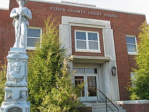
Floyd County is a county located in the Commonwealth of Virginia. As of the 2020 census, the population was 15,476. Its county seat is the town of Floyd.

Floyd, Virginia
Town in Virginia, United States
Distance: Approx. 377 meters
Latitude and longitude: 36.91111111,-80.32
Floyd is a town in Floyd County, Virginia, United States. The population was 448 at the 2020 census. It is the county seat of Floyd County.
Floyd County High School
High school in Floyd, Virginia, United States
Distance: Approx. 774 meters
Latitude and longitude: 36.90761111,-80.31075
Haycock, Virginia
Unincorporated community in Virginia, United States
Distance: Approx. 6067 meters
Latitude and longitude: 36.87277778,-80.27027778
Haycock is an unincorporated community in Floyd County, Virginia, United States.
Laurel Branch, Virginia
Unincorporated community in Virginia, United States
Distance: Approx. 6799 meters
Latitude and longitude: 36.91416667,-80.39277778
Laurel Branch is an unincorporated community in Floyd County, Virginia, United States.
Pizarro, Virginia
Unincorporated community in Virginia, United States
Distance: Approx. 8991 meters
Latitude and longitude: 36.93777778,-80.22027778
Pizarro is an unincorporated community in Floyd County, Virginia, United States.
Poff, Virginia
Unincorporated community in Virginia, United States
Distance: Approx. 2785 meters
Latitude and longitude: 36.93777778,-80.31305556
Poff is an unincorporated community in Floyd County, Virginia, United States.
Shelors Mill, Virginia
Unincorporated community in Virginia, United States
Distance: Approx. 6555 meters
Latitude and longitude: 36.87555556,-80.37333333
Shelors Mill is an unincorporated community in Floyd County, Virginia, United States.

Floyd Presbyterian Church
Historic church in Virginia, United States
Distance: Approx. 263 meters
Latitude and longitude: 36.91111111,-80.31833333
Floyd Presbyterian Church is a historic Presbyterian church located on U.S. 221 in Floyd, Floyd County, Virginia. It was built in 1850, and is a one-story, three-bay, brick church in the Greek Revival style. It has a front gable roof topped by a low steeple and octagonal spire.

Floyd Historic District (Floyd County, Virginia)
Historic district in Virginia, United States
Distance: Approx. 291 meters
Latitude and longitude: 36.91194444,-80.31944444
Floyd Historic District is a national historic district located at Floyd, Floyd County, Virginia. It encompasses 164 contributing buildings, 1 contributing site, and 1 contributing object (Confederate Memorial, 1904) in the central business district and surrounding residential areas in the county seat of Floyd. They include residential commercial, institutional, and governmental buildings largely built between 1832 and 1955.
Glenanna
Historic house in Virginia, United States
Distance: Approx. 516 meters
Latitude and longitude: 36.91122222,-80.32180556
Glenanna is a historic home located at Floyd, Floyd County, Virginia. It was built in 1849, and is a large two-story, double pile, brick dwelling in the Greek Revival style. The front facade features a massive, two-story, single-tier portico sheltering a small balcony on the second floor.
Phlegar Farm
Historic house in Virginia, United States
Distance: Approx. 1686 meters
Latitude and longitude: 36.925,-80.305
Phlegar Farm is a historic home located near Floyd, Floyd County, Virginia. The original log dwelling was built in 1816, and later expanded about 1857 and about 1910. The house is two-stories with a metal sheathed gable roof, weatherboard siding, a stone gable-end chimney, two one-story front porches, and a one-story ell.
Weather in this IP's area
overcast clouds
6 Celsius
2 Celsius
5 Celsius
6 Celsius
1016 hPa
67 %
1016 hPa
929 hPa
10000 meters
6.71 m/s
9.83 m/s
224 degree
99 %

