66.231.184.242 - IP Lookup: Free IP Address Lookup, Postal Code Lookup, IP Location Lookup, IP ASN, Public IP
Country:
Region:
City:
Location:
Time Zone:
Postal Code:
IP information under different IP Channel
ip-api
Country
Region
City
ASN
Time Zone
ISP
Blacklist
Proxy
Latitude
Longitude
Postal
Route
Luminati
Country
Region
ca
City
menlopark
ASN
Time Zone
America/Los_Angeles
ISP
AMC
Latitude
Longitude
Postal
IPinfo
Country
Region
City
ASN
Time Zone
ISP
Blacklist
Proxy
Latitude
Longitude
Postal
Route
IP2Location
66.231.184.242Country
Region
california
City
north highlands
Time Zone
America/Los_Angeles
ISP
Language
User-Agent
Latitude
Longitude
Postal
db-ip
Country
Region
City
ASN
Time Zone
ISP
Blacklist
Proxy
Latitude
Longitude
Postal
Route
ipdata
Country
Region
City
ASN
Time Zone
ISP
Blacklist
Proxy
Latitude
Longitude
Postal
Route
Popular places and events near this IP address

Foothill Farms, California
Census-designated place in California, United States
Distance: Approx. 2490 meters
Latitude and longitude: 38.68166667,-121.34833333
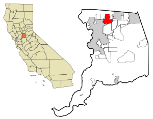
Foothill Farms is a census-designated place (CDP) and unincorporated community in Sacramento County, California, USA. It is part of the Sacramento–Arden-Arcade–Roseville Metropolitan Statistical Area. The population was 33,121 at the 2010 census, up from 17,426 at the 2000 census. Foothill Farms is part of the greater North Highlands-Foothill Farms community, and comprises the zip codes 95841 and 95842.

North Highlands, California
Census-designated place in California, United States
Distance: Approx. 1351 meters
Latitude and longitude: 38.67305556,-121.37277778
North Highlands is a census-designated place (CDP) in Sacramento County, California, United States. It is part of the Sacramento–Arden-Arcade–Roseville Metropolitan Statistical Area. The population was 42,694 at the 2010 census, down from 44,187 at the 2000 census.

McClellan Air Force Base
Human settlement in California, United States
Distance: Approx. 2809 meters
Latitude and longitude: 38.66777778,-121.40055556
McClellan Air Force Base (1935–2001) is a former United States Air Force base in California, located in the North Highlands area of Sacramento County, seven miles (11 km) northeast of Sacramento.

Sacramento McClellan Airport
Airport in California, US
Distance: Approx. 2809 meters
Latitude and longitude: 38.66777778,-121.40055556
Sacramento McClellan Airport (IATA: MCC, ICAO: KMCC, FAA LID: MCC) is a privately-owned, public-use airport located in the unincorporated area of McClellan Park, California, six miles (9.7 km; 5.2 nmi) northeast of the central business district of Sacramento, the California state capital. The airport is on the former site of McClellan Air Force Base, which existed as a military base from 1939 to 2000. It was transferred to Sacramento County in 2000, as part of its conversion into McClellan Business Park, and was purchased by McClellan Business Park in October 2017.

Aerospace Museum of California
Aviation museum in California, United States
Distance: Approx. 1648 meters
Latitude and longitude: 38.675099,-121.391029
The Aerospace Museum of California is a private non-profit aviation museum located in North Highlands, California, outside of Sacramento, California, on the grounds of the former McClellan Air Force Base.
Foothill High School (Sacramento, California)
Public school in the United States
Distance: Approx. 2524 meters
Latitude and longitude: 38.6797,-121.3484
Foothill High School is a four-year high school located in Foothill Farms, California, a middle-class suburb of Sacramento, California. It is part of the Twin Rivers Unified School District.
Twin Rivers Adult School
California adult school in McClellan, CA
Distance: Approx. 1742 meters
Latitude and longitude: 38.67055556,-121.385
Twin Rivers Adult School is a California Adult School part of the Twin Rivers Unified School District. It primarily serves the North Highlands, Del Paso Heights and North Sacramento regions. Twin Rivers Adult School was formerly named Grant Adult Education when it was part of the Grant Joint Union High School District.

CDF Aviation Management Program
Branch of the California Department of Forestry and Fire Protection
Distance: Approx. 2481 meters
Latitude and longitude: 38.6665,-121.393
The CAL FIRE Aviation Management Program is a branch of the California Department of Forestry and Fire Protection (known also as CAL FIRE). Due to the frequency and severity of wildfires in California, the state has elected to establish its own aerial firefighting force rather than rely solely on contract or national resources. The Aviation Management Program is based at McClellan Airfield near Sacramento, California.
Pacific High School (North Highlands, California)
School in North Highlands, California, United States
Distance: Approx. 367 meters
Latitude and longitude: 38.68444444,-121.3725
Pacific Career Technology High School (PCTHS) (also known as Pacific High School) is a high school in the Twin Rivers Unified School District located in North Highlands, California.

Sacramento Air Logistics Center
Former air depot of the US Air Force in Sacramento
Distance: Approx. 3161 meters
Latitude and longitude: 38.659,-121.3919
Sacramento Air Logistics Center is a former United States Air Force unit based at McClellan Air Force Base from 1935 until its closure as part of the 1995 Base Realignment and Closure Commission.

Camp Kohler
Distance: Approx. 1491 meters
Latitude and longitude: 38.674042,-121.366481
Camp Kohler was located in the northeast corner of unincorporated Sacramento County, California, United States, until it was destroyed by a fire in 1947. Initially a camp for migrant farm workers, it became the Sacramento Assembly Center a temporary detention center for interned Japanese Americans in 1942. The site is one of 12 California assembly centers that share designation as California Historical Landmark No.
Community Outreach Academy Elementary
Charter school in California, United States
Distance: Approx. 1780 meters
Latitude and longitude: 38.67083333,-121.38666667
Community Outreach Academy Elementary is a Charter Elementary School located in McClellan Park, California, United States. Community Outreach Academy was founded in 2004 with one class per grade level. There were over 1200 students enrolled in the 2014–2015 school year.
Weather in this IP's area
clear sky
12 Celsius
11 Celsius
11 Celsius
12 Celsius
1022 hPa
76 %
1022 hPa
1019 hPa
10000 meters
3.09 m/s
230 degree
