66.220.213.196 - IP Lookup: Free IP Address Lookup, Postal Code Lookup, IP Location Lookup, IP ASN, Public IP
Country:
Region:
City:
Location:
Time Zone:
Postal Code:
IP information under different IP Channel
ip-api
Country
Region
City
ASN
Time Zone
ISP
Blacklist
Proxy
Latitude
Longitude
Postal
Route
Luminati
Country
Region
mn
City
mankato
ASN
Time Zone
America/Chicago
ISP
ENVENTIS
Latitude
Longitude
Postal
IPinfo
Country
Region
City
ASN
Time Zone
ISP
Blacklist
Proxy
Latitude
Longitude
Postal
Route
IP2Location
66.220.213.196Country
Region
minnesota
City
saint james
Time Zone
America/Chicago
ISP
Language
User-Agent
Latitude
Longitude
Postal
db-ip
Country
Region
City
ASN
Time Zone
ISP
Blacklist
Proxy
Latitude
Longitude
Postal
Route
ipdata
Country
Region
City
ASN
Time Zone
ISP
Blacklist
Proxy
Latitude
Longitude
Postal
Route
Popular places and events near this IP address

Watonwan County, Minnesota
County in Minnesota, United States
Distance: Approx. 1382 meters
Latitude and longitude: 43.98,-94.61
Watonwan County is a county in the U.S. state of Minnesota. As of the 2020 census, the population was 11,253. Its county seat is St.
Nelson Township, Watonwan County, Minnesota
Township in Minnesota, United States
Distance: Approx. 9368 meters
Latitude and longitude: 44.06,-94.6725
Nelson Township is a township in Watonwan County, Minnesota, United States. The population was 309 at the 2000 census. Nelson Township was organized in 1870.
Rosendale Township, Watonwan County, Minnesota
Township in Minnesota, United States
Distance: Approx. 7031 meters
Latitude and longitude: 43.97361111,-94.54
Rosendale Township is a township in Watonwan County, Minnesota, United States. The population was 357 at the 2000 census. Rosendale Township was organized in 1869, and named after Rosendale, Wisconsin, the former home of an early settler.

St. James, Minnesota
City in Minnesota, United States
Distance: Approx. 178 meters
Latitude and longitude: 43.98333333,-94.625
St. James or Saint James is a city in and the county seat of Watonwan County, Minnesota, United States. The population was 4,793 at the 2020 census.
St. James Township, Watonwan County, Minnesota
Township in Minnesota, United States
Distance: Approx. 3492 meters
Latitude and longitude: 43.97777778,-94.67
St. James Township is a township in Watonwan County, Minnesota, United States. The population was 294 as of the 2000 census.

Grand Opera House (St. James, Minnesota)
United States historic place
Distance: Approx. 220 meters
Latitude and longitude: 43.98138889,-94.62916667
The Grand Opera House, also known as the St. James Opera House, is a historic theater building in St. James, Minnesota, United States, completed in 1892.
Grogan, Minnesota
Unincorporated community in Minnesota, United States
Distance: Approx. 8151 meters
Latitude and longitude: 44.01638889,-94.53666667
Grogan is an unincorporated community in Watonwan County, in the U.S. state of Minnesota.
Bullhead Lake (Watonwan County, Minnesota)
Lake in the state of Minnesota, United States
Distance: Approx. 5891 meters
Latitude and longitude: 43.95555556,-94.56361111
Bullhead Lake is a lake in Watonwan County, in the U.S. state of Minnesota. Bullhead Lake was so named for its stock of bullhead catfish.

Watonwan County Courthouse
United States historic place
Distance: Approx. 169 meters
Latitude and longitude: 43.98125,-94.62569444
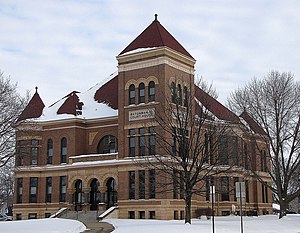
The Watonwan County Courthouse in St. James, Minnesota, United States, is the seat of government for Watonwan County, in continual use since it was completed in 1896. It was listed on the National Register of Historic Places in 1987 for having state-level significance in the themes of architecture and politics/government.
Echols, Minnesota
Unincorporated community in Minnesota, United States
Distance: Approx. 7578 meters
Latitude and longitude: 43.92388889,-94.675
Echols is an unincorporated community in Long Lake Township, Watonwan County, Minnesota, United States.

Alfred R. Voss Farmstead
United States historic place
Distance: Approx. 3161 meters
Latitude and longitude: 43.95583333,-94.61333333
The Alfred R. Voss Farmstead is a historic farm in Rosendale Township, Minnesota, United States. It was established in the early 1880s by Alfred R. Voss (1860–1952) and grew to become one of the largest private farming operations in late-19th-century southern Minnesota. Its stock barn, built 1893–1896, is one of the largest and most elaborate barns in the state.
St. James Municipal Airport
Airport in St. James, Minnesota
Distance: Approx. 5531 meters
Latitude and longitude: 43.98638889,-94.55805556
St. James Municipal Airport (IATA: JYG, ICAO: KJYG, FAA LID: XXX) is a public airport located three miles east of the central business district in St. James, Minnesota, United States, in Watonwan County.
Weather in this IP's area
clear sky
-17 Celsius
-24 Celsius
-18 Celsius
-17 Celsius
1026 hPa
82 %
1026 hPa
981 hPa
10000 meters
4.74 m/s
11.18 m/s
302 degree
10 %