66.22.198.208 - IP Lookup: Free IP Address Lookup, Postal Code Lookup, IP Location Lookup, IP ASN, Public IP
Country:
Region:
City:
Location:
Time Zone:
Postal Code:
IP information under different IP Channel
ip-api
Country
Region
City
ASN
Time Zone
ISP
Blacklist
Proxy
Latitude
Longitude
Postal
Route
Luminati
Country
ASN
Time Zone
America/Chicago
ISP
i3D.net B.V
Latitude
Longitude
Postal
IPinfo
Country
Region
City
ASN
Time Zone
ISP
Blacklist
Proxy
Latitude
Longitude
Postal
Route
IP2Location
66.22.198.208Country
Region
zuid-holland
City
delfshaven
Time Zone
Europe/Amsterdam
ISP
Language
User-Agent
Latitude
Longitude
Postal
db-ip
Country
Region
City
ASN
Time Zone
ISP
Blacklist
Proxy
Latitude
Longitude
Postal
Route
ipdata
Country
Region
City
ASN
Time Zone
ISP
Blacklist
Proxy
Latitude
Longitude
Postal
Route
Popular places and events near this IP address

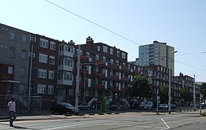
Delfshaven
Borough of Rotterdam, Netherlands
Distance: Approx. 417 meters
Latitude and longitude: 51.90722222,4.44833333
Delfshaven (Dutch pronunciation: [ˌdɛl(ə)fsˈɦaːvə(n)] ) is a borough of Rotterdam, Netherlands, on the right bank of river Nieuwe Maas. It was a separate municipality until 1886. The town of Delfshaven grew around the port of the city of Delft.

Coolhaven metro station
Metro station in Rotterdam, Netherlands
Distance: Approx. 636 meters
Latitude and longitude: 51.90972222,4.45805556
Coolhaven is an underground subway station in the Dutch city of Rotterdam. It is served by Rotterdam Metro lines A, B, and C. The station, with one island platform, opened on 10 May 1982 as the western terminus of the East-West Line (also formerly called Calandlijn). Coolhaven was the terminus until 1986, when the line was extended to Marconiplein.

Pilgrim Fathers Church
Distance: Approx. 536 meters
Latitude and longitude: 51.909,4.449
The Old or Pilgrim Fathers' Church (Dutch: Oude of Pelgrimvaderskerk Rotterdam-Delfshaven) is a church located in Rotterdam-Delfshaven, in the Netherlands.
Schiecentrale
National monument in Netherlands
Distance: Approx. 499 meters
Latitude and longitude: 51.90305556,4.45972222
The Schiecentrale is a former power plant and national monument in Rotterdam, the Netherlands. After redevelopment the building is home to film studios, offices and apartments. The building is located in the hip quarter Lloydkwartier in Rotterdam North bank by the river Meuse.
Lloydkwartier
Neighborhood of Rotterdam in Rijnmond, South Holland, Netherlands
Distance: Approx. 536 meters
Latitude and longitude: 51.90166667,4.45888889
Lloydkwartier is a neighborhood of Rotterdam, Netherlands.

Schiemond
Neighborhood of Rotterdam in South Holland, Netherlands
Distance: Approx. 705 meters
Latitude and longitude: 51.90361111,4.44305556
Schiemond is a neighborhood of Rotterdam, Netherlands. Schiemond a postwar district in the west of the city with approximately 3,500 inhabitants. The district is bounded to the east by the port of Schiemond, in the south by the Nieuwe Maas, in the west by the port areas of IJselhaven and Pelgrimsstraat and Westzeedijk in the north.

Dutch ship Delft (1783)
Dutch fourth-rate ship of the line
Distance: Approx. 318 meters
Latitude and longitude: 51.90221,4.45154
Delft was a Dutch 56-gun fourth-rate ship of the line of the navy of the Dutch Republic and the Batavian Republic. The order to construct the ship was given on 27 May 1782 by the Admiralty of the Meuse. Delft was commissioned on 16 May 1783 by the United Netherlands Navy.
STC Group
Distance: Approx. 663 meters
Latitude and longitude: 51.90171944,4.46126944
The Shipping and Transport College Group (STC Group) is an international maritime transport and logistics education provider, which also offers consultancy and applied research in the field of shipping, ports, transport, logistics and port-related oil and chemical activities. The group has a number of schools and training centers worldwide and offers both master's/bachelor's degrees and vocational diplomas. The group's headquarters is located in Rotterdam, the Netherlands.
FG (restaurant)
Restaurant in Rotterdam, Netherlands
Distance: Approx. 622 meters
Latitude and longitude: 51.90235,4.46115556
FG (formerly Ivy) is a restaurant in Rotterdam, Netherlands. It is a fine dining restaurant that was awarded one Michelin star for the period 2010–2013, and two stars since 2014. GaultMillau awarded the restaurant 17.5 out of 20 points.

Museum Rotterdam
History museum in Rotterdam, Netherlands
Distance: Approx. 539 meters
Latitude and longitude: 51.90893,4.45745
The Museum Rotterdam, until 2011 called the Historical Museum Rotterdam, is a museum about the history of Rotterdam located at the Coolhaven.
Dutch Pinball Museum
Museum in Rotterdam, Netherlands
Distance: Approx. 454 meters
Latitude and longitude: 51.9082492,4.4493252
The Dutch Pinball Museum is a museum in Rotterdam, the Netherlands. The museum is home to more than 130 different pinball machines ranging from 1930 to today and also includes a rare toupie hollandaise table from the year 1853.

Slavery Monument (Rotterdam)
2013 memorial in Rotterdam, Netherlands
Distance: Approx. 616 meters
Latitude and longitude: 51.90127222,4.45987222
The Slavery Monument is a memorial commemorating the Dutch history of slavery, located in the city of Rotterdam, Netherlands. Named Clave: The body that is a slave leaves, the soul that is free remains the name inspired by the rhythms of Afro-Cuban music and the lyrics of a Cape Verdean folk song, the monument was designed by the painter and sculptor Alex da Silva (b. Luanda, Angola, 1974 – d.
Weather in this IP's area
mist
8 Celsius
6 Celsius
7 Celsius
9 Celsius
1028 hPa
96 %
1028 hPa
1027 hPa
1600 meters
2.57 m/s
210 degree
100 %

