Country:
 USA
USARegion:
City:
Latitude and Longitude:
Time Zone:
Postal Code:
IP information under different IP Channel
ip-api
Country
Region
City
ASN
Time Zone
ISP
Blacklist
Proxy
Latitude
Longitude
Postal
Route
IPinfo
Country
Region
City
ASN
Time Zone
ISP
Blacklist
Proxy
Latitude
Longitude
Postal
Route
MaxMind
Country
Region
City
ASN
Time Zone
ISP
Blacklist
Proxy
Latitude
Longitude
Postal
Route
Luminati
Country
USRegion
mi
City
twining
ASN
Time Zone
America/Detroit
ISP
AGRI-VALLEY
Latitude
Longitude
Postal
db-ip
Country
Region
City
ASN
Time Zone
ISP
Blacklist
Proxy
Latitude
Longitude
Postal
Route
ipdata
Country
Region
City
ASN
Time Zone
ISP
Blacklist
Proxy
Latitude
Longitude
Postal
Route
Popular places and events near this IP address

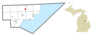
Mason Township, Arenac County, Michigan
Civil township in Michigan, United States
Distance: Approx. 697 meters
Latitude and longitude: 44.12777778,-83.85861111
Mason Township is a civil township of Arenac County in the U.S. state of Michigan. The population was 750 at the 2020 census. The western portion of the village of Twining is located within the township.
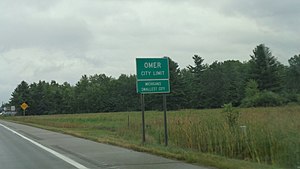
Omer, Michigan
City in Michigan, United States
Distance: Approx. 9419 meters
Latitude and longitude: 44.0475,-83.85444444
Omer is a city in Arenac County in the U.S. state of Michigan. The population was 274 at the 2020 census, which ranks it as the least-populated city in the state. Omer is consistently ranked as "Michigan's Smallest City" in terms of population, although the city of Lake Angelus held this distinction when it recorded a lower population at the 2010 census.

Turner, Michigan
Village in Michigan, United States
Distance: Approx. 5407 meters
Latitude and longitude: 44.14222222,-83.78611111
Turner is a village in Arenac County of the U.S. state of Michigan. The population was 121 at the 2020 census, which ranks Turner as the least-populated village in the state. The village is located within Turner Township.

Turner Township, Michigan
Civil township in Michigan, United States
Distance: Approx. 8064 meters
Latitude and longitude: 44.12444444,-83.75194444
Turner Township is a civil township of Arenac County in the U.S. state of Michigan. As of the 2020 census, it had a population of 519. The villages of Turner and the eastern portion of Twining are located within the township.
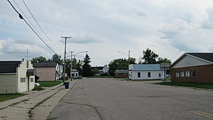
Twining, Michigan
Village in Michigan, United States
Distance: Approx. 4161 meters
Latitude and longitude: 44.11305556,-83.8075
Twining is a village in Arenac County of the U.S. state of Michigan. The population was 130 at the 2020 census. The village is situated on the boundary between Mason Township on the west and Turner Township on the east, with about half of the village in each.
Burleigh Township, Michigan
Civil township in Michigan, United States
Distance: Approx. 8194 meters
Latitude and longitude: 44.20305556,-83.825
Burleigh Township is a civil township of Iosco County in the U.S. state of Michigan. As of the 2020 census, the township population was 726.
Prescott, Michigan
Village in Michigan, United States
Distance: Approx. 9203 meters
Latitude and longitude: 44.19166667,-83.93222222
Prescott is a village in Ogemaw County of the U.S. state of Michigan. The population was 266 at the 2010 census. The village is located within Richland Township.

Richland Township, Ogemaw County, Michigan
Civil township in Michigan, United States
Distance: Approx. 9969 meters
Latitude and longitude: 44.19583333,-83.94
Richland Township is a civil township of Ogemaw County in the U.S. state of Michigan. The population was 827 at the 2020 census.
Maple Ridge, Michigan
Unincorporated community in Michigan, United States
Distance: Approx. 6107 meters
Latitude and longitude: 44.14194444,-83.9275
Maple Ridge is an unincorporated community in Arenac County within Clayton Township and Mason Township at 44°08′31″N 83°55′39″W, about twelve miles north of Standish. A post office operated here from December 4, 1873 until June 14, 1919. As an unincorporated community, Maple Ridge has no defined area or population statistics.

Second Arenac County Courthouse
United States historic place
Distance: Approx. 9449 meters
Latitude and longitude: 44.04722222,-83.85388889
The Second Arenac County Courthouse, also known as Ye Olde Courthouse Masonic Hall and the Omer Masonic Hall, is a historic building located on Central Avenue in Omer, Michigan. The building is an outstanding example of a highly detailed vernacular frame building. It was designated a Michigan State Historic Site in 1976 and listed on the National Register of Historic Places in 1982.
Weather in this IP's area
broken clouds
21 Celsius
21 Celsius
20 Celsius
21 Celsius
1012 hPa
84 %
1012 hPa
987 hPa
10000 meters
1.87 m/s
2.32 m/s
128 degree
51 %
07:19:41
19:38:27