Country:
 Canada
Region:
City:
Latitude and Longitude:
Time Zone:
Postal Code:
IP information under different IP Channel
ip-api
Country
Region
City
ASN
Time Zone
ISP
Blacklist
Proxy
Latitude
Longitude
Postal
Route
IPinfo
Country
Region
City
ASN
Time Zone
ISP
Blacklist
Proxy
Latitude
Longitude
Postal
Route
MaxMind
Country
Region
City
ASN
Time Zone
ISP
Blacklist
Proxy
Latitude
Longitude
Postal
Route
Luminati
Country
CARegion
qc
City
saintececiledemasham
ASN
Time Zone
America/Toronto
ISP
CC-3272
Latitude
Longitude
Postal
db-ip
Country
Region
City
ASN
Time Zone
ISP
Blacklist
Proxy
Latitude
Longitude
Postal
Route
ipdata
Country
Region
City
ASN
Time Zone
ISP
Blacklist
Proxy
Latitude
Longitude
Postal
Route
Popular places and events near this IP address

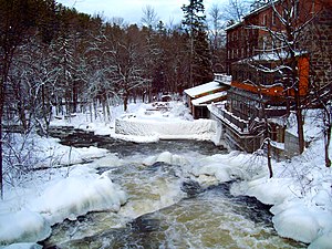
Wakefield, Quebec
Distance: Approx. 8460 meters
Latitude and longitude: 45.633,-75.933
Wakefield is one of many villages of the municipality of La Pêche, with the village centre on the western shore of the Gatineau River, at the confluence of the La Pêche River in the Outaouais region of the province of Quebec in Canada. It is thirty-five kilometres northwest of Ottawa, Ontario. The village, named after the city of Wakefield in West Yorkshire, England, is now the southern edge of the municipality of La Pêche, and was founded in 1830 by Irish, Scottish, and English immigrants.
La Pêche River
River in Quebec, Canada
Distance: Approx. 8588 meters
Latitude and longitude: 45.63722222,-75.93
The La Pêche River (French: Rivière la Pêche) is a river in western Quebec, in Canada, which drains La Pêche Lake (Lac La Pêche) in Gatineau Park and empties into the Gatineau River at Wakefield.

Gatineau Park
Federal park in Gatineau, Quebec
Distance: Approx. 8138 meters
Latitude and longitude: 45.58333333,-76
Gatineau Park (French: Parc de la Gatineau) is a federal park located in the Outaouais region of Quebec, Canada. Administered by the National Capital Commission as part of the National Capital Region, Gatineau Park is a 361 square kilometres (139 sq mi) wedge of land extending north and west from the city of Gatineau. With a perimeter of 179.2 kilometres (111.3 mi), the park includes parts of the municipalities of Chelsea, Pontiac, La Pêche, and the City of Gatineau.
Rupert, Quebec
Place in Quebec, Canada
Distance: Approx. 5288 meters
Latitude and longitude: 45.68611111,-75.99225
Rupert is a village located about 10 kilometers NNW of Wakefield, Quebec, at the convergence of the Shouldice Road and Maple Drive. On December 9, 1944, a fire destroyed the Rupert General Store. The article from the Evening Citizen (now the Ottawa Citizen) on that date reads: "Fire Razes Home And Rupert General Store.
Gatineau (provincial electoral district)
Provincial electoral district in Quebec, Canada
Distance: Approx. 9925 meters
Latitude and longitude: 45.64,-75.912
Gatineau is a provincial electoral district in the Outaouais region of Quebec, Canada which elects members to the National Assembly of Quebec. It notably includes parts of the city of Gatineau as well as Val-des-Monts, Cantley and La Pêche. It was created from parts of Hull for the 1931 election.

Lac Phillipe
Distance: Approx. 5721 meters
Latitude and longitude: 45.60638889,-76.00277778
Lac Philippe is a medium-sized lake located on the north side of Gatineau Park. The lake is one of a chain of freshwater lakes found within the Gatineau park that drain into the Gatineau River through Meech Creek. It is one of the largest bodies of water in the northernmost stretches of the park, along with lac La Pêche (Fishing Lake) and lac des Loups (Lake of the Wolves), which are located in the extreme northwestern reaches.

La Pêche
Municipality in Quebec, Canada
Distance: Approx. 5580 meters
Latitude and longitude: 45.68333333,-75.98333333
La Pêche (French: [la pɛːʃ], locally [la paɪ̯ʃ]; meaning "Fishing") is a municipality along both sides of the Gatineau River in Les Collines-de-l'Outaouais Regional County Municipality in the Outaouais region of Quebec, Canada, about 30 km (19 mi) north of downtown Gatineau. Bordering on the north side of the Gatineau Park, La Pêche provides multiple access points to this park. La Pêche was declared Quebec's first and Canada's second fair trade town on November 9, 2007.

Alcove, Quebec
Distance: Approx. 9123 meters
Latitude and longitude: 45.68333333,-75.93055556
Alcove is a small community in Quebec, Canada, part of the Municipality of La Pêche. It is located along Highway 105 and the Gatineau River approximately 35 minutes north of Ottawa, immediately north of Wakefield and south of Farrellton. The main features of Alcove are a gas station, church, graveyard and aged buildings.

Maclaren Cemetery
Cemetery in Wakefield, Outaouais Region, Quebec, Canada
Distance: Approx. 7957 meters
Latitude and longitude: 45.6371,-75.9383
Maclaren Cemetery is a small cemetery in the town of Wakefield, Quebec and the final resting place for Prime Minister Lester B. Pearson. Established near the 1870s, the cemetery is located in the clearing below the hills bordering the Gatineau River and is the resting place for Scottish settlers in the area. Notable persons interred here include: David Maclaren – settler and namesake of the cemetery Malak Karsh (1915–2001) – Canadian photographer.
Taylor Lake (Quebec)
Lake in Gatineau Park
Distance: Approx. 5316 meters
Latitude and longitude: 45.60416667,-76.04944444
Taylor Lake is a small lake in Gatineau Park area of Quebec, Canada. It is one of the park's smaller lakes. It is located mostly in the municipality of La Pêche and partly in Pontiac, both in Les Collines-de-l'Outaouais Regional County Municipality, Quebec.
Vorlage (ski hill)
Distance: Approx. 8120 meters
Latitude and longitude: 45.64583333,-75.93444444
Vorlage is a ski hill located at the village of Wakefield, within the municipality of La Pêche, Quebec, in the Gatineau Hills north of Ottawa, Ontario. It consists of 18 runs, 13 of which have night skiing. It was opened in 1941 and has a terrain park.
Weather in this IP's area
clear sky
27 Celsius
28 Celsius
27 Celsius
28 Celsius
1022 hPa
55 %
1022 hPa
1003 hPa
10000 meters
0.94 m/s
1.22 m/s
130 degree
06:44:22
19:13:30