Country:
 Canada
Region:
City:
Latitude and Longitude:
Time Zone:
Postal Code:
IP information under different IP Channel
ip-api
Country
Region
City
ASN
Time Zone
ISP
Blacklist
Proxy
Latitude
Longitude
Postal
Route
IPinfo
Country
Region
City
ASN
Time Zone
ISP
Blacklist
Proxy
Latitude
Longitude
Postal
Route
MaxMind
Country
Region
City
ASN
Time Zone
ISP
Blacklist
Proxy
Latitude
Longitude
Postal
Route
Luminati
Country
CARegion
qc
City
pontrouge
ASN
Time Zone
America/Toronto
ISP
CC-3272
Latitude
Longitude
Postal
db-ip
Country
Region
City
ASN
Time Zone
ISP
Blacklist
Proxy
Latitude
Longitude
Postal
Route
ipdata
Country
Region
City
ASN
Time Zone
ISP
Blacklist
Proxy
Latitude
Longitude
Postal
Route
Popular places and events near this IP address

Donnacona, Quebec
City in Quebec, Canada
Distance: Approx. 8951 meters
Latitude and longitude: 46.67472222,-71.72944444
Donnacona is an industrial town located about 40 kilometres (25 mi) west of Quebec City in Portneuf County, Quebec, Canada.

Saint-Basile, Quebec
City in Quebec, Canada
Distance: Approx. 8926 meters
Latitude and longitude: 46.75,-71.81666667
Saint-Basile is a municipality situated in Portneuf Regional County Municipality in the Canadian province of Quebec.

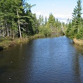
Pont-Rouge
City in Quebec, Canada
Distance: Approx. 279 meters
Latitude and longitude: 46.75,-71.7
Pont-Rouge is a Canadian city along the Jacques-Cartier River in southern Quebec, Canada. In the Canada 2021 Census the population was 10,121 inhabitants.
Jules-Carpentier Ecological Reserve
Distance: Approx. 3823 meters
Latitude and longitude: 46.7778,-71.6658
Jules-Carpentier Ecological Reserve is an ecological reserve in Quebec, Canada. It was established on May 18, 2000. The reserve is named after local Jules Carpentier.
Zec de la Rivière-Jacques-Cartier
Distance: Approx. 4194 meters
Latitude and longitude: 46.71666667,-71.71666667
The zec de la Rivière-Jacques-Cartier is a "zone d'exploitation contrôlée" (controlled harvesting zone) (zec) in the municipality of Donnacona, in the Portneuf Regional County Municipality, in the administrative area of the Capitale-Nationale, in Quebec, in Canada.
Noire River (rivière aux Pommes)
River in Quebec, Canada
Distance: Approx. 6471 meters
Latitude and longitude: 46.69805556,-71.67
The rivière Noire (English: Black River) is a tributary of the rivière aux Pommes, flowing in the municipalities of Saint-Augustin-de-Desmaures, Pont-Rouge and Neuville, in the Portneuf Regional County Municipality, in the administrative region of Capitale-Nationale, in Quebec, Canada. The Black River Valley is mainly served by route 365, route 367 and autoroute 40 which links the cities of Quebec and Trois-Rivières. Some secondary roads serve this area for agricultural purposes.
Rivière aux Pommes
Tributary of Jacques-Cartier River in Québec, Canada
Distance: Approx. 6760 meters
Latitude and longitude: 46.69722222,-71.73638889
The rivière aux Pommes is a tributary of the Jacques-Cartier River, flowing in the municipalities of Sainte-Catherine-de-la-Jacques-Cartier, Pont-Rouge, Neuville and Donnacona, in the Portneuf Regional County Municipality, in the administrative region of Capitale-Nationale, in Quebec, Canada. The Rivière aux Pommes valley is mainly served by the route 365, the route 367 and the autoroute 40 which links the cities of Quebec and Trois-Rivières. Some secondary roads serve this area for agricultural purposes.
Rivière des Sept Îles
River in Quebec, Canada
Distance: Approx. 8665 meters
Latitude and longitude: 46.7499568,-71.813244
The Rivière des Sept Îles is a tributary of the Portneuf River, flowing in the municipalities of Saint-Raymond and Saint-Basile, in the regional county municipality (MRC) of Portneuf Regional County Municipality, in the administrative region of Capitale-Nationale, in Quebec, in Canada. Apart from the passage of the river near hamlet and near the village of Saint-Basile, the Rivière des Sept Îles flows mainly in agricultural and forestry areas, being the main economic activities of this small valley . The lower part of this valley is served by boulevard du Centenaire, rue Sainte-Angélique which turns north on chemin du rang Sainte-Angélique.
Blanche River (Portneuf River tributary)
River in Quebec, Canada
Distance: Approx. 6861 meters
Latitude and longitude: 46.80472,-71.7475
The Rivière Blanche is a tributary of the Portneuf River, flowing in the municipalities of Sainte-Catherine-de-la-Jacques-Cartier, Pont-Rouge and Saint-Basile, in the regional county municipality (MRC) of Portneuf Regional County Municipality, in the administrative region of Capitale-Nationale, in the province of Quebec, in Canada. Apart from the passage of the river in a small hamlet of Pont-Rouge (near Lake André), the Blanche river flows especially at the border between the agricultural and forest environment, the main economic activities of this small valley. This valley is served by chemin du Rang Sainte-Madeleine, chemin du 2e rang du Brûlé, rue Lamothe, chemin Tâché and chemin des Ormeaux.
Rivière d'Aulnage
River in Quebec, Canada
Distance: Approx. 9010 meters
Latitude and longitude: 46.7625,-71.81694
The Rivière d'Aulnage (English: Aulnage River) is a tributary of the rivière des Sept Îles, flowing on the north shore of the Saint Lawrence river in the municipalities of Saint-Léonard-de-Portneuf and Saint-Basile, in the Portneuf Regional County Municipality, in the administrative region of Capitale-Nationale, in the province of Quebec, in Canada. The upper part of the Aulnage river flows mainly in the forest, descending the Montagne de Sainte-Angélique; the lower part is mainly in agricultural area. For example, forestry and agriculture are the main economic activities in this valley.
Saint-Jacques River (Portneuf River tributary)
River in Quebec, Canada
Distance: Approx. 8171 meters
Latitude and longitude: 46.74833,-71.80666
The Saint-Jacques River is a tributary of the Portneuf River, flowing in the municipalities of Pont-Rouge and Saint-Basile, in the Portneuf Regional County Municipality, in the administrative region of Capitale-Nationale, in the province of Quebec, Canada. The Saint-Jacques river flows mainly in agricultural areas, the main economic activity in this small valley. Its course crosses a few forest islands.
Rivière à Matte
Watercourse in Portneuf, Québec, Canada
Distance: Approx. 8418 meters
Latitude and longitude: 46.69111,-71.63528
The rivière à Matte (English: Matte's River) is a tributary of the northwest shore of the St. Lawrence River, flowing in the municipality of Neuville, in the Portneuf Regional County Municipality, in the administrative region of Capitale-Nationale, in the province, in Quebec, in Canada. The Matte river valley is mainly served by the route 365 which is perpendicular to the Saint-Laurent river, the 2nd range road, the Gravel road and the Lomer road in particular for needs agriculture and forestry are the two main economic activities in this area.
Weather in this IP's area
clear sky
10 Celsius
10 Celsius
9 Celsius
12 Celsius
1031 hPa
81 %
1031 hPa
1018 hPa
10000 meters
1.87 m/s
1.87 m/s
243 degree
07:09:12
17:54:10