Country:
Region:
City:
Latitude and Longitude:
Time Zone:
Postal Code:
IP information under different IP Channel
ip-api
Country
Region
City
ASN
Time Zone
ISP
Blacklist
Proxy
Latitude
Longitude
Postal
Route
Luminati
Country
ASN
Time Zone
America/Chicago
ISP
ASN-INTERNAP-BLK
Latitude
Longitude
Postal
IPinfo
Country
Region
City
ASN
Time Zone
ISP
Blacklist
Proxy
Latitude
Longitude
Postal
Route
db-ip
Country
Region
City
ASN
Time Zone
ISP
Blacklist
Proxy
Latitude
Longitude
Postal
Route
ipdata
Country
Region
City
ASN
Time Zone
ISP
Blacklist
Proxy
Latitude
Longitude
Postal
Route
Popular places and events near this IP address

South Bay (Los Angeles County)
Region in California, United States
Distance: Approx. 2125 meters
Latitude and longitude: 33.83694444,-118.31805556
The South Bay is a region of the Los Angeles metropolitan area, located in the southwest corner of Los Angeles County. The name stems from its geographic location stretching along the southern shore of Santa Monica Bay. The South Bay contains sixteen cities plus portions of the City of Los Angeles and unincorporated portions of the county.

Torrance, California
City in Los Angeles County, California, United States
Distance: Approx. 125 meters
Latitude and longitude: 33.83472222,-118.34138889
Torrance is a coastal city in the Los Angeles metropolitan area, located in southwest Los Angeles County, California, United States. The city is part of what is known as the South Bay region of the metropolitan area. A small section of the city, 1.5 miles (2.4 km), abuts the Pacific Ocean.

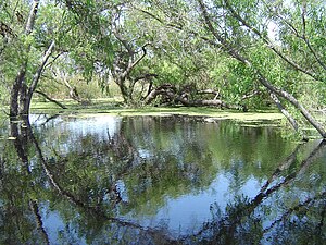
Madrona Marsh
Vernal freshwater marsh in Southern California, USA
Distance: Approx. 996 meters
Latitude and longitude: 33.82694444,-118.3425
The Madrona Marsh Preserve, in the city of Torrance in the South Bay region of Southern California, is a seasonal wetland with vernal pools. The 43 acres (17 ha) was a former site of oil wells and is one of the few natural areas remaining within an urban landscape. Formed eons ago when the mountains of the Palos Verdes Peninsula rose to the south, Madrona Marsh is a shallow depression fed by wet season (spring) storms as the name "vernal" indicates.

Torrance High School
Public school in Torrance, California, United States
Distance: Approx. 1974 meters
Latitude and longitude: 33.82925,-118.3211661
Torrance High School is a high school located in Torrance, California. Founded in 1917, it is one of the oldest high schools in continuous use in California and is the oldest of the five high schools in the Torrance Unified School District. Four of its buildings are listed on the U.S. National Register of Historic Places.

Del Amo Fashion Center
Shopping mall in Southern California
Distance: Approx. 1184 meters
Latitude and longitude: 33.828072,-118.349796
Del Amo Fashion Center is a three-level regional shopping mall in Torrance, California, United States. It is currently managed and co-owned by Simon Property Group. With a gross leasable area (GLA) of 2,519,601 sq ft (234,079 m2), it is the sixth largest shopping mall in the United States.
Little Company of Mary Hospital (Torrance)
Hospital in California, United States
Distance: Approx. 1524 meters
Latitude and longitude: 33.8386,-118.35713
Providence Little Company of Mary Medical Center is a Roman Catholic hospital in Torrance, California, United States. The hospital was founded by the Sisters of the Little Company of Mary, and is part of the Providence Health & Services system.
Southern California Regional Occupational Center
Vocational school in Southern California, United States
Distance: Approx. 1805 meters
Latitude and longitude: 33.82428,-118.32726
The Southern California Regional Occupational Center or SoCal ROC is located in Torrance, California. It is a Joint Powers Authority serving 6 school districts (Inglewood, Manhattan Beach, Palos Verdes Peninsula, Redondo Beach, El Segundo, and Torrance). As of 2020, the six school districts sent less than 20 high school students each.
Home Economics Building (Torrance High School)
United States historic place
Distance: Approx. 1912 meters
Latitude and longitude: 33.83111111,-118.32111111
The Home Economics Building is located on the campus of Torrance High School in Torrance, Los Angeles County, California. It was built in 1922–1923, in the Mediterranean Revival style. It was listed on the National Register of Historic Places in 1983.

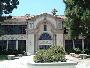
Main Building (Torrance High School)
United States historic place
Distance: Approx. 1994 meters
Latitude and longitude: 33.83083333,-118.32027778
The Main Building of Torrance High School is located on the campus in Torrance, southwestern Los Angeles County, California. The Main Building was opened to students as Torrance School in 1917.

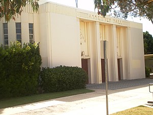
Auditorium (Torrance High School)
United States historic place
Distance: Approx. 2071 meters
Latitude and longitude: 33.83,-118.31972222
The Auditorium, also known as the Assembly Hall, is a PWA Moderne style building located on the campus of Torrance High School in Torrance, Los Angeles County, California. When built in 1924 the building was a source of pride for Torrance, and was its first large meeting hall, preceding construction of a civic center. It was damaged in the 1933 Long Beach earthquake and was rebuilt as a New Deal project.
Ambassador Christian School
Private christian high school in Torrance, California, United States
Distance: Approx. 1799 meters
Latitude and longitude: 33.82435824,-118.32726024
Ambassador Christian School (ACS), formerly Ambassador High School, is a Christian middle and high school in Torrance, California. The school was established in 2013 by Michael Barker. In 2015, a team from Ambassador High School developed an experiment about the usage of wind as a means of pollination in microgravity.

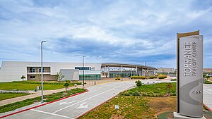
Torrance Transit Center
Transport hub in Torrance, California
Distance: Approx. 1266 meters
Latitude and longitude: 33.8421,-118.3296
The Torrance Transit Center (officially the Mary K. Giordano Regional Transit Center) is a bus station in Torrance that serves as the city's transport hub. It opened on June 9, 2023. The station is planned to serve as the southern terminus of the Los Angeles Metro Rail K Line via a proposed extension.
Weather in this IP's area
clear sky
16 Celsius
15 Celsius
14 Celsius
18 Celsius
1017 hPa
61 %
1017 hPa
1014 hPa
10000 meters
3.09 m/s
30 degree
06:16:48
16:57:09
