Country:
 USA
USARegion:
City:
Latitude and Longitude:
Time Zone:
Postal Code:
IP information under different IP Channel
ip-api
Country
Region
City
ASN
Time Zone
ISP
Blacklist
Proxy
Latitude
Longitude
Postal
Route
IPinfo
Country
Region
City
ASN
Time Zone
ISP
Blacklist
Proxy
Latitude
Longitude
Postal
Route
MaxMind
Country
Region
City
ASN
Time Zone
ISP
Blacklist
Proxy
Latitude
Longitude
Postal
Route
Luminati
Country
USRegion
wi
City
wisconsinrapids
ASN
Time Zone
America/Chicago
ISP
WCTC
Latitude
Longitude
Postal
db-ip
Country
Region
City
ASN
Time Zone
ISP
Blacklist
Proxy
Latitude
Longitude
Postal
Route
ipdata
Country
Region
City
ASN
Time Zone
ISP
Blacklist
Proxy
Latitude
Longitude
Postal
Route
Popular places and events near this IP address
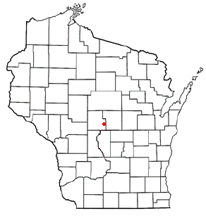
Grand Rapids, Wisconsin
Town in Wisconsin, United States
Distance: Approx. 2541 meters
Latitude and longitude: 44.36722222,-89.77333333
The Town of Grand Rapids is located in Wood County, Wisconsin, United States. The population was 7,801 at the 2000 census. The census-designated place of Lake Wazeecha is located in the town.
Wisconsin Rapids, Wisconsin
City in Wisconsin, United States
Distance: Approx. 2048 meters
Latitude and longitude: 44.38666667,-89.82305556
Wisconsin Rapids is a city in and the county seat of Wood County, Wisconsin, United States, along the Wisconsin River. The population was 18,877 at the 2020 census. It is a principal city of the Marshfield–Wisconsin Rapids micropolitan statistical area, which includes all of Wood County and had a population of 74,207 in 2020.

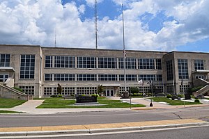
McMillan Memorial Library
Distance: Approx. 2048 meters
Latitude and longitude: 44.38793,-89.82138
The McMillan Memorial Library is the municipal library of Wisconsin Rapids, Wisconsin and serves southern Wood County. It is a member of the South Central Library System, which serves seven counties in Wisconsin.
Assumption High School (Wisconsin)
School in Wisconsin Rapids, Wisconsin, United States
Distance: Approx. 1990 meters
Latitude and longitude: 44.38416667,-89.82472222
Assumption High School is a Roman Catholic high school in Wisconsin Rapids, Wisconsin, in the Diocese of La Crosse. Assumption was established in 1951. It is the only high school in the Wisconsin Rapids Area Catholic Schools, which also operates one middle school, and three primary/elementary schools.

Witter Field
Distance: Approx. 1816 meters
Latitude and longitude: 44.385493,-89.820621
Witter Field is a baseball ballpark located at 521 Lincoln Street in Wisconsin Rapids, Wisconsin, United States. It was built in 1928. It served as the home park for multiple minor league teams: the Wisconsin Rapids White Sox, Wisconsin Rapids Senators and Wisconsin Rapids Twins.
Belle Island (Wisconsin)
Distance: Approx. 2642 meters
Latitude and longitude: 44.38694444,-89.83194444
Belle Island is a river island in Wood County, Wisconsin. Former variant names were Neeve's Island and Mead Island, after former owners George Neeves and George Mead, respectively. The present name "Belle Island" is commendatory.
Fourmile Creek (Wood County, Wisconsin)
Stream in Wisconsin, U.S.
Distance: Approx. 3034 meters
Latitude and longitude: 44.3475,-89.80111111
Fourmile Creek is a stream in the U.S. state of Wisconsin. Fourmile Creek was so named for its distance, four miles (6.4 km) from the original Grand Rapids townsite. The name sometimes is spelled out "Four Mile Creek".
Garrison Island
Distance: Approx. 3303 meters
Latitude and longitude: 44.37527778,-89.845
Garrison Island is a river island in Wood County, Wisconsin. The island is on the Wisconsin River at the city of Wisconsin Rapids. Garrison Island was named after Frank Garrison, a former owner of the site.
Gaynor Park
Urban park in Wisconsin Rapids
Distance: Approx. 2517 meters
Latitude and longitude: 44.39361111,-89.82083333
Gaynor Park is an urban park located in and administered by the city of Wisconsin Rapids, Wisconsin. The park has an area of 4.64 acres (1.88 ha). Gaynor Park was named after John A. Gaynor, a local judge.
Lyon Park (Wisconsin)
Distance: Approx. 2976 meters
Latitude and longitude: 44.38444444,-89.83833333
Lyon Park is an urban park located in and administered by the city of Wisconsin Rapids, Wisconsin. The park has an area of 6.18 acres (2.50 ha). Lyon Park has the name of Clark Lyon, a local landowner.
Onemile Creek
Stream in Wisconsin, U.S.
Distance: Approx. 2890 meters
Latitude and longitude: 44.35694444,-89.83
Onemile Creek is a stream in the U.S. state of Wisconsin. It is a tributary to Twomile Creek. Onemile Creek was so named for its distance, one mile (1.6 km) from the original Grand Rapids townsite.
Robinson Park
Distance: Approx. 2507 meters
Latitude and longitude: 44.39722222,-89.80361111
Robinson Park is an urban park located in and administered by the city of Wisconsin Rapids, Wisconsin. The park was named after Dr. F. Byron Robinson, the original owner of the site.
Weather in this IP's area
clear sky
8 Celsius
6 Celsius
7 Celsius
10 Celsius
1029 hPa
53 %
1029 hPa
991 hPa
10000 meters
2.57 m/s
170 degree
07:19:46
18:08:03