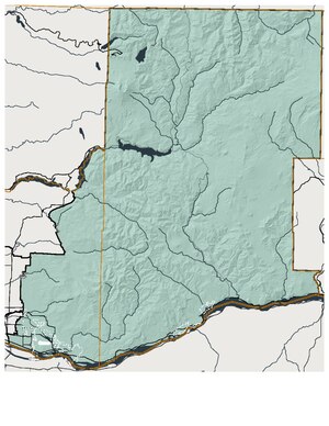
Country:
Region:
City:
Latitude and Longitude:
Time Zone:
Postal Code:
IP information under different IP Channel
ip-api
Country
Region
City
ASN
Time Zone
ISP
Blacklist
Proxy
Latitude
Longitude
Postal
Route
Luminati
Country
ASN
Time Zone
America/Chicago
ISP
INTERNAP-BLOCK-4
Latitude
Longitude
Postal
IPinfo
Country
Region
City
ASN
Time Zone
ISP
Blacklist
Proxy
Latitude
Longitude
Postal
Route
db-ip
Country
Region
City
ASN
Time Zone
ISP
Blacklist
Proxy
Latitude
Longitude
Postal
Route
ipdata
Country
Region
City
ASN
Time Zone
ISP
Blacklist
Proxy
Latitude
Longitude
Postal
Route
Popular places and events near this IP address

Five Corners, Washington
Census-designated place in Washington, United States
Distance: Approx. 3444 meters
Latitude and longitude: 45.68222222,-122.56944444
Five Corners is a census-designated place (CDP) in Clark County, Washington, United States. The population was 20,973 at the 2020 census.

Minnehaha, Washington
Census-designated place in Washington, United States
Distance: Approx. 2018 meters
Latitude and longitude: 45.65,-122.61666667
Minnehaha is a census-designated place (CDP) in Clark County, Washington, United States. The population was 11,871 at the 2020 census.

Walnut Grove, Washington
Census-designated place in Washington, United States
Distance: Approx. 2192 meters
Latitude and longitude: 45.67416667,-122.60138889
Walnut Grove is a census-designated place (CDP) in Clark County, Washington, United States. The population was 9,790 at the 2010 census, up from 7,164 at the 2000 census. Based on per capita income, one of the more reliable measures of affluence, Walnut Grove ranks 78th out of 522 areas in the state of Washington to be ranked.

Vancouver Mall
Shopping mall in Vancouver, Washington, US.
Distance: Approx. 708 meters
Latitude and longitude: 45.65805556,-122.58361111
Vancouver Mall is a shopping mall owned by Cenntenial Real Estate, and located in the city of Vancouver, Washington, U.S., which is within the Portland (Oregon) metropolitan area. It is anchored by Gold's Gym, H&M, JCPenney, Macy's, AMC, Hobby Lobby, Round One, and Old Navy. Longtime past anchor stores included Meier & Frank, Sears, Nordstrom and Mervyn's.

Fort Vancouver High School
Public school in Vancouver, Clark County, Washington, United States
Distance: Approx. 2685 meters
Latitude and longitude: 45.636111,-122.612317
Fort Vancouver High School, known as FVHS and Fort Vancouver High School Center for International Studies, is a public high school located in Vancouver, Washington. FVHS is named after Fort Vancouver, an early trading outpost built in 1824-25 near the banks of the Columbia River, a few miles from where the school is located. The FVHS symbol is the Trapper, in reference to the fur trade in the early 19th century by such groups as Hudson's Bay Company voyageurs.

Vancouver Public Schools
School district in Washington, United States
Distance: Approx. 3052 meters
Latitude and longitude: 45.64277778,-122.62666667
Vancouver Public Schools is a school district in Vancouver, Washington covering 58 square miles (150.2 km2) in Clark County.

PeaceHealth Southwest Medical Center
Hospital in Washington, United States
Distance: Approx. 3747 meters
Latitude and longitude: 45.623,-122.58
PeaceHealth Southwest Medical Center is a 450-bed community hospital located in Vancouver, Washington. The hospital was founded in 1858. In 2010, the hospital had about 114,000 emergency department (ED) visits, 27,000 in-patient visits, and 3,000 child births.

Washington's 17th legislative district
One of forty-nine districts in Washington state for representation in the state legislature.
Distance: Approx. 3160 meters
Latitude and longitude: 45.68333333,-122.58333333
Washington's 17th legislative district is one of forty-nine districts in Washington state for representation in the state legislature. The district includes eastern Vancouver and other parts of southwest Clark County east of I-205. This urban district is represented state senator Lynda Wilson and state representatives Kevin Waters (position 1) and Paul Harris (position 2), all Republicans.

Henrietta Lacks Health and Bioscience High School
Secondary school in Vancouver, Washington, United States
Distance: Approx. 3299 meters
Latitude and longitude: 45.6273,-122.5794
Henrietta Lacks Health and Bioscience High School, commonly known as HeLa (alternatively spelled He-La), is a high school located in Vancouver, Washington. It is the most recent high school built in the Evergreen Public Schools, and one of six high schools in the district. The school's colors are light blue, dark blue, and grey.
KXRW-LP
Community radio station in Vancouver, Washington, United States
Distance: Approx. 779 meters
Latitude and longitude: 45.65166667,-122.60027778
KXRW-LP 99.9 FM Community Radio is a low-power FM non-commercial radio station broadcasting in Vancouver, Washington. The station is licensed to the Media Institute for Social Change, an Oregon-based nonprofit organization. As of March 2017, KXRW-LP relays programming from KXRY, branded as XRAY.FM in Portland, Oregon.
2019 Pacific Northwest measles outbreak
Measles outbreak in the Portland metropolitan area
Distance: Approx. 2556 meters
Latitude and longitude: 45.63333333,-122.6
In early months of 2019, a measles outbreak occurred in the Portland metropolitan area, including the Clark County, Washington suburbs, in the United States. At the time, the outbreak was the largest outbreak in more than two decades; outbreaks in 2019 in areas including Brooklyn and Rockland County, New York have since seen far greater numbers of cases.

Wooden Shoe Tulip Festival
Tulip festival in Woodburn, Oregon, U.S.
Distance: Approx. 3521 meters
Latitude and longitude: 45.624,-122.59
The Wooden Shoe Tulip Festival is a Tulip festival held in Woodburn, Oregon, United States.
Weather in this IP's area
scattered clouds
7 Celsius
7 Celsius
6 Celsius
9 Celsius
1018 hPa
85 %
1018 hPa
1009 hPa
10000 meters
1.54 m/s
340 degree
40 %
07:10:49
16:39:35