Country:
Region:
City:
Latitude and Longitude:
Time Zone:
Postal Code:
IP information under different IP Channel
ip-api
Country
Region
City
ASN
Time Zone
ISP
Blacklist
Proxy
Latitude
Longitude
Postal
Route
Luminati
Country
Region
ca
City
applevalley
ASN
Time Zone
America/Los_Angeles
ISP
UIA
Latitude
Longitude
Postal
IPinfo
Country
Region
City
ASN
Time Zone
ISP
Blacklist
Proxy
Latitude
Longitude
Postal
Route
db-ip
Country
Region
City
ASN
Time Zone
ISP
Blacklist
Proxy
Latitude
Longitude
Postal
Route
ipdata
Country
Region
City
ASN
Time Zone
ISP
Blacklist
Proxy
Latitude
Longitude
Postal
Route
Popular places and events near this IP address

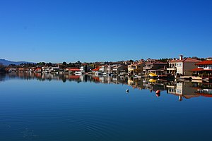
Apple Valley, California
City in California, United States
Distance: Approx. 896 meters
Latitude and longitude: 34.53416667,-117.205
Apple Valley is an incorporated town in the Victor Valley of San Bernardino County, in the U.S. state of California. Its population was 75,791 as of the 2020 United States Census. The town is east of and adjoining to the neighboring cities of Victorville and Hesperia, 35 miles (56 km) south of Barstow, and 49 miles (79 km) north of San Bernardino through the Cajon Pass.

Victorville, California
City in California, United States
Distance: Approx. 7148 meters
Latitude and longitude: 34.53611111,-117.29111111
Victorville is a city in Victor Valley in San Bernardino County, California. Its population as of the 2020 census was 134,810. Victorville is the principal city of a Victor Valley–based urban area defined by the United States Census Bureau: the Victorville–Hesperia–Apple Valley urban area had a population of 355,816 as of the 2020 census, making it the 117th largest in the United States.
Bell Mountain (San Bernardino County, California)
Desert mountain in the American state of California
Distance: Approx. 5861 meters
Latitude and longitude: 34.582772,-117.2169882
Bell Mountain is a desert mountain, with summit and elevation of 3,897 feet (1,188 m), in the Mojave Desert of Southern California. It is located north of Apple Valley, in San Bernardino County.
Academy for Academic Excellence
School in Apple Valley, California, United States
Distance: Approx. 5991 meters
Latitude and longitude: 34.5328286,-117.2787523
The Academy for Academic Excellence (AAE) is a K-12 public charter school based in Apple Valley, California. It is part of the Lewis Center for Educational Research (LCER), named for a major supporter, then Congressman Jerry Lewis. The school was first chartered in 1997 by the Apple Valley Unified School District.
Victor Valley Transportation Center
Intermodal transit center in Victorville, California
Distance: Approx. 7366 meters
Latitude and longitude: 34.5375,-117.29333333
The Victor Valley Transportation Center (Victorville station) is an intermodal transit center in Victorville, California. It is served by the daily Amtrak Southwest Chief train, as well as Greyhound Lines intercity buses and Victor Valley Transit Authority local buses.
Lewis Center for Educational Research
Distance: Approx. 5898 meters
Latitude and longitude: 34.5311,-117.2778
The Lewis Center for Educational Research (LCER) is an educational organization located in Apple Valley, California. It operates two charter schools: the Academy for Academic Excellence in Apple Valley, and the Norton Science and Language Academy in San Bernardino.
Murray's Dude Ranch
Distance: Approx. 3068 meters
Latitude and longitude: 34.5573,-117.2074
Murray's Ranch, sometimes called the Overall Wearing Dude Ranch, was a guest ranch in Bell Mountain, California from the 1920s until the 1960s. The ranch was located at the northwest corner of Waalew Road and Dale Evans Parkway in Apple Valley, just outside the city limits of Victorville. It was owned by African Americans and catered primarily to an African American clientele.
KWRN
Radio station in Apple Valley, California
Distance: Approx. 5312 meters
Latitude and longitude: 34.53666667,-117.15611111
KWRN (1550 kHz) is a commercial AM radio station broadcasting a Regional Mexican format, branded as "Radio Lazer 99.5 y 1550". Licensed to Apple Valley, California, it serves the Victor Valley area and is owned by Lazer Broadcasting. By day, KWRN is powered at 5,000 watts non-directional.

Granite Hills High School (Apple Valley, California)
Public secondary school in Apple Valley, California, United States
Distance: Approx. 4971 meters
Latitude and longitude: 34.509,-117.1658
Granite Hills High School is a public high school located in Apple Valley, California and is part of the Apple Valley Unified School District. The school was established in 1999 to relieve pressure on the crowded Apple Valley High School.
Apple Valley Inn
Hotel located in Apple Valley, California, United States
Distance: Approx. 965 meters
Latitude and longitude: 34.52186968,-117.21640027
The Apple Valley Inn was a hotel and restaurant established in Apple Valley, California, to help developer Newton T. Bass attract wealthy land buyers to the southern California desert town. Bass and partner Bernard "Bud" Westlund owned Apple Valley Ranchos Land Development Co. The inn, which opened on Thanksgiving Day 1948, is a landmark in the community and a prominent feature in the history of Apple Valley.

Spring Valley Lake, California
Census-designated place in California, United States
Distance: Approx. 6268 meters
Latitude and longitude: 34.49722222,-117.26888889
Spring Valley Lake is a census-designated place in the Victor Valley of the Mojave Desert, within San Bernardino County, California. It is located along the Mojave River.
Victor Valley College Solar Farm
Distance: Approx. 6899 meters
Latitude and longitude: 34.48027778,-117.25805556
The Victor Valley College Solar Farm is a 1.26 MWp (1.02 MWAC) concentrator photovoltaics (CPV) power station in Victorville, California. Upon completion in May 2010 it was the largest CPV project installed in North America. It was built by Sachs Electric using 122 dual-axis SF-1100S systems, each of which contains 28 SF-1100 modules.
Weather in this IP's area
clear sky
10 Celsius
9 Celsius
8 Celsius
11 Celsius
1013 hPa
59 %
1013 hPa
910 hPa
10000 meters
2.03 m/s
3.72 m/s
306 degree
1 %
06:11:31
16:53:15
