66.135.98.242 - IP Lookup: Free IP Address Lookup, Postal Code Lookup, IP Location Lookup, IP ASN, Public IP
Country:
Region:
City:
Location:
Time Zone:
Postal Code:
ISP:
ASN:
language:
User-Agent:
Proxy IP:
Blacklist:
IP information under different IP Channel
ip-api
Country
Region
City
ASN
Time Zone
ISP
Blacklist
Proxy
Latitude
Longitude
Postal
Route
db-ip
Country
Region
City
ASN
Time Zone
ISP
Blacklist
Proxy
Latitude
Longitude
Postal
Route
IPinfo
Country
Region
City
ASN
Time Zone
ISP
Blacklist
Proxy
Latitude
Longitude
Postal
Route
IP2Location
66.135.98.242Country
Region
ontario
City
north york
Time Zone
America/Toronto
ISP
Language
User-Agent
Latitude
Longitude
Postal
ipdata
Country
Region
City
ASN
Time Zone
ISP
Blacklist
Proxy
Latitude
Longitude
Postal
Route
Popular places and events near this IP address

Henry Farm
Neighbourhood in Toronto, Ontario, Canada
Distance: Approx. 1365 meters
Latitude and longitude: 43.77,-79.352
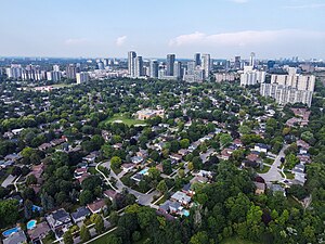
Henry Farm is a neighbourhood in the City of Toronto, Ontario, Canada. It is located in the north central part of the city within the former city of North York. The City of Toronto has officially designated the neighbourhood of Henry Farm to encompass the Parkway Forest residential subdivision, between Don Mills Road and Highway 404.
Don Mills station
Toronto subway station
Distance: Approx. 981 meters
Latitude and longitude: 43.7753,-79.3459
Don Mills is a subway station that is the eastern terminus of Line 4 Sheppard in Toronto, Ontario, Canada. The station is at the northeast corner of Sheppard Avenue East and Don Mills Road, within the residential communities of Don Valley Village and Henry Farm, adjacent to Fairview Mall. The station is close to Highways 401 and 404, as well as the Don Valley Parkway.

Fairview Mall
Shopping mall in Toronto
Distance: Approx. 1049 meters
Latitude and longitude: 43.77777778,-79.34444444
Fairview Mall (corporately designated CF Fairview Mall) is a large shopping centre in Toronto, Ontario, Canada, encompassing approximately 80,000 m2 (860,000 sq ft). Opened in 1970, the centre has over 180 stores, offices and a cinema complex. It is located several kilometres north-east of downtown, at the northeast corner of Don Mills Road and Sheppard Avenue East in the former city of North York.

Parkway Forest
Neighbourhood of Toronto, Ontario, Canada
Distance: Approx. 619 meters
Latitude and longitude: 43.7721,-79.3427
Parkway Forest is a neighbourhood in Toronto, Ontario, Canada. It is located in the north of the city, in the former suburb of North York. Parkway Forest is bounded on the west by Don Mills Road, on the north by Sheppard Avenue, on the east by the Don Valley Parkway, and on the south by Highway 401.

North Toronto Christian School
Christian school in North York, Toronto, Ontario, Canada
Distance: Approx. 322 meters
Latitude and longitude: 43.77348,-79.33757
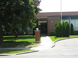
North Toronto Christian School (NTCS) is a non-semestered private Christian school located in the North York district of Toronto, Ontario, Canada. The school is a co-educational Christian elementary and high school, not affiliated with any specific church or denomination. Space is offered for both domestic and international students, along with an accompanying ESL and homestay program.

Johnny's Hamburgers
Burger joint in Scarborough, Toronto
Distance: Approx. 1108 meters
Latitude and longitude: 43.77489,-79.322298
Johnny's Hamburgers is an eatery located in Scarborough, Toronto, at Victoria Park Avenue and Sheppard Avenue. It was established in 1967. It serves hamburgers, French fries, and other fast-food items, and is popular with locals.

Crestwood Preparatory College
Private school in Toronto, Ontario, Canada
Distance: Approx. 1567 meters
Latitude and longitude: 43.7592,-79.3249
Crestwood Preparatory College is a co-ed, non-semestered high school in Toronto, Ontario. Located in the former Brookbanks Public School property, Crestwood Preparatory College is owned by Toronto Lands Corporation (a real estate arm of the Toronto District School Board).

A.R.S. Armenian School
Private school in Toronto, Ontario
Distance: Approx. 909 meters
Latitude and longitude: 43.7693,-79.3241
A.R.S. Armenian School (Հ.Օ.Մ.-ի Ամէնօրեայ Վարժարան (H.Ō.M.-i Amēnōryeah Varzharan) in Armenian) (also called A.R.S. Day School, or A.R.S. Armenian Private School) is a private day school in Toronto, Ontario, Canada. It is the largest co-educational, Armenian-Canadian trilingual and bi-cultural day school in Ontario, catering to students from Kindergarten through to Grade 12.
Academy of Applied Pharmaceutical Sciences
Distance: Approx. 347 meters
Latitude and longitude: 43.7727833,-79.3313833
Academy of Applied Pharmaceutical Sciences (AAPS) Inc. is an English-language private post-secondary career college specializing in pharmaceutical, food and healthcare training. The college has one main campus located in the North York district of Toronto, Ontario.
George S. Henry Academy
High school in Toronto, Ontario, Canada
Distance: Approx. 919 meters
Latitude and longitude: 43.763748,-79.340011
George S. Henry Academy is a semestered public high school in Toronto, Ontario, Canada. It is operated by the Toronto District School Board.
Graydon Hall
Neighbourhood in Toronto, Ontario, Canada
Distance: Approx. 1031 meters
Latitude and longitude: 43.763845,-79.3429
Graydon or sometimes referred to as Graydon Hall is a neighbourhood in the city of Toronto, Ontario, Canada. It is located just south of Ontario Highway 401, West of a nearby neighborhood called Parkwoods, North of York Mills Road and west of the Don Valley Parkway. The neighbourhood is built up on hillside terrains and is home to the Donalda Golf course.
Radisson Toronto East Hotel
Hotel in Ontario, Canada
Distance: Approx. 1058 meters
Latitude and longitude: 43.7693,-79.3222
Radisson Toronto East Hotel is a hotel in North York, Toronto, Ontario. It is located at 55 Hallcrown Place, immediately north-west of the intersection of Highway 401 and Highway 404. As of September 2018, there were 400 African refugees staying there long term, causing the media to label it as a refugee camp and refugee hotel.
Weather in this IP's area
overcast clouds
-4 Celsius
-11 Celsius
-4 Celsius
-3 Celsius
1023 hPa
71 %
1023 hPa
1002 hPa
10000 meters
6.69 m/s
270 degree
100 %

