66.135.111.147 - IP Lookup: Free IP Address Lookup, Postal Code Lookup, IP Location Lookup, IP ASN, Public IP
Country:
Region:
City:
Location:
Time Zone:
Postal Code:
ISP:
ASN:
language:
User-Agent:
Proxy IP:
Blacklist:
IP information under different IP Channel
ip-api
Country
Region
City
ASN
Time Zone
ISP
Blacklist
Proxy
Latitude
Longitude
Postal
Route
db-ip
Country
Region
City
ASN
Time Zone
ISP
Blacklist
Proxy
Latitude
Longitude
Postal
Route
IPinfo
Country
Region
City
ASN
Time Zone
ISP
Blacklist
Proxy
Latitude
Longitude
Postal
Route
IP2Location
66.135.111.147Country
Region
ontario
City
whitby
Time Zone
America/Toronto
ISP
Language
User-Agent
Latitude
Longitude
Postal
ipdata
Country
Region
City
ASN
Time Zone
ISP
Blacklist
Proxy
Latitude
Longitude
Postal
Route
Popular places and events near this IP address

Trafalgar Castle School
School in Canada
Distance: Approx. 2497 meters
Latitude and longitude: 43.87856,-78.93289
Trafalgar Castle School in Whitby, Ontario is an internationally known, independent day and boarding school for girls and young women in grades 4 through 12. Boarding at the school begins in grade 7. Founded in 1874 as "Ontario Ladies' College", Trafalgar Castle School is one of the oldest independent schools in Canada and the second-oldest girls' school in Ontario.

Camp X
WWII Allied training base in Canada
Distance: Approx. 2421 meters
Latitude and longitude: 43.85416667,-78.885
Camp X was the unofficial name of the secret Special Training School No. 103, a Second World War British paramilitary installation for training covert agents in the methods required for success in clandestine operations. It was located on the northwestern shore of Lake Ontario between Whitby and Oshawa in Ontario, Canada.

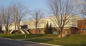
Oshawa Civic Auditorium
Former indoor arena
Distance: Approx. 2079 meters
Latitude and longitude: 43.887795,-78.890998
The Oshawa Civic Auditorium was an indoor arena in Oshawa, Ontario, Canada. It operated from 1964 to 2006, and was primarily used as an ice hockey venue for the Oshawa Generals. The auditorium was built as a replacement to the Hambly Arena, which burned down in 1953.

Oshawa GO Station
Railway station in Oshawa, Ontario, Canada
Distance: Approx. 1435 meters
Latitude and longitude: 43.87055556,-78.88555556
Durham College Oshawa GO station is a station for commuter rail, passenger rail and regional bus services in Oshawa, Ontario, Canada. It is the terminal station for the Lakeshore East line of GO Transit and serves Via Rail's Corridor service, which travels from Toronto to both Ottawa and Montreal. The bus terminal is served by bus routes of GO Transit and Durham Region Transit.
Anderson Collegiate Vocational Institute
Public secondary school in Whitby, Ontario, Canada
Distance: Approx. 2462 meters
Latitude and longitude: 43.8875,-78.92444444
Anderson Collegiate Vocational Institute (Anderson CVI, Anderson Collegiate, Anderson, or ACVI) is located in Whitby, Ontario within the Durham District School Board. Established in 1960, the school has students in grades 9–12 and offers a wide range of academic and extracurricular activities. Anderson is the only high school in Whitby that offers the gifted program and thus acts as a magnet school, attracting students across the municipality.
RCAF Station Oshawa
Distance: Approx. 1356 meters
Latitude and longitude: 43.88333333,-78.9
RCAF Station Oshawa was a training station of the British Commonwealth Air Training Plan (BCATP) during World War II located near Oshawa, Ontario, Canada. The No. 20 Elementary Flying Training School (EFTS) was located in Oshawa from June 1941 to December 1944.

Oshawa Centre
Shopping mall
Distance: Approx. 2829 meters
Latitude and longitude: 43.88998,-78.87935
Oshawa Centre is a two-storey shopping mall located in the city of Oshawa, Ontario, Canada. Located at King Street and Stevenson Road, it is the largest mall in Durham Region and the largest in Ontario east of Toronto with over 230 retail stores and public services. Its Executive Office complex includes the Ministry of Health of Ontario.
Oshawa Metal
Distance: Approx. 2291 meters
Latitude and longitude: 43.87036389,-78.87488333
Oshawa Metal or Oshawa Metal Centre is a General Motors of Canada facility in Oshawa, Ontario. Built in 1986 to supply metal for Chevrolet Lumina and Buick Regal made in Oshawa, the plant now makes steel used at the Oshawa Car Assembly plant and other GM customers. It is GM's only metal facility in Canada located close to an assembly plant.
Thornton's Corners East GO Station
Proposed railway station in Oshawa, Ontario, Canada
Distance: Approx. 1837 meters
Latitude and longitude: 43.8798,-78.8837
Thornton's Corners East GO Station is a planned GO Transit train station to be built by Metrolinx in the community of Oshawa, Ontario, as part of the approved expansion of train service on the Lakeshore East line to Bowmanville. The station would be located along a new single-track spur line connecting the CN rail corridor east of Oshawa GO Station to CP Rail's Belleville Subdivision farther north. The station would be on the west side of Fox Street north of Laval Drive.
Corbett Creek
Distance: Approx. 2507 meters
Latitude and longitude: 43.8532,-78.885
Corbett Creek is a small watercourse that drains into Lake Ontario in Whitby, Ontario. It drains 1,455 hectares (5.62 sq mi). To the west it borders on the watershed of Pringle Creek.
Whitby Rail Maintenance Facility
Canadian rolling stock maintenance facility
Distance: Approx. 1445 meters
Latitude and longitude: 43.8639,-78.9181
The Whitby Rail Maintenance Facility is a GO Transit rolling stock maintenance facility in Whitby, Ontario, Canada. The depot lies between Victoria Street East and GO Transit's Lakeshore East line just east of South Blair Street. It is a secondary depot, the primary depot being the Willowbrook Rail Maintenance Facility along GO Transit's Lakeshore West line.
Whitby Mall
Shopping mall in Whitby, Ontario, Canada
Distance: Approx. 1604 meters
Latitude and longitude: 43.885,-78.91
The Whitby Mall Shopping Centre is a shopping mall located in Whitby, Ontario, Canada.
Weather in this IP's area
overcast clouds
-6 Celsius
-13 Celsius
-7 Celsius
-5 Celsius
1005 hPa
66 %
1005 hPa
987 hPa
10000 meters
5.14 m/s
7.72 m/s
230 degree
100 %