66.135.107.111 - IP Lookup: Free IP Address Lookup, Postal Code Lookup, IP Location Lookup, IP ASN, Public IP
Country:
Region:
City:
Location:
Time Zone:
Postal Code:
ISP:
ASN:
language:
User-Agent:
Proxy IP:
Blacklist:
IP information under different IP Channel
ip-api
Country
Region
City
ASN
Time Zone
ISP
Blacklist
Proxy
Latitude
Longitude
Postal
Route
db-ip
Country
Region
City
ASN
Time Zone
ISP
Blacklist
Proxy
Latitude
Longitude
Postal
Route
IPinfo
Country
Region
City
ASN
Time Zone
ISP
Blacklist
Proxy
Latitude
Longitude
Postal
Route
IP2Location
66.135.107.111Country
Region
ontario
City
toronto
Time Zone
America/Toronto
ISP
Language
User-Agent
Latitude
Longitude
Postal
ipdata
Country
Region
City
ASN
Time Zone
ISP
Blacklist
Proxy
Latitude
Longitude
Postal
Route
Popular places and events near this IP address

Mount Pleasant Cemetery, Toronto
Cemetery in Toronto, Canada
Distance: Approx. 558 meters
Latitude and longitude: 43.696351,-79.384882
Mount Pleasant Cemetery is a cemetery located in Toronto, Ontario, Canada, and is part of the Mount Pleasant Group of Cemeteries. It was opened in November 1876 and is located north of Moore Park, a neighbourhood of Toronto. The cemetery has kilometres of drives and walking paths interspersed with fountains, statues and botanical gardens, as well as rare and distinct trees.

Metropolitan Toronto
Dissolved region in Ontario, Canada
Distance: Approx. 862 meters
Latitude and longitude: 43.7072,-79.3805
The Municipality of Metropolitan Toronto was an upper-tier level of municipal government in Ontario, Canada, from 1953 to 1998. It was made up of the old city of Toronto and numerous townships, towns and villages that surrounded Toronto, which were starting to urbanize rapidly after World War II. It was commonly referred to as "Metro Toronto" or "Metro". Passage of the 1997 City of Toronto Act caused the 1998 amalgamation of Metropolitan Toronto and its constituents into the current City of Toronto.
First Christian Reformed Church of Toronto
Distance: Approx. 753 meters
Latitude and longitude: 43.707822,-79.388088
The First Christian Reformed Church of Toronto is a congregation of the Christian Reformed Church in North America in Toronto, Ontario, Canada. It is one of the more liberal churches in its classis and the denomination. It was the first CRC parish to call a woman minister and declared itself open to gays and lesbians in committed relationships serving as deacons and elders.
William McBrien Building
Administrative Building
Distance: Approx. 854 meters
Latitude and longitude: 43.69777778,-79.39666667
William McBrien Building (formally known as the W. C. McBrien Building) is the administrative headquarters of the Toronto Transit Commission. Designed by Charles B. Dolphin (1888-1969) and opened on February 7, 1958, the seven-storey building is located at 1900 Yonge Street above the Davisville subway station. The building is named for former TTC Chairman William C. McBrien who died in June 1954, shortly after the opening of the Yonge Subway.
Greenwood College School
Year school in Toronto, Ontario, Canada
Distance: Approx. 119 meters
Latitude and longitude: 43.70015,-79.38643
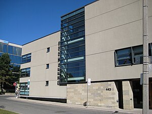
Greenwood College School is an independent co-educational middle school and high school located on the south-east corner of Mount Pleasant Road and Davisville Avenue in Toronto, Ontario, Canada.
Davisville Village
Neighbourhood in Toronto, Ontario, Canada
Distance: Approx. 153 meters
Latitude and longitude: 43.701,-79.389
Davisville Village is a neighbourhood of Toronto, Ontario, Canada. It is located near the intersection of Davisville Avenue and Yonge Street. There is a subway station named Davisville at this intersection.
Spectrum Alternative School
Distance: Approx. 808 meters
Latitude and longitude: 43.707908,-79.390592
Spectrum Alternative School is an alternative education middle school of Toronto's Mount Pleasant west district that was established in 1978. Its original teachers included Ellen Dorfman, Brian Taylor, and David Clyne who all came from Deer Park Senior Public school in a program called Spectrum. It was the first alternative school for grade 7 and 8 students.

Toronto Prep School
Private school in Toronto, Ontario, Canada
Distance: Approx. 77 meters
Latitude and longitude: 43.70063,-79.3864
Toronto Prep School (TPS) is a private school in Toronto, Ontario that was founded in 2009. Toronto Prep School is a Grade 7 through 12, coeducational, private, day school situated on an urban campus in the heart of Toronto near Mount Pleasant Road and Davisville Ave. The school is accredited by the Ontario Ministry of Education.
Sunnybrook School (Toronto)
School in Toronto, Ontario, Canada
Distance: Approx. 440 meters
Latitude and longitude: 43.69889,-79.38257
Sunnybrook School (SBS) is a coeducational, private elementary school offering Junior Kindergarten to Grade 6, with one class per grade. Founded in 1952 as one of Toronto's first Preschools, Sunnybrook is located on a residential street in North Toronto, specifically in the Mount Pleasant West area of Davisville Village west of Bayview Avenue. Sunnybrook School has been family-run for over 60 years.

Mount Pleasant station (Toronto)
Future underground LRT station in Canada
Distance: Approx. 848 meters
Latitude and longitude: 43.70838889,-79.39016667
Mount Pleasant is an underground light rail transit (LRT) station under construction on Line 5 Eglinton, a new line that is part of the Toronto subway system. The station will be located in North Toronto at the intersection of Mount Pleasant Road and Eglinton Avenue. Nearby destinations include Northern Secondary School, North Toronto Collegiate Institute, and the Davisville Village neighbourhood.
Yukashi
Restaurant in Toronto, Ontario, Canada
Distance: Approx. 448 meters
Latitude and longitude: 43.70497222,-79.38861111
Yukashi is a Japanese restaurant in Toronto, Ontario, Canada.
Kappo Sato
Japanese restaurant in Toronto, Ontario, Canada
Distance: Approx. 274 meters
Latitude and longitude: 43.70347222,-79.388
Kappo Sato is a Japanese restaurant in Toronto, Ontario, Canada. The restaurant has received a Michelin star.
Weather in this IP's area
broken clouds
-5 Celsius
-12 Celsius
-6 Celsius
-4 Celsius
1004 hPa
64 %
1004 hPa
988 hPa
10000 meters
5.14 m/s
7.72 m/s
240 degree
75 %


