66.135.104.173 - IP Lookup: Free IP Address Lookup, Postal Code Lookup, IP Location Lookup, IP ASN, Public IP
Country:
Region:
City:
Location:
Time Zone:
Postal Code:
ISP:
ASN:
language:
User-Agent:
Proxy IP:
Blacklist:
IP information under different IP Channel
ip-api
Country
Region
City
ASN
Time Zone
ISP
Blacklist
Proxy
Latitude
Longitude
Postal
Route
db-ip
Country
Region
City
ASN
Time Zone
ISP
Blacklist
Proxy
Latitude
Longitude
Postal
Route
IPinfo
Country
Region
City
ASN
Time Zone
ISP
Blacklist
Proxy
Latitude
Longitude
Postal
Route
IP2Location
66.135.104.173Country
Region
ontario
City
toronto
Time Zone
America/Toronto
ISP
Language
User-Agent
Latitude
Longitude
Postal
ipdata
Country
Region
City
ASN
Time Zone
ISP
Blacklist
Proxy
Latitude
Longitude
Postal
Route
Popular places and events near this IP address

Lawrence Park, Toronto
Neighbourhood in Toronto, Ontario, Canada
Distance: Approx. 798 meters
Latitude and longitude: 43.722,-79.388
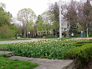
Lawrence Park is a neighbourhood in Toronto, Ontario, Canada. It is bordered by Yonge Street to the west and Bayview Avenue to the east, and from Blythwood Ravine on the south to Lawrence Avenue on the north. Lawrence Park was one of Toronto's first planned garden suburbs.
Glendon College
College in Ontario
Distance: Approx. 1184 meters
Latitude and longitude: 43.7275,-79.3785
Glendon College is a public liberal arts college in Toronto, Ontario, Canada. Formally the federated bilingual campus of York University, it is one of the school's nine colleges and 11 faculties with 100 full-time faculty members and a student population of about 2,100. Founded as the first permanent establishment of York University, the school began academic operation under the mentorship of the University of Toronto in September 1960.

Lawrence station (Toronto)
Toronto subway station
Distance: Approx. 774 meters
Latitude and longitude: 43.7263,-79.4025
Lawrence is a subway station on Line 1 Yonge–University in Toronto, Ontario, Canada. It is located under Yonge Street at Lawrence Avenue, in the Bedford Park, Lawrence Park and Lytton Park neighbourhoods.

Wanless Park
Neighbourhood in Toronto, Ontario, Canada
Distance: Approx. 139 meters
Latitude and longitude: 43.729,-79.392
Wanless Park is a neighbourhood and park in North Toronto, Ontario, Canada. It is located just north of Lawrence Avenue, between Bayview Avenue and Ronan Avenue. Central to the Wanless Park neighbourhood is a public park called Wanless Park.
Toronto French School
Day school in Toronto, Ontario, Canada
Distance: Approx. 821 meters
Latitude and longitude: 43.728,-79.383
The Toronto French School (TFS), founded in 1962, is an independent, bilingual, co-educational, non-denominational school in Toronto, Ontario, Canada. Charles III, as King of Canada, is the royal patron of the school. The school rebranded in 2011 to become TFS – Canada's International School.
Paradise Comics
Comic book store in Toronto, Ontario, Canada
Distance: Approx. 883 meters
Latitude and longitude: 43.730281,-79.40375
Paradise Comics is a comic book store located in Toronto, Ontario, Canada. The owner and proprietor is Peter Dixon. Paradise Comics is actively buying with free evaluations and selling gold, silver and bronze age vintage comics, 1933 to 1980 and CGC graded comics and CGC Signature Series (signed and graded) comic books.
Uptown Toronto
Distance: Approx. 795 meters
Latitude and longitude: 43.7264,-79.4028
Uptown Toronto is an area in Toronto, Ontario, Canada that is considered to be north of Midtown Toronto.

Rosedale Golf Club
Distance: Approx. 885 meters
Latitude and longitude: 43.736,-79.392
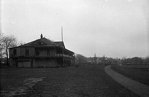
Rosedale Golf Club is a private golf club in Toronto, founded in 1893 in Moore Park. The course hosted the Canadian Open in 1912 and 1928.

Bayview Bridge (Toronto)
Bridge in Ontario, Canada
Distance: Approx. 978 meters
Latitude and longitude: 43.7302,-79.3814
The Bayview Bridge is a deck truss bridge over the West Don River in Toronto, Ontario, Canada. The six-lane bridge carries Bayview Avenue across the Don Valley, connecting with Lawrence Avenue East at its southern end. Built in 1929, the bridge helped spur the development of the Bridle Path, an affluent neighbourhood northeast of the bridge's span.

Alexander Muir Memorial Gardens
Municipal park in Toronto, Ontario, Canada
Distance: Approx. 988 meters
Latitude and longitude: 43.721439,-79.401312
Alexander Muir Memorial Gardens is a municipal park in Toronto, Ontario, Canada. The park was created in 1933 by public subscription to honour Alexander Muir, who composed the song "The Maple Leaf Forever". The park was originally located opposite Mount Pleasant Cemetery on Yonge Street, but was moved to its present location in 1951 due to the construction of the Yonge subway.
Teddington Park
Neighbourhood in Toronto, Ontario, Canada
Distance: Approx. 921 meters
Latitude and longitude: 43.734184,-79.400962
Teddington Park is a neighbourhood in Toronto, Ontario, Canada. It is bordered by Yonge Street to the west and Bayview Avenue to the east, and from Snowden Road in the south to north of Glen Echo Road and Rosedale Golf Club. Development occurred in and around the 1930s, and was farmland before that time.
Shoushin
Restaurant in Toronto, Ontario, Canada
Distance: Approx. 949 meters
Latitude and longitude: 43.73138889,-79.40408333
Shoushin is a Japanese restaurant in Toronto, Ontario, Canada. The restaurant serves sushi and has received a Michelin star. Jackie Lin is the owner and head chef.
Weather in this IP's area
overcast clouds
-4 Celsius
-10 Celsius
-4 Celsius
-3 Celsius
1023 hPa
70 %
1023 hPa
1005 hPa
10000 meters
6.69 m/s
270 degree
100 %
