66.135.101.165 - IP Lookup: Free IP Address Lookup, Postal Code Lookup, IP Location Lookup, IP ASN, Public IP
Country:
Region:
City:
Location:
Time Zone:
Postal Code:
ISP:
ASN:
language:
User-Agent:
Proxy IP:
Blacklist:
IP information under different IP Channel
ip-api
Country
Region
City
ASN
Time Zone
ISP
Blacklist
Proxy
Latitude
Longitude
Postal
Route
db-ip
Country
Region
City
ASN
Time Zone
ISP
Blacklist
Proxy
Latitude
Longitude
Postal
Route
IPinfo
Country
Region
City
ASN
Time Zone
ISP
Blacklist
Proxy
Latitude
Longitude
Postal
Route
IP2Location
66.135.101.165Country
Region
ontario
City
mississauga
Time Zone
America/Toronto
ISP
Language
User-Agent
Latitude
Longitude
Postal
ipdata
Country
Region
City
ASN
Time Zone
ISP
Blacklist
Proxy
Latitude
Longitude
Postal
Route
Popular places and events near this IP address
Paramount Fine Foods Centre
Arena in Mississauga, Ontario
Distance: Approx. 1029 meters
Latitude and longitude: 43.6323,-79.6535
The Paramount Fine Foods Centre, formerly the Hershey Centre, is a multi-purpose sports and entertainment complex located in Mississauga, Ontario, Canada. Its current name was adopted on July 1, 2018, following a new naming rights agreement with Mississauga-based restaurant chain Paramount Fine Foods.

Philip Pocock Catholic Secondary School
Catholic high school in Mississauga, Ontario, Canada
Distance: Approx. 1550 meters
Latitude and longitude: 43.625,-79.626
Philip Pocock Catholic Secondary School (alternatively called as Philip Pocock, PPCSS, PP, Philip Pocock CSS, or Pocock) is a Roman Catholic high school in Mississauga, Ontario, Canada. It is operated by the Dufferin-Peel Catholic District School Board and has approximately 1,350 students. The school includes an Extended French Program as well as an Advanced Placement Program for Mathematics and the Sciences (Biology, Physics, Chemistry).
CINA (AM)
Multicultural radio station in Mississauga, Ontario
Distance: Approx. 1210 meters
Latitude and longitude: 43.62555556,-79.63111111
CINA (1650 kHz) is a commercial AM radio station, licensed to Mississauga, Ontario, Canada and serving the Greater Toronto area. It broadcasts a South Asian format of talk radio, all-news radio and music shows. It is owned by Neeti Prakash Ray, who co-owns a sister station in Windsor, CINA-FM. By day, CINA is powered at 5,000 watts; however, to protect other stations from interference, at night it reduces power to 680 watts.
Baitul Hamd Mosque (Mississauga)
Mosque in Ontario, Canada
Distance: Approx. 497 meters
Latitude and longitude: 43.63722222,-79.63694444
The Baitul Hamd Mosque (Urdu: بیت الحمد, lit. 'House of Praise') is an Ahmadiyy mosque in Mississauga, Ontario, in Canada. The mosque is run by the Ahmadiyya Muslim Community Canada (AMJ). In 1999, the AMJ purchased the building from Trinity Club House.

Mississauga—Malton (federal electoral district)
Federal electoral district in Ontario, Canada
Distance: Approx. 2817 meters
Latitude and longitude: 43.655,-79.66
Mississauga—Malton is a federal electoral district in Ontario. It encompasses a portion of Ontario previously included in the electoral districts of Bramalea—Gore—Malton, Mississauga—Brampton South and Mississauga—Streetsville. Mississauga—Malton was created by the 2012 federal electoral boundaries redistribution and was legally defined in the 2013 representation order.

Etobicoke Creek station
Distance: Approx. 2690 meters
Latitude and longitude: 43.64472222,-79.61111111
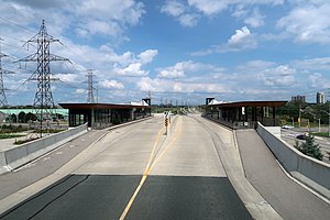
Etobicoke Creek is a bus rapid transit station on the Mississauga Transitway in Mississauga, Ontario, Canada. It is located along the north side of Eglinton Avenue at Tahoe Boulevard. Tahoe and Etobicoke Creek stations opened on February 16, 2016.

Tahoe station
Distance: Approx. 2546 meters
Latitude and longitude: 43.63861111,-79.61
Tahoe is a bus rapid transit station on the Mississauga Transitway in Mississauga, Ontario, Canada. It is located along the east side of Eastgate Parkway on the south side of Tahoe Boulevard. Tahoe and Etobicoke Creek opened on 16 February 2016.

Dixie station (MiWay)
Bus station in Mississauga, Ontario
Distance: Approx. 2167 meters
Latitude and longitude: 43.63027778,-79.61444444
Dixie is a bus rapid transit station on the Mississauga Transitway in central Mississauga, Ontario, Canada. It is located on the west side of Dixie Road along the north side of Eastgate Parkway. The first four stations on the Transitway at Central Parkway, Cawthra, Tomken, and Dixie, opened on 17 November 2014.

Tomken station
Distance: Approx. 1940 meters
Latitude and longitude: 43.62166667,-79.62361111
Tomken is a bus rapid transit station on the Mississauga Transitway in central Mississauga, Ontario, Canada. It is located on the west side of Tomken Road along the north side of Eastgate Parkway. The first four stations on the Transitway at Central Parkway, Cawthra, Tomken and Dixie, opened on 17 November 2014.

Cawthra station
Bus rapid transit station in Ontario, Canada
Distance: Approx. 2100 meters
Latitude and longitude: 43.6175,-79.62777778
Cawthra is a bus rapid transit station on the Mississauga Transitway in central Mississauga, Ontario, Canada. It is located along the north side of Eastgate Parkway on the east side of Cawthra Road. The first four stations on the Transitway at Central Parkway, Cawthra, Tomken and Dixie, opened on 17 November 2014.

Mississauga—Malton (provincial electoral district)
Provincial electoral district in Ontario, Canada
Distance: Approx. 2817 meters
Latitude and longitude: 43.655,-79.66
Mississauga—Malton is a provincial electoral district in Ontario, Canada. It elects one member to the Legislative Assembly of Ontario. This riding was created in 2015.

2016 Mississauga explosion
2016 explosion in Mississauga, Ontario, Canada
Distance: Approx. 2705 meters
Latitude and longitude: 43.6252,-79.6095
On June 28, 2016, a residential house exploded in the Hickory neighbourhood in Mississauga, Ontario, Canada.
Weather in this IP's area
overcast clouds
-5 Celsius
-11 Celsius
-6 Celsius
-4 Celsius
1004 hPa
59 %
1004 hPa
983 hPa
10000 meters
5.14 m/s
7.72 m/s
240 degree
100 %
