66.135.100.43 - IP Lookup: Free IP Address Lookup, Postal Code Lookup, IP Location Lookup, IP ASN, Public IP
Country:
Region:
City:
Location:
Time Zone:
Postal Code:
ISP:
ASN:
language:
User-Agent:
Proxy IP:
Blacklist:
IP information under different IP Channel
ip-api
Country
Region
City
ASN
Time Zone
ISP
Blacklist
Proxy
Latitude
Longitude
Postal
Route
db-ip
Country
Region
City
ASN
Time Zone
ISP
Blacklist
Proxy
Latitude
Longitude
Postal
Route
IPinfo
Country
Region
City
ASN
Time Zone
ISP
Blacklist
Proxy
Latitude
Longitude
Postal
Route
IP2Location
66.135.100.43Country
Region
ontario
City
toronto
Time Zone
America/Toronto
ISP
Language
User-Agent
Latitude
Longitude
Postal
ipdata
Country
Region
City
ASN
Time Zone
ISP
Blacklist
Proxy
Latitude
Longitude
Postal
Route
Popular places and events near this IP address

Black Creek (Toronto)
River in Ontario, Canada
Distance: Approx. 810 meters
Latitude and longitude: 43.66916667,-79.51138889
Black Creek is a river in the Golden Horseshoe region of Ontario, Canada. It flows from the city of Vaughan in the Regional Municipality of York to the Humber River in Toronto. Black Creek is smaller than most of the waterways in the Greater Toronto Area.
Humber Valley Village
Neighbourhood in Toronto, Ontario, Canada
Distance: Approx. 523 meters
Latitude and longitude: 43.67166667,-79.51444444
Humber Valley Village is a neighbourhood located in Toronto, Ontario, Canada. It is within the former suburb of Etobicoke and includes some of the most expensive real estate in the metropolitan west end. The boundaries are from Dundas Street on the south to Islington Avenue to the west, Eglinton Avenue to the north, and the Humber River in the east.

Mount Dennis
Neighbourhood in Toronto, Ontario, Canada
Distance: Approx. 1839 meters
Latitude and longitude: 43.69198333,-79.50621389
Mount Dennis is a neighbourhood in Toronto, Ontario, Canada. It was initially an urban area within the former township of York. Primarily located along Eglinton Avenue between the Humber River and the Kitchener commuter rail line, the neighbourhood was best known for Kodak Heights, once a major film manufacturing facility owned and operated by the Eastman Kodak Company.

Lambton Golf and Country Club
Golf and tennis club in Toronto, Canada
Distance: Approx. 825 meters
Latitude and longitude: 43.67,-79.508
The Lambton Golf and Country Club is a private golf and tennis club in Toronto, Ontario, Canada. The golf club was established by Albert William Austin in 1902. The golf club is presently members with Golf Canada, and the United States Golf Association., and has hosted a number of competitions including the Canadian Open, and the Canadian Amateur Championship.
St. George's Golf and Country Club
Distance: Approx. 1424 meters
Latitude and longitude: 43.675,-79.531
St. George's Golf and Country Club (originally The Royal York Golf Club) is a golf course and country club located in Etobicoke, Toronto, Ontario, Canada in the west end neighbourhood of Islington.

Lambton House
Historical house museum in Ontario, Canada.
Distance: Approx. 1667 meters
Latitude and longitude: 43.663078,-79.503669
Lambton House is a historic former inn in Toronto, Ontario, Canada. It is the last remaining building from the former village of Lambton Mills along the Humber River. The inn was established in 1847, with its present building erected in 1860.

Lambton Mills
Place in Ontario, Canada
Distance: Approx. 1328 meters
Latitude and longitude: 43.665,-79.5081
The Village of Lambton Mills was a settlement at the crossing of Dundas Street and the Humber River. The settlement was on both sides of the Humber River, in both the former Etobicoke Township and York Township, within today's City of Toronto, Ontario, Canada. It extended as far west as Royal York Road at Dundas, as far north as the still-existing CPR rail line north of Dundas, as far east as Scarlett Road and as far south as today's Queen Anne Road.

James Gardens
Public park in Toronto, Ontario, Canada
Distance: Approx. 539 meters
Latitude and longitude: 43.67146,-79.51346
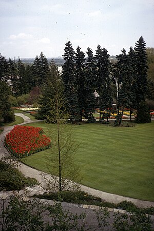
James Gardens is a public botanical garden in the Etobicoke district of Toronto, Ontario, Canada along the Humber River. It was a former private estate sold to the City of Toronto and now managed by the Toronto Parks Department.
1980 Peter Jackson Classic
Distance: Approx. 1424 meters
Latitude and longitude: 43.675,-79.531
The 1980 Peter Jackson Classic was contested from August 7–10 at St. George's Golf and Country Club. It was the 8th edition of the Peter Jackson Classic, and the second edition as a major championship on the LPGA Tour.
1982 Peter Jackson Classic
Distance: Approx. 1424 meters
Latitude and longitude: 43.675,-79.531
The 1982 Peter Jackson Classic was contested from July 1–4 at St. George's Golf and Country Club. It was the 10th edition of the Peter Jackson Classic, and the fourth edition as a major championship on the LPGA Tour.
1984 du Maurier Classic
Distance: Approx. 1424 meters
Latitude and longitude: 43.675,-79.531
The 1984 du Maurier Classic was contested from July 26–29 at St. George's Golf and Country Club. It was the 12th edition of the du Maurier Classic, and the sixth edition as a major championship on the LPGA Tour.
York Humber High School
High school in Toronto, Ontario, Canada
Distance: Approx. 1572 meters
Latitude and longitude: 43.688712,-79.504084
York Humber High School (also called York Humber HS, YMHS, or York Humber) is a specialized vocational basic high school located in Toronto, Ontario, Canada. It is administered by the Toronto District School Board. Prior to 1998, it was part of the Board of Education for the City of York.
Weather in this IP's area
overcast clouds
-3 Celsius
-10 Celsius
-4 Celsius
-3 Celsius
1023 hPa
70 %
1023 hPa
1005 hPa
10000 meters
6.69 m/s
270 degree
100 %
