Country:
Region:
City:
Latitude and Longitude:
Time Zone:
Postal Code:
IP information under different IP Channel
ip-api
Country
Region
City
ASN
Time Zone
ISP
Blacklist
Proxy
Latitude
Longitude
Postal
Route
Luminati
Country
ASN
Time Zone
America/Chicago
ISP
CORESITE
Latitude
Longitude
Postal
IPinfo
Country
Region
City
ASN
Time Zone
ISP
Blacklist
Proxy
Latitude
Longitude
Postal
Route
db-ip
Country
Region
City
ASN
Time Zone
ISP
Blacklist
Proxy
Latitude
Longitude
Postal
Route
ipdata
Country
Region
City
ASN
Time Zone
ISP
Blacklist
Proxy
Latitude
Longitude
Postal
Route
Popular places and events near this IP address

Petaluma, California
City in Northern California, United States
Distance: Approx. 1574 meters
Latitude and longitude: 38.24583333,-122.63138889
Petaluma is a city in Sonoma County, California, located in the North Bay region of the San Francisco Bay Area. Its population is, according to World Population Review, 58,489 people. It was 59,776 according to the 2020 census.

Phoenix Theater
All-ages nightclub in Petaluma, California
Distance: Approx. 604 meters
Latitude and longitude: 38.235001,-122.643056
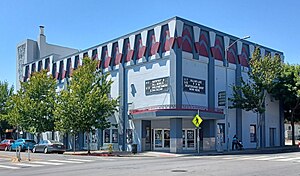
The Phoenix Theater is an all-ages nightclub located in Petaluma, California. The club has been in existence since 1905 and has changed in both structure and purpose, mostly due to severe damage caused by several fires.
Old Petaluma Opera House
United States historic place
Distance: Approx. 527 meters
Latitude and longitude: 38.23494444,-122.64208333
The Old Petaluma Opera House (also known as the Maclay Building) is a historic building located in downtown Petaluma, California.

Petaluma High School
Public school in Petaluma, California, United States
Distance: Approx. 1002 meters
Latitude and longitude: 38.22694444,-122.64611111
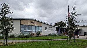
Petaluma High School is located one mile from historic downtown Petaluma in California. It is a comprehensive public high school with approximately 1,310 students in grades 9–12, serving the west side of Petaluma and many of the rural areas that surround the city in both Sonoma County and Marin County.

Washington Creek
River in California, United States
Distance: Approx. 1440 meters
Latitude and longitude: 38.24527778,-122.63861111
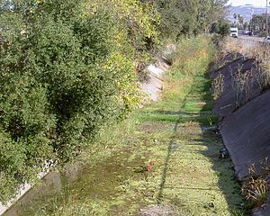
Washington Creek is a southward-flowing stream in Sonoma County, California, United States which enters the city of Petaluma and discharges to the Petaluma River.

Petaluma Wildlife & Natural Science Museum
Museum in Petaluma, California
Distance: Approx. 948 meters
Latitude and longitude: 38.22777778,-122.64611111
Petaluma Wildlife & Natural Science Museum is a student-run museum located in the city of Petaluma, California. It is the largest student-run museum in the United States. Its mission is "to inspire the next generation through practical environmental education and conservation." It is a 501(c)3 non-profit organization, relying on donations to fund expenses.
Free Public Library of Petaluma
United States historic place
Distance: Approx. 254 meters
Latitude and longitude: 38.2325,-122.6399
The Free Public Library of Petaluma (also Old Carnegie Library, Carnegie Free Library and Petaluma Historical Library and Museum) is a research library and history museum at 20 Fourth Street in Petaluma, Sonoma County, California, US. Built in 1904 as a Carnegie Free Library, it was designed by Brainerd Jones as his first major commission before the architect gained regional recognition. In the 1970s, it was re-purposed as a research library and historical museum, known as the Petaluma Historical Library and Museum. The building is listed on the National Register of Historic Places.
United States Post Office (Petaluma, California)
United States historic post office
Distance: Approx. 93 meters
Latitude and longitude: 38.23166667,-122.6375
The United States Post Office in Petaluma, California, is located at 120 West Fourth Street. The building, completed in 1933, has been listed on the National Register of Historic Places since 1985. The building is in the Spanish Colonial Revival style with some Gothic touches.
Petaluma Downtown station
Railway station in California
Distance: Approx. 581 meters
Latitude and longitude: 38.2374,-122.6351
Petaluma Downtown station is a Sonoma–Marin Area Rail Transit station in Petaluma. It opened to preview service on June 29, 2017; full commuter service commenced on August 25, 2017. A new platform and facilities were constructed adjacent to the historic Northwestern Pacific Railroad station building, which opened in 1914.
Ellis-Martin House
United States historic place
Distance: Approx. 1559 meters
Latitude and longitude: 38.24527778,-122.63
The Ellis--Martin House, at 1197 E. Washington St. in Petaluma, California, is a Craftsman style house which was built in 1908. It was listed on the National Register of Historic Places in 2006.
Philip Sweed House
United States historic place
Distance: Approx. 913 meters
Latitude and longitude: 38.236242,-122.64623
The Philip Sweed House, in Petaluma, California, is a Queen Anne-style house built in 1892. It has sometimes, mistakenly, been reported as the "Philip Swede House." The house is located at the intersection of Keokuk and Prospect Streets. It was listed on the National Register of Historic Places in 1992.

Mystic Theatre (Petaluma, California)
Music venue in Petaluma, California
Distance: Approx. 332 meters
Latitude and longitude: 38.234104,-122.64012
Mystic Theatre, also known as McNear's Mystic Theatre, is a historic building and music venue built in 1911, and located in Petaluma, California. The McNear's Saloon and Dining House is housed next door in an adjoined building. The building is part of the Petaluma Historic Commercial District, which has been listed on the National Register of Historic Places since March 31, 1995.
Weather in this IP's area
clear sky
16 Celsius
15 Celsius
15 Celsius
17 Celsius
1017 hPa
34 %
1017 hPa
1016 hPa
10000 meters
1.54 m/s
06:53:38
16:57:31


