66.102.233.239 - IP Lookup: Free IP Address Lookup, Postal Code Lookup, IP Location Lookup, IP ASN, Public IP
Country:
Region:
City:
Location:
Time Zone:
Postal Code:
IP information under different IP Channel
ip-api
Country
Region
City
ASN
Time Zone
ISP
Blacklist
Proxy
Latitude
Longitude
Postal
Route
Luminati
Country
Region
dc
City
washington
ASN
Time Zone
America/New_York
ISP
FIBER-64
Latitude
Longitude
Postal
IPinfo
Country
Region
City
ASN
Time Zone
ISP
Blacklist
Proxy
Latitude
Longitude
Postal
Route
IP2Location
66.102.233.239Country
Region
georgia
City
alpharetta
Time Zone
America/New_York
ISP
Language
User-Agent
Latitude
Longitude
Postal
db-ip
Country
Region
City
ASN
Time Zone
ISP
Blacklist
Proxy
Latitude
Longitude
Postal
Route
ipdata
Country
Region
City
ASN
Time Zone
ISP
Blacklist
Proxy
Latitude
Longitude
Postal
Route
Popular places and events near this IP address

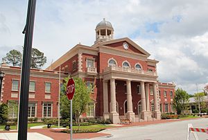
Alpharetta, Georgia
City in Georgia, United States
Distance: Approx. 4253 meters
Latitude and longitude: 34.07527778,-84.29416667
Alpharetta is a city in northern Fulton County, Georgia, United States, and part of the Atlanta metropolitan area. As of the 2020 U.S. census, Alpharetta's population was 65,818; in 2010, the population had been 57,551.
North Point Community Church
US evangelical church in Alpharetta, Georgia
Distance: Approx. 4659 meters
Latitude and longitude: 34.057565,-84.259669
North Point Community Church is a non-denominational, evangelical megachurch located in Alpharetta, Georgia, a suburb of Atlanta. North Point has an attendance of 23,000 people in eight locations in the north metro Atlanta area. The senior pastor Andy Stanley serves as the church's lead pastor and, in turn, leads the North Point Community Church staff.

Independence High School (Georgia)
Alternative school in Alpharetta, Georgia, United States
Distance: Approx. 4595 meters
Latitude and longitude: 34.07812,-84.30111
Independence High School was an alternative high school in the historic district of Roswell, Georgia, United States. It was located on the old Milton High School campus.
Alpharetta High School
High school in Georgia, United States
Distance: Approx. 2392 meters
Latitude and longitude: 34.078,-84.256
Alpharetta High School is a public high school located in Alpharetta, Georgia, United States within the Fulton County School System. Atlanta Magazine named Alpharetta High School one of the metro Atlanta area's best all-around high schools. In 2020, the U.S. News & World Report ranked the school #7 in Georgia and #281 nationally.
Lionheart School
Independent school, special education school in Alpharetta, Georgia, United States
Distance: Approx. 5200 meters
Latitude and longitude: 34.07052,-84.30273
The Lionheart School is a 501(c)(3) non-profit independent school for children ages 5 to 21 with autism or other disorders of relating and communicating. The school was established in 2000 and is located in Alpharetta, Georgia, United States. Lionheart was awarded SACS/SAIS (Southern Association of Colleges and Schools/ Southern Association of Independent Schools) Accreditation in 2008.
Taste of Alpharetta
Distance: Approx. 4268 meters
Latitude and longitude: 34.0753,-84.2944
Taste of Alpharetta is a festival/event where over 60 restaurants offer a wide range of foods. Established in 1991, it's located in Alpharetta, Georgia and drew over 60,000 people one year. Restaurants typically sell small "tasting" size portions which are typical of the restaurants' offerings from tables and tents.

Avalon (Alpharetta, Georgia)
Distance: Approx. 3649 meters
Latitude and longitude: 34.0706,-84.2773
Avalon is a mixed-use development in Alpharetta, Georgia. Phase I of the 86-acre (35 ha) site includes 500,000 square feet (46,000 m2) of retail space, a 12-screen Regal Cinemas theater, 105,000 square foot of Class A office space over retail, 101 single-family residences and 250 luxury rental homes. Phase I opened In October 2014 drawing shoppers away from North Point Mall.

Crooked Creek (Georgia)
Neighborhood located in Milton, Georgia, United States
Distance: Approx. 3230 meters
Latitude and longitude: 34.1275,-84.26713889
Crooked Creek is a neighborhood located in Milton, Georgia (formerly Alpharetta). Surrounded by the Iron Horse Golf Club, it has 640 homes on over 500 acres of rolling hills.

National Christian Foundation
Organization
Distance: Approx. 4851 meters
Latitude and longitude: 34.063635,-84.288454
National Christian Foundation (NCF) is a US non-profit organization that assists donors in donating to charitable causes. NCF accepts non-cash assets and is the nation's largest provider of donor-advised funds focused primarily on Christian donors. Since 1982, NCF has granted over $14.5 billion to causes and charities.

Cambridge High School (Georgia)
Public high school in Milton, Fulton County, Georgia, United States
Distance: Approx. 2609 meters
Latitude and longitude: 34.1182,-84.2753
Cambridge High School is a public high school in Milton, Georgia and a school of the Fulton County School System. The 17th high school to open in the district and relieving Alpharetta High School and Milton High School, it opened in August 2012.
Halcyon (Forsyth County, Georgia)
Distance: Approx. 3266 meters
Latitude and longitude: 34.1114423,-84.2260948
Halcyon is a mixed-use development in southern Forsyth County, Georgia, in the Atlanta metropolitan area. It has an Alpharetta postal address, despite not being located within the Alpharetta city limits or even in the same county. Halcyon is located at McFarland Parkway and Georgia State Route 400 (U.S. Route 19).
The Gathering at South Forsyth
Proposed indoor arena and mixed-use development in Forsyth County, Georgia, United States
Distance: Approx. 2254 meters
Latitude and longitude: 34.103462,-84.234447
The Gathering at South Forsyth is a proposed mixed-use development in the Atlanta metropolitan area to be located in Forsyth County, Georgia near the city of Alpharetta. The centerpiece of the development is an 18,000-seat arena, intended to bring a National Hockey League franchise back to the Atlanta area. The Gathering at South Forsyth is modeled after The Battery Atlanta, a mixed-use development in Cobb County anchored by Truist Park, home of the Atlanta Braves of Major League Baseball.
Weather in this IP's area
clear sky
9 Celsius
7 Celsius
8 Celsius
10 Celsius
1013 hPa
91 %
1013 hPa
976 hPa
10000 meters
2.86 m/s
9.38 m/s
260 degree
1 %
