65.98.137.146 - IP Lookup: Free IP Address Lookup, Postal Code Lookup, IP Location Lookup, IP ASN, Public IP
Country:
Region:
City:
Location:
Time Zone:
Postal Code:
IP information under different IP Channel
ip-api
Country
Region
City
ASN
Time Zone
ISP
Blacklist
Proxy
Latitude
Longitude
Postal
Route
Luminati
Country
Region
tx
City
kennedale
ASN
Time Zone
America/Chicago
ISP
US-TELEPACIFIC
Latitude
Longitude
Postal
IPinfo
Country
Region
City
ASN
Time Zone
ISP
Blacklist
Proxy
Latitude
Longitude
Postal
Route
IP2Location
65.98.137.146Country
Region
texas
City
houston
Time Zone
America/Chicago
ISP
Language
User-Agent
Latitude
Longitude
Postal
db-ip
Country
Region
City
ASN
Time Zone
ISP
Blacklist
Proxy
Latitude
Longitude
Postal
Route
ipdata
Country
Region
City
ASN
Time Zone
ISP
Blacklist
Proxy
Latitude
Longitude
Postal
Route
Popular places and events near this IP address
Brookside Village, Texas
City in Brazoria County, Texas, United States
Distance: Approx. 3514 meters
Latitude and longitude: 29.59083333,-95.31805556
Brookside Village is a city in Brazoria County, Texas, United States. The population of the city was 1,548 at the 2020 U.S. census, an increase over the figure of 1,523 tabulated in the 2010 U.S. census. The city of Brookside Village is part of the Houston–The Woodlands–Sugar Land metropolitan statistical area.
South Park, Houston
Neighborhood in Houston, Texas, United States
Distance: Approx. 5668 meters
Latitude and longitude: 29.67,-95.34
South Park is a broad post-World War II development in the south-central area of Houston, Texas, a few miles south of MacGregor Park and directly south of the 610 Loop. According to the 2000 Census, the community has a population of 22,282. 81% of the South Park population is African American, compared to 25% for the city as a whole.
Sunnyside, Houston
Distance: Approx. 5585 meters
Latitude and longitude: 29.662,-95.364
Sunnyside is a community in southern Houston, Texas, United States, south of Downtown Houston. Sunnyside is outside the 610 Loop and inside Beltway 8 off State Highway 288 south of Downtown Houston and is predominantly African American. The community's slogan is "Sunnyside Pride." Sunnyside included a landfill, an adjacent garbage incinerator, and several salvage yards; the incinerator has closed.

Worthing High School (Houston)
Public high school in Houston, Texas, United States
Distance: Approx. 5310 meters
Latitude and longitude: 29.657335,-95.366774
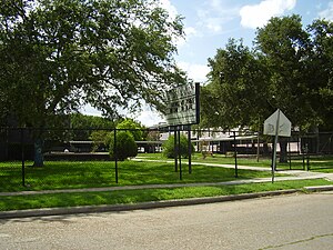
Evan Edward Worthing Early College High School is a secondary school located in the Sunnyside area of Houston, Texas, United States. Worthing serves grades 9 through 12 and is a part of the Houston Independent School District. Worthing has Houston ISD's magnet program for Mathematics, Science and Technology.
Cloverland, Houston
Neighborhood in Houston, Texas
Distance: Approx. 3713 meters
Latitude and longitude: 29.634,-95.368
Cloverland is a neighborhood located on the south side of Houston, Texas, United States. Cloverland was the home neighborhood for Lil Flip and many other Houston rappers. In 2005, Cloverburger, a hamburger joint in the neighborhood located at 4515 Mowery Road, was the site of the T.I./Lil Flip altercation.

Sterling High School (Houston)
Public high school in Houston, Texas, United States
Distance: Approx. 2145 meters
Latitude and longitude: 29.636255,-95.322758
Ross Shaw Sterling High School, also known as Sterling Aviation High School, is a secondary school located in Houston, Texas. Sterling, which serves grades 9 through 12, is a part of the Houston Independent School District. The school was named after Ross S. Sterling.

1940 Air Terminal Museum
Building in Houston (vicinity), Harris County, Texas
Distance: Approx. 5516 meters
Latitude and longitude: 29.64694444,-95.28611111
The 1940 Air Terminal Museum is a museum located in Houston, Texas, United States, at William P. Hobby Airport. Collections are housed in the original art deco building which served as the first purpose-built terminal for passenger flight in Houston. The museum currently exhibits several collections focusing on Houston's civil aviation history and is operated by the Houston Aeronautical Heritage Society (HAHS), a recognized Texas 501(c)(3) tax-exempt organization.
Bay Ridge Christian College
Historically black college in Texas, U.S.
Distance: Approx. 3426 meters
Latitude and longitude: 29.6161,-95.3687
Bay Ridge Christian College is an unaccredited, historically black college located in unincorporated Fort Bend County, Texas, United States, north of Kendleton and west of Beasley. This two-year Christian junior college, offers a college credit program (a two-year Ministerial Certificate) and a continuing education program called the Ministry and Leadership Development Institute.

Glenda Dawson High School
Public school in Pearland, Texas, United States
Distance: Approx. 5428 meters
Latitude and longitude: 29.57361111,-95.35277778
Glenda Dawson High School (DHS) is a public high school in Pearland, Texas, United States. It is a part of the Pearland Independent School District serving grades 9 through 12. In 2014, the school was awarded a national rank of 1,165th by U.S. News & World Report, which puts it in the silver medal category.

Mount Carmel High School (Houston)
Private, coeducational school in Houston, Texas, United States
Distance: Approx. 5470 meters
Latitude and longitude: 29.66299,-95.30741
Mount Carmel High School was a private, Roman Catholic high school in Houston, Texas, United States. Founded in 1956 by the Carmelite order, Mount Carmel was the first Houston area Catholic high school established east of downtown and the first to serve greater Southeast Houston. From 1986 to 2008, it was administered by the Roman Catholic Archdiocese of Galveston-Houston.
Mykawa, Houston
Distance: Approx. 1951 meters
Latitude and longitude: 29.6208,-95.3134
Mykawa ( mi-KAH-wə) is an area within Houston, Texas, United States that was formerly a distinct unincorporated community in Harris County.
Mount Carmel Academy (Texas)
High school in Texas, United States
Distance: Approx. 5531 meters
Latitude and longitude: 29.660721,-95.301761
Mount Carmel Academy (MCA) is a secondary school located at 7155 Ashburn Street in the Garden Villas area of Houston, Texas, United States. Mount Carmel is a contract charter school of the Houston Independent School District. Mount Carmel Academy was established in 2008 to serve students formerly attending Mount Carmel High School, a Catholic school of the Roman Catholic Archdiocese of Galveston-Houston.
Weather in this IP's area
mist
10 Celsius
7 Celsius
8 Celsius
11 Celsius
1013 hPa
85 %
1013 hPa
1011 hPa
10000 meters
5.14 m/s
110 degree
100 %


