65.5.118.67 - IP Lookup: Free IP Address Lookup, Postal Code Lookup, IP Location Lookup, IP ASN, Public IP
Country:
Region:
City:
Location:
Time Zone:
Postal Code:
ISP:
ASN:
language:
User-Agent:
Proxy IP:
Blacklist:
IP information under different IP Channel
ip-api
Country
Region
City
ASN
Time Zone
ISP
Blacklist
Proxy
Latitude
Longitude
Postal
Route
db-ip
Country
Region
City
ASN
Time Zone
ISP
Blacklist
Proxy
Latitude
Longitude
Postal
Route
IPinfo
Country
Region
City
ASN
Time Zone
ISP
Blacklist
Proxy
Latitude
Longitude
Postal
Route
IP2Location
65.5.118.67Country
Region
alabama
City
birmingham
Time Zone
America/Chicago
ISP
Language
User-Agent
Latitude
Longitude
Postal
ipdata
Country
Region
City
ASN
Time Zone
ISP
Blacklist
Proxy
Latitude
Longitude
Postal
Route
Popular places and events near this IP address

Adamsville, Alabama
City in Alabama, United States
Distance: Approx. 5511 meters
Latitude and longitude: 33.59027778,-86.94916667
Adamsville is a city in western Jefferson County, Alabama, United States. It is north from the Birmingham suburb of Pleasant Grove. It initially incorporated in 1901 (although the 1910 U.S. Census stated 1900), but disincorporated in 1915.

Forestdale, Alabama
Unincorporated community in Alabama, United States
Distance: Approx. 899 meters
Latitude and longitude: 33.574305,-86.902937
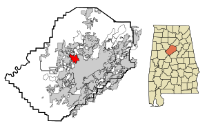
Forestdale is an unincorporated community and census-designated place (CDP) in Jefferson County, Alabama, United States. It is north of the Birmingham city neighborhood of Ensley. At the 2020 census, the population was 10,409.

Minor, Alabama
CDP in Alabama, United States
Distance: Approx. 5734 meters
Latitude and longitude: 33.539656,-86.94
Minor is a census-designated place (CDP) in Jefferson County, Alabama, United States. It is located north of the Birmingham suburb, Pleasant Grove and has a population of 1,094 (2010 census). Minor was damaged by an F5 tornado on April 8, 1998, including damage inflicted on the non-denominational Open Door Church.

WAPI (AM)
Radio station in Birmingham, Alabama
Distance: Approx. 2904 meters
Latitude and longitude: 33.55194444,-86.91111111
WAPI (1070 kHz, "Talk 99-5, Birmingham's Real Talk") is a commercial AM radio station in Birmingham, Alabama. It is owned by Cumulus Media and carries a news/talk format, simulcast with FM sister station 99.5 WZRR. The radio studios and offices are on Goodwin Crest Drive in Homewood. WAPI and WZRR carry local talk shows during the day, but at night they run nationally syndicated shows from Cumulus subsidiary Westwood One including Mark Levin, Ben Shapiro, Dan Bongino, Red Eye Radio and First Light.
Crumley Chapel, Alabama
Unincorporated community in Alabama, United States
Distance: Approx. 1834 meters
Latitude and longitude: 33.57055556,-86.91277778
Crumley Chapel, also known as Crumleys Chapel or Oakwood, is an unincorporated community in Jefferson County, Alabama northwest of Birmingham. The area was first settled in early 1840. The community's name originated from a local church and cemetery, which were named after Robert Crumley, an early farmer of the area.
P.D. Jackson-Olin High School
Public high school in Birmingham, Alabama, United States
Distance: Approx. 5982 meters
Latitude and longitude: 33.5197,-86.89097
P.D. Jackson-Olin High School (J-O) is a four-year public high school in Birmingham, Alabama. It is one of seven high schools in the Birmingham City School System. Founded in 1952 as Western High School, it was renamed Western-Olin High the following year in honor of the F.W. Olin Foundation, a grantor of $600,000 grant for the school's vocational building.
Mount Ararat Baptist Church (Ensley, Alabama)
Historic church in Alabama, United States
Distance: Approx. 6281 meters
Latitude and longitude: 33.51833333,-86.90805556
Mount Ararat Baptist Church is a historic church at 1920 Slayden Avenue, Ensley in Birmingham, Alabama. It is located in the Ensley suburb, west of downtown Birmingham, and overlooks Highway 239. It was originally built in 1929 but was modified in 1950 to add a red brick veneer.
Minor High School
Public school in Adamsville, Alabama, United States
Distance: Approx. 3172 meters
Latitude and longitude: 33.5765,-86.9273
Minor High School is a four-year public high school in the Birmingham, Alabama suburb of Adamsville. It is one of fourteen high schools in the Jefferson County School System. School colors are purple and white, and the athletic teams are called the Tenacious Tigers.
Docena, Alabama
Unincorporated community in Alabama, United States
Distance: Approx. 3836 meters
Latitude and longitude: 33.55944444,-86.93111111
Docena is an unincorporated community in Jefferson County, Alabama, United States. Docena is 8 miles (13 km) west-northwest of downtown Birmingham and has a post office with ZIP code 35060.
Coalburg, Alabama
Unincorporated community in Alabama, United States
Distance: Approx. 4032 meters
Latitude and longitude: 33.59361111,-86.85722222
Coalburg is an unincorporated community in Jefferson County, Alabama, United States.
Pratt City Carline Historic District
Historic district in Alabama, United States
Distance: Approx. 4641 meters
Latitude and longitude: 33.5325,-86.88361111
The Pratt City Carline Historic District, in Birmingham, Alabama, was listed on the National Register of Historic Places in 1989. Also known as the Carline District, it developed along a historic streetcar line. It is roughly along Ave.

Acipcoville, Alabama
Neighborhood in Birmingham, Alabama, United States
Distance: Approx. 5038 meters
Latitude and longitude: 33.55622222,-86.84305556
Acipcoville is a neighborhood in Birmingham in Jefferson County, Alabama, United States.
Weather in this IP's area
few clouds
-2 Celsius
-2 Celsius
-2 Celsius
0 Celsius
1031 hPa
71 %
1031 hPa
1009 hPa
10000 meters
20 %