Country:
Region:
City:
Latitude and Longitude:
Time Zone:
Postal Code:
IP information under different IP Channel
ip-api
Country
Region
City
ASN
Time Zone
ISP
Blacklist
Proxy
Latitude
Longitude
Postal
Route
Luminati
Country
City
providenciales
ASN
Time Zone
America/Grand_Turk
ISP
TCIGATEWAY
Latitude
Longitude
Postal
IPinfo
Country
Region
City
ASN
Time Zone
ISP
Blacklist
Proxy
Latitude
Longitude
Postal
Route
db-ip
Country
Region
City
ASN
Time Zone
ISP
Blacklist
Proxy
Latitude
Longitude
Postal
Route
ipdata
Country
Region
City
ASN
Time Zone
ISP
Blacklist
Proxy
Latitude
Longitude
Postal
Route
Popular places and events near this IP address

Providenciales
Island and the largest city of Turks and Caicos Islands
Distance: Approx. 1597 meters
Latitude and longitude: 21.7775,-72.26222222
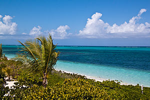
Providenciales (known locally as Provo) is an island in the northwest Caicos Islands, part of the Turks and Caicos Islands, a British Overseas Territory. The island has an area of 98 km2 (38 sq mi) and a 2012 Census population of 23,769. Providenciales is the third largest island in the Turks and Caicos in area, and is home to a large majority of the population of the Turks and Caicos Islands.

Providenciales International Airport
International airport serving on Providenciales, Turks and Caicos Islands
Distance: Approx. 2114 meters
Latitude and longitude: 21.77361111,-72.26583333
Providenciales International Airport (IATA: PLS, ICAO: MBPV), on the island of Providenciales in the Caicos Islands, is the main international airport serving the Turks and Caicos Islands, a British Overseas Territory of the United Kingdom. It is operated by Turks and Caicos Islands Airports Authority (TCIAA). The territory's other international airport is JAGS McCartney International Airport on Grand Turk Island.
TCIFA National Academy
Distance: Approx. 3836 meters
Latitude and longitude: 21.773026,-72.211992
TCIFA National Academy is a multi-use stadium in Providenciales, Turks and Caicos Islands. It is currently used mostly for football matches. The stadium holds 3,000 and was built in 2004.
Blue Hills, Turks and Caicos Islands
Distance: Approx. 4172 meters
Latitude and longitude: 21.8,-72.28333333
Blue Hills are the highest point of Turks and Caicos Islands, a British Overseas Territory located in the Caribbean, with an elevation of 49 metres (161 ft).
Graceway Sports Complex
Distance: Approx. 3841 meters
Latitude and longitude: 21.77402708,-72.21165419
Graceway Sports Complex is a multi-use sporting facilities in Providenciales, Turks and Caicos Islands. It is currently used for indoor and outdoor activities including athletics, soccer, basketball, volleyball, tennis, squash, hockey and martial arts. Also rugby union matches played at Astroturf Football Field.
Meridian Field
Rugby stadium in Turks and Caicos Islands
Distance: Approx. 6828 meters
Latitude and longitude: 21.79017681,-72.18218208
Meridian Field is a multi-use rugby stadium in Village of Grace, Providenciales, Turks and Caicos Islands. It is currently used for rugby union.
Our Lady of Divine Providence Church, Providenciales
Church in Turks and Caicos Islands , United Kingdom
Distance: Approx. 529 meters
Latitude and longitude: 21.782,-72.2528
The Our Lady of Divine Providence Church, Providenciales is a Catholic place of worship on Providenciales, an island of Turks and Caicos in the Caribbean.
Charisma University
Distance: Approx. 7470 meters
Latitude and longitude: 21.7939,-72.1765
Charisma University (CU) is an academic institution located in the Turks and Caicos Islands (TCI), British Overseas Territories of the United Kingdom. It is a non-profit institution recognized by the Turks and Caicos Islands Ministry of Education, Labour, Employment and Customer Service to offer accredited undergraduate, graduate, post-graduate degree programs and certificate programs in various disciplines taught by over 100 faculty members. The university specialises in providing for adult learners and online learning.
Clement Howell High School
School in Turks and Caicos
Distance: Approx. 3675 meters
Latitude and longitude: 21.80432,-72.27428
Clement Howell High School is a senior high school in Providenciales, Turks and Caicos. Named after Clement Howell, it serves forms three through five and is operated by the Ministry of Education (Turks and Caicos).
Louise Garland Thomas High School
School in Providenciales, Turks and Caicos
Distance: Approx. 8694 meters
Latitude and longitude: 21.7932,-72.1644
Louise Garland Thomas High School, formerly known as the Long Bay High School is a senior high school in Long Bay, Providenciales, Turks and Caicos.

Cheshire Hall Plantation
Historical plantation in Providenciales, Turks and Caicos
Distance: Approx. 472 meters
Latitude and longitude: 21.78083333,-72.25194444
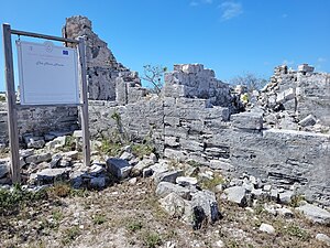
Cheshire Hall Plantation was a 5,000-acre (2,000 ha) sisal and cotton plantation in Providenciales, Turks and Caicos Islands, owned by the British Loyalist Thomas Stubbs from the late 1700s until 1810 and afterwards by his brother Wade Stubbs. A portion of the former plantation is currently owned and managed as a historical site by the Turks and Caicos National Trust.
Weather in this IP's area
few clouds
27 Celsius
30 Celsius
27 Celsius
27 Celsius
1009 hPa
76 %
1009 hPa
1006 hPa
10000 meters
8.35 m/s
9.15 m/s
51 degree
15 %
05:56:41
17:08:56