Country:
 USA
USARegion:
City:
Latitude and Longitude:
Time Zone:
Postal Code:
IP information under different IP Channel
ip-api
Country
Region
City
ASN
Time Zone
ISP
Blacklist
Proxy
Latitude
Longitude
Postal
Route
IPinfo
Country
Region
City
ASN
Time Zone
ISP
Blacklist
Proxy
Latitude
Longitude
Postal
Route
MaxMind
Country
Region
City
ASN
Time Zone
ISP
Blacklist
Proxy
Latitude
Longitude
Postal
Route
Luminati
Country
USRegion
mo
City
bethel
ASN
Time Zone
America/Chicago
ISP
MARK-TWAIN
Latitude
Longitude
Postal
db-ip
Country
Region
City
ASN
Time Zone
ISP
Blacklist
Proxy
Latitude
Longitude
Postal
Route
ipdata
Country
Region
City
ASN
Time Zone
ISP
Blacklist
Proxy
Latitude
Longitude
Postal
Route
Popular places and events near this IP address

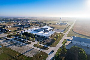
Bethel, Missouri
Village in Missouri, United States
Distance: Approx. 1463 meters
Latitude and longitude: 39.87722222,-92.02444444
Bethel is a village in Shelby County, Missouri, United States. The population was 135 at the 2020 census.

Bethel Historic District (Bethel, Missouri)
Historic district in Missouri, United States
Distance: Approx. 1313 meters
Latitude and longitude: 39.87833333,-92.02333333
Bethel Historic District is roughly bounded by Liberty, King, 1st, and 4th Sts. in Bethel, Missouri. Construction of the town, which was for over thirty years a successful experiment in communal living, began in 1844.
Heartland Christian Academy, Missouri
Private school in Missouri, United States
Distance: Approx. 6488 meters
Latitude and longitude: 39.9437304,-91.9904957
Heartland Christian Academy (HCS) is a private Christian school located within the Heartland Community in Shelby County, Missouri. Founded in 1995, targeting students with behavioral issues as a part of CNS International Ministries, the school treats troubled youth and adults using work therapy and Christian instruction. It has a daycare and serves students from preschool to high school.
Board Branch
Stream in Shelby County, Missouri, U.S.
Distance: Approx. 7074 meters
Latitude and longitude: 39.9086522,-91.9390594
Board Branch is a stream in Shelby County in the U.S. state of Missouri. It is a tributary of Tiger Fork. Board Branch was so named for the board trees near its course which supplied sawmills.
Elgin, Missouri
Unincorporated community in the American state of Missouri
Distance: Approx. 5451 meters
Latitude and longitude: 39.935596,-91.99684
Elgin is an unincorporated community in Shelby County, in the U.S. state of Missouri.
Epworth, Missouri
Unincorporated community in the American state of Missouri
Distance: Approx. 6551 meters
Latitude and longitude: 39.89416667,-92.09444444
Epworth is an unincorporated community in Shelby County, in the U.S. state of Missouri.
Hebron, Shelby County, Missouri
Distance: Approx. 1072 meters
Latitude and longitude: 39.89222222,-92.03
Hebron is an extinct town in Shelby County, in the U.S. state of Missouri. The GNIS classifies it as a populated place. Hebron was founded in the 1840s, and named after the ancient city of Hebron, a place mentioned in the Hebrew Bible.
Mesner Branch
Stream in Shelby County, Missouri, U.S.
Distance: Approx. 4145 meters
Latitude and longitude: 39.853929,-92.003228
Mesner Branch is a stream in Shelby County in the U.S. state of Missouri. It is a tributary of the North River. A variant spelling was "Messner Branch".
Thomas Branch (Tiger Fork tributary)
Stream in Shelby County, Missouri, U.S.
Distance: Approx. 5176 meters
Latitude and longitude: 39.92143,-91.974061
Thomas Branch is a stream in Shelby County in the U.S. state of Missouri. It is a tributary of Tiger Fork. Thomas Branch has the name of the original owner of the site.
Bethel Township, Shelby County, Missouri
Inactive township in the American state of Missouri
Distance: Approx. 2225 meters
Latitude and longitude: 39.9008,-92.0394
Bethel Township is an inactive township in Shelby County, in the U.S. state of Missouri. Bethel Township was erected in the 1840s, and named after the community of Bethel, Missouri.
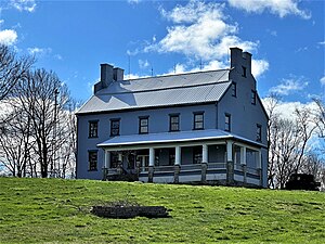
Elim (Bethel, Missouri)
Historic house in Missouri, United States
Distance: Approx. 2574 meters
Latitude and longitude: 39.86944444,-92.00277778
Elim, also known as the Dr. William Keil House, is a historic home located near Bethel, Shelby County, Missouri. It was built in the late-1840s, and is a 2+1⁄2-story, brick and stone dwelling over a full basement.
Hebron (Bethel, Missouri)
Historic house in Missouri, United States
Distance: Approx. 978 meters
Latitude and longitude: 39.88972222,-92.02944444
Hebron is a historic home located near Bethel, Shelby County, Missouri. It was built about 1852, and is a two-story, brick and wood-frame building sheathed with clapboard. It has a medium pitched gable roof.
Weather in this IP's area
clear sky
14 Celsius
12 Celsius
14 Celsius
14 Celsius
1019 hPa
31 %
1019 hPa
991 hPa
10000 meters
2.44 m/s
2.47 m/s
39 degree
07:10:35
18:40:36