65.229.32.100 - IP Lookup: Free IP Address Lookup, Postal Code Lookup, IP Location Lookup, IP ASN, Public IP
Country:
Region:
City:
Location:
Time Zone:
Postal Code:
IP information under different IP Channel
ip-api
Country
Region
City
ASN
Time Zone
ISP
Blacklist
Proxy
Latitude
Longitude
Postal
Route
Luminati
Country
ASN
Time Zone
America/Chicago
ISP
CELLCO-PART
Latitude
Longitude
Postal
IPinfo
Country
Region
City
ASN
Time Zone
ISP
Blacklist
Proxy
Latitude
Longitude
Postal
Route
IP2Location
65.229.32.100Country
Region
california
City
bloomington
Time Zone
America/Los_Angeles
ISP
Language
User-Agent
Latitude
Longitude
Postal
db-ip
Country
Region
City
ASN
Time Zone
ISP
Blacklist
Proxy
Latitude
Longitude
Postal
Route
ipdata
Country
Region
City
ASN
Time Zone
ISP
Blacklist
Proxy
Latitude
Longitude
Postal
Route
Popular places and events near this IP address

Bloomington, California
Place in California, United States
Distance: Approx. 410 meters
Latitude and longitude: 34.07027778,-117.39583333
Bloomington is an urban unincorporated community in San Bernardino County, California, United States. The population was 23,851 at the 2010 census, up from 19,318 at the 2000 census. For statistical purposes, the United States Census Bureau has defined Bloomington as a census-designated place (CDP).
Bloomington High School (California)
School in Bloomington, California, United States
Distance: Approx. 1926 meters
Latitude and longitude: 34.05833333,-117.41444444
Bloomington High School is a high school in unincorporated Bloomington, California, near Riverside, Rialto, San Bernardino, and Fontana.
Rialto High School
Public high school in Rialto, California
Distance: Approx. 4585 meters
Latitude and longitude: 34.09138889,-117.35638889
Rialto High School is a public high school located in San Bernardino, California, with a Rialto postal address. that opened in September 1992. It is operated by the Rialto Unified School District, and is a member of the San Andreas.

Arrowhead Regional Medical Center
Hospital in California, United States
Distance: Approx. 4228 meters
Latitude and longitude: 34.0739,-117.3511
Arrowhead Regional Medical Center (ARMC) is a teaching hospital located in Colton, California, within Southern California's Inland Empire. ARMC is owned and operated by the County of San Bernardino. The emergency department (ED) at ARMC is the second busiest ED in the state of California.

Rialto station
Distance: Approx. 3994 meters
Latitude and longitude: 34.0969,-117.3729
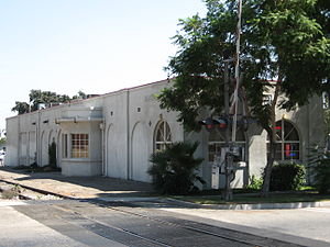
Rialto station (also known as the John Longville Depot) is a Metrolink San Bernardino Line station located at 292 South Palm Avenue in Rialto, in San Bernardino County, California, just south of Rialto Avenue off of Riverside Avenue. The station is named for former Assemblymember and Rialto Mayor John Longville. The station is owned by the city of Rialto and was designed as a replica of the former 1888-built Atchison, Topeka and Santa Fe Railway frame-built structure.

Jurupa Oak
Exceptionally old clonal oak colony in Riverside, California
Distance: Approx. 3770 meters
Latitude and longitude: 34.033,-117.391
The Jurupa Oak, or Hurungna Oak, is a clonal colony of Quercus palmeri (Palmer's oak) trees in the Jurupa Mountains in Crestmore Heights, Riverside County, California. The colony has survived an estimated 13,000 years through clonal reproduction, making it one of the world's oldest living trees. The oak was discovered by botanist Mitch Provance in the 1990s and at the time he recognized it as disjunct for the species and likely an “ancient” clonal stand.

Agua Mansa, California
Ghost town in California, United States of America
Distance: Approx. 4045 meters
Latitude and longitude: 34.04194444,-117.36388889
Agua Mansa (Spanish for "gentle water") is a former settlement in an unincorporated area of San Bernardino County, near Colton, California, United States. Once the largest settlement in San Bernardino County, it is now a ghost town. Only the cemetery remains.
Kaiser Fontana Medical Center
Hospital in California, United States
Distance: Approx. 3402 meters
Latitude and longitude: 34.0729,-117.4322
Kaiser Fontana Medical Center is a large Kaiser Permanente medical facility and 420-bed hospital in Fontana, California. Built in 1955 to replace the smaller hospital at the Kaiser Steel Mill, the facility now serves over 400,000 members of Kaiser Permanente's health care plans in the area. The hospital is accredited by the Joint Commission.
Crestmore Heights, California
Place in California, United States
Distance: Approx. 4074 meters
Latitude and longitude: 34.03,-117.39583333
Crestmore Heights is a former census-designated place in Riverside County, California, now part of the city of Jurupa Valley, California. Crestmore Heights sits at an elevation of 1,033 feet (315 m). The 2010 United States census reported Crestmore Heights's population was 384.

First Christian Church of Rialto
Historic church in California, United States
Distance: Approx. 4731 meters
Latitude and longitude: 34.10277778,-117.36916667
First Christian Church of Rialto is a historic church located at 201 N. Riverside Avenue in Rialto, California. The church was built from 1906 to 1907 to serve Rialto's First Christian Church, which was founded in 1905. Architect H. M. Patterson designed the church in the Late Gothic Revival style; his design also features elements of the American Craftsman style.
California University of Science and Medicine
Private medical school in California, US
Distance: Approx. 4332 meters
Latitude and longitude: 34.0772,-117.3509
The California University of Science and Medicine (CUSM) is a private accredited medical school located in Colton, California/San Bernardino, San Bernardino County, United States. CUSM received preliminary LCME accreditation in February 2018, and enrolled students for classes conferring an M.D. degree beginning July 2018. The new CUSM campus, completed in 2020, has two lecture halls, nine college rooms, 15 clinical skills rooms and three labs.

Rialto station (Pacific Electric)
Distance: Approx. 4558 meters
Latitude and longitude: 34.10138,-117.37002
Rialto station was a Pacific Electric train station in Rialto, California. It is located on Riverside Avenue at crossing of the Union Pacific (formerly Pacific Electric and Southern Pacific) tracks. This was the point where the Riverside–Rialto Line branched south from the Upland–San Bernardino Line.
Weather in this IP's area
clear sky
14 Celsius
13 Celsius
12 Celsius
16 Celsius
1018 hPa
67 %
1018 hPa
979 hPa
10000 meters
2.24 m/s
4.02 m/s
280 degree