Country:
Region:
City:
Latitude and Longitude:
Time Zone:
Postal Code:
IP information under different IP Channel
ip-api
Country
Region
City
ASN
Time Zone
ISP
Blacklist
Proxy
Latitude
Longitude
Postal
Route
Luminati
Country
Region
nm
City
santafe
ASN
Time Zone
America/Denver
ISP
CYBERMESA-ASN
Latitude
Longitude
Postal
IPinfo
Country
Region
City
ASN
Time Zone
ISP
Blacklist
Proxy
Latitude
Longitude
Postal
Route
db-ip
Country
Region
City
ASN
Time Zone
ISP
Blacklist
Proxy
Latitude
Longitude
Postal
Route
ipdata
Country
Region
City
ASN
Time Zone
ISP
Blacklist
Proxy
Latitude
Longitude
Postal
Route
Popular places and events near this IP address

Cañada de los Alamos, New Mexico
CDP in New Mexico, United States
Distance: Approx. 3076 meters
Latitude and longitude: 35.59444444,-105.87
Cañada de los Alamos is a census-designated place (CDP) in Santa Fe County, New Mexico, United States. It is part of the Santa Fe, New Mexico Metropolitan Statistical Area. The population was 434 at the 2010 census.

Bobcat Bite
Restaurant in Santa Fe, New Mexico
Distance: Approx. 5155 meters
Latitude and longitude: 35.5825,-105.89722222
Bobcat Bite is a restaurant that is located in Santa Fe, New Mexico, off of the Old Las Vegas Highway. The location itself has hosted two businesses, both of which have gone by the name "Bobcat Bite". The original Bobcat Bite specialized in the preparation of steak, chops, and hamburgers.
Santa Fe Preparatory School
Private school in Santa Fe, New Mexico, United States
Distance: Approx. 6691 meters
Latitude and longitude: 35.669085,-105.913472
Santa Fe Preparatory School is a private school located in Santa Fe, New Mexico The school provides grades 7–12 with an enrollment of 340 students. It was founded in February 1961.

Seton Village
United States historic place
Distance: Approx. 6352 meters
Latitude and longitude: 35.59888889,-105.93166667
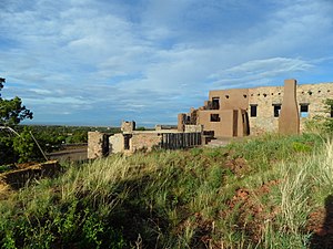
Seton Village is a National Historic Landmark District in a rural residential area south of Santa Fe in Santa Fe County, New Mexico, United States. It encompasses a residential settlement and educational facility established in 1930 by Ernest Thompson Seton (1860-1946), an educator and conservationist best known as a founder of the Boy Scouts of America. The district includes the remains of Seton's 32-room home and other residential and educational buildings constructed mostly between 1930 and 1945.
Academy for the Love of Learning
Distance: Approx. 6199 meters
Latitude and longitude: 35.59972222,-105.93027778
The Academy for the Love of Learning is a non-profit organization conceived by American composers Leonard Bernstein and Aaron Stern. The Academy was incorporated as a 501(c)3 in 1998. Its campus is located in southeast Santa Fe, NM, on the former estate of Ernest Thompson Seton.
La Loma, New Mexico
Unincorporated community in New Mexico, United States
Distance: Approx. 5713 meters
Latitude and longitude: 35.61944444,-105.93055556
La Loma is an unincorporated community located in Santa Fe County, New Mexico, United States. The community is 4.5 miles (7.2 km) south of downtown Santa Fe. La Loma had its own post office from March 24, 1942, to September 10, 2011; it still has its own ZIP code, 87724.

Atalaya Mountain (Santa Fe County, New Mexico)
Mountain in New Mexico, United States
Distance: Approx. 5149 meters
Latitude and longitude: 35.667693,-105.876366
Atalaya Mountain is a mountain peak located within the Santa Fe National Forest, in northern New Mexico, United States. It is part of the Santa Fe Mountains in the Sangre de Cristo Range, a subrange of the Southern Rocky Mountains. A relevant viewscape from the city of Santa Fe, there are no higher peaks between the city and Atalaya Mountain to the east.

Atalaya Trail
Hiking trail in Santa Fe, New Mexico, USA
Distance: Approx. 6562 meters
Latitude and longitude: 35.66862,-105.9119
The Atalaya Trail is an out and back trail to the summit of Atalaya Mountain, in Santa Fe, New Mexico.
Arroyo Hondo, Santa Fe County, New Mexico
Census-designated place in New Mexico, United States
Distance: Approx. 6615 meters
Latitude and longitude: 35.61638889,-105.94027778
Arroyo Hondo is an unincorporated community and census-designated place (CDP) in Santa Fe County, New Mexico, United States. It was first listed as a CDP prior to the 2020 census.
Conejo, New Mexico
Census-designated place in New Mexico, United States
Distance: Approx. 6020 meters
Latitude and longitude: 35.62555556,-105.93388889
Conejo is an unincorporated community and census-designated place (CDP) in Santa Fe County, New Mexico, United States. It was first listed as a CDP prior to the 2020 census.
Santa Fe Foothills, New Mexico
Census-designated place in New Mexico, United States
Distance: Approx. 2669 meters
Latitude and longitude: 35.62333333,-105.89694444
Santa Fe Foothills is an unincorporated community and census-designated place (CDP) in Santa Fe County, New Mexico, United States. It was first listed as a CDP prior to the 2020 census. The CDP is in northern Santa Fe County and is bordered to the northwest by the city of Santa Fe, the state capital, to the west by Conejo, to the southwest by Sunlit Hills, to the southeast by Cañada de los Alamos, and to the northeast by Santa Fe National Forest.
Sunlit Hills, New Mexico
Census-designated place in New Mexico, United States
Distance: Approx. 5659 meters
Latitude and longitude: 35.59583333,-105.92111111
Sunlit Hills is an unincorporated community and census-designated place (CDP) in Santa Fe County, New Mexico, United States. It was first listed as a CDP prior to the 2020 census. The CDP is north of the geographic center of Santa Fe County and is bordered to the west by Seton Village, to the northwest by Arroyo Hondo, to the north by Conejo, and to the northeast by Santa Fe Foothills.
Weather in this IP's area
broken clouds
-6 Celsius
-9 Celsius
-7 Celsius
-5 Celsius
1026 hPa
93 %
1026 hPa
758 hPa
10000 meters
1.79 m/s
4.92 m/s
36 degree
76 %
06:31:50
17:02:35
