65.18.122.23 - IP Lookup: Free IP Address Lookup, Postal Code Lookup, IP Location Lookup, IP ASN, Public IP
Country:
Region:
City:
Location:
Time Zone:
Postal Code:
ISP:
ASN:
language:
User-Agent:
Proxy IP:
Blacklist:
IP information under different IP Channel
ip-api
Country
Region
City
ASN
Time Zone
ISP
Blacklist
Proxy
Latitude
Longitude
Postal
Route
db-ip
Country
Region
City
ASN
Time Zone
ISP
Blacklist
Proxy
Latitude
Longitude
Postal
Route
IPinfo
Country
Region
City
ASN
Time Zone
ISP
Blacklist
Proxy
Latitude
Longitude
Postal
Route
IP2Location
65.18.122.23Country
Region
shan
City
lashio
Time Zone
Asia/Rangoon
ISP
Language
User-Agent
Latitude
Longitude
Postal
ipdata
Country
Region
City
ASN
Time Zone
ISP
Blacklist
Proxy
Latitude
Longitude
Postal
Route
Popular places and events near this IP address
Lashio
Town in Shan State, Myanmar
Distance: Approx. 4 meters
Latitude and longitude: 22.93333333,97.75
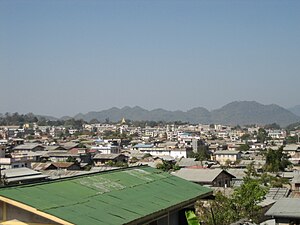
Lashio (Burmese: လားရှိုးမြို့; MLCTS: la: hrui: mrui. [láʃó mjo̰]; Shan: ဝဵင်းလႃႈသဵဝ်ႈ [weŋ˥ laː˧˧˨ sʰeu˧˧˨]) is the largest town in northern Shan State, Myanmar, about 200 kilometres (120 mi) north-east of Mandalay. It is situated on a low mountain spur overlooking the valley of the Yaw River.
Roman Catholic Diocese of Lashio
Distance: Approx. 859 meters
Latitude and longitude: 22.941,97.7505
The diocese of Lashio is a Roman Catholic diocese of Myanmar centered at Lashio. The diocesan territory covers a land area of 61,266 square kilometers. Philip Lasap Za Hawng (born 1945) is the current bishop of Lashio (from 1998).

Lashio Airport
Airport in Lashio, Myanmar
Distance: Approx. 4742 meters
Latitude and longitude: 22.97583333,97.7525
Lashio Airport (IATA: LSH, ICAO: VYLS) is an airport in Lashio, Myanmar. It is near the former headquarters of Northeast Military Command. On 30 July 2024 the airport was captured by the Myanmar National Democratic Alliance Army.
Lashio District
District in Shan State, Burma
Distance: Approx. 2520 meters
Latitude and longitude: 22.91666667,97.73333333
Lashio District (Burmese: လားရှိုးခရိုင်) is a district of Shan State in Myanmar. It consisted of four towns and 2431 villages in 2001.

Hsenwi State
Former Shan state in Burma
Distance: Approx. 4 meters
Latitude and longitude: 22.93333333,97.75
Hsenwi (Shan: သဵၼ်ႈဝီ; Tai Nüa: ᥔᥦᥢᥲ ᥝᥤᥴ), also known as Theinni (Burmese: သိန္နီ), was a Shan state in the Northern Shan States in what is today Burma. The capital was Hsenwi town.

North Hsenwi
Former Shan State in Burma
Distance: Approx. 4 meters
Latitude and longitude: 22.93333333,97.75
North Hsenwi was a Shan state in the Northern Shan States in what is today Burma. The capital was Lashio town which was also the headquarters of the superintendent of the Northern Shan State. North Hsenwi, with an area of 6330 m², had a population in 1901 of 118,325 persons and an estimated revenue of £6000.
2018 Lashio bombing
Distance: Approx. 650 meters
Latitude and longitude: 22.938062,97.74633
The 2018 Lashio bombing was a bomb blast in the town of Lashio, in northern Shan State, Myanmar, that killed two employees of Yoma Bank and injured 22 others.

Lashio University
Liberal arts university
Distance: Approx. 2699 meters
Latitude and longitude: 22.9552,97.7387
Lashio University (Burmese: လားရှိုးတက္ကသိုလ်) is a public liberal arts university located in Lashio, Myanmar. Formerly an affiliate of Mandalay University. The university offers bachelor's degree programs in common liberal arts, sciences and law disciplines.

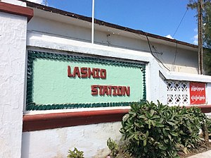
Lashio Railway Station
Train station in Shan State, Myanmar
Distance: Approx. 4848 meters
Latitude and longitude: 22.97333333,97.73138889
Lashio station (Burmese: လားရှိုးဘူတာ) is a railway station located in Lashio, Shan State, Myanmar. This station was opened in 1903 as the terminus of the Mandalay–Lashio Railway. As of 2023, there are plans to extend the route to Muse near the Chinese border.

Battle of Lashio
2024 capture of Lashio by Myanmar rebels
Distance: Approx. 3705 meters
Latitude and longitude: 22.9665,97.7525
The Battle of Lashio was an offensive conducted by the Three Brotherhood Alliance, along with other resistance forces, to capture the northern Shan city of Lashio. The headquarters for the Tatmadaw's Northeastern Command, the city was besieged by rebel forces following the collapse of the Chinese-mediated ceasefire that had paused the rebels' Operation 1027.
Weather in this IP's area
clear sky
17 Celsius
16 Celsius
17 Celsius
17 Celsius
1010 hPa
53 %
1010 hPa
918 hPa
10000 meters
0.68 m/s
0.64 m/s
143 degree
