Country:
 USA
USARegion:
City:
Latitude and Longitude:
Time Zone:
Postal Code:
IP information under different IP Channel
ip-api
Country
Region
City
ASN
Time Zone
ISP
Blacklist
Proxy
Latitude
Longitude
Postal
Route
IPinfo
Country
Region
City
ASN
Time Zone
ISP
Blacklist
Proxy
Latitude
Longitude
Postal
Route
MaxMind
Country
Region
City
ASN
Time Zone
ISP
Blacklist
Proxy
Latitude
Longitude
Postal
Route
Luminati
Country
USASN
Time Zone
America/Chicago
ISP
OSTK-COM
Latitude
Longitude
Postal
db-ip
Country
Region
City
ASN
Time Zone
ISP
Blacklist
Proxy
Latitude
Longitude
Postal
Route
ipdata
Country
Region
City
ASN
Time Zone
ISP
Blacklist
Proxy
Latitude
Longitude
Postal
Route
Popular places and events near this IP address

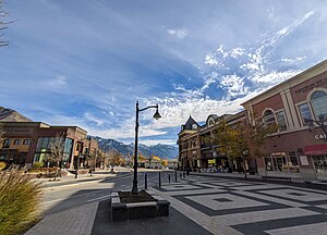
Cottonwood Heights, Utah
City in the United States
Distance: Approx. 2037 meters
Latitude and longitude: 40.61722222,-111.82027778
Cottonwood Heights is a city located in Salt Lake County, Utah, United States, along the east bench of the Salt Lake Valley. It lies south of the cities of Holladay and Murray, east of Midvale, and north of Sandy within the Salt Lake City, Utah Metropolitan Statistical Area. Originally a census-designated place (CDP), following a successful referendum in May 2004, the city was incorporated on January 14, 2005.
Cottonwood West, Utah
Former CDP in Utah, United States
Distance: Approx. 3609 meters
Latitude and longitude: 40.64555556,-111.84861111
Cottonwood West was a census-designated place (CDP) in Salt Lake County, Utah, United States. The CDP was situated between the cities of Holladay and Murray, which by the mid-2000s had annexed virtually all of the area between them. The population was 18,727 at the 2000 census, a slight increase over the 1990 census figure of 17,476.
Holladay, Utah
City in Utah, United States
Distance: Approx. 2707 meters
Latitude and longitude: 40.65638889,-111.81944444
Holladay is a city in central Salt Lake County, Utah, United States. It is part of the Salt Lake City, Utah Metropolitan Statistical Area and abuts the Wasatch National Forest. The population was 31,965 at the 2020 census, a significant increase from 14,561 in 2000 when the first area incorporated from Salt Lake County.

Big Cottonwood Canyon
Canyon in Salt Lake County, Utah, United States
Distance: Approx. 3210 meters
Latitude and longitude: 40.61972222,-111.77555556
Big Cottonwood Canyon is a canyon in the Wasatch Range 12 miles (19 km) southeast of Salt Lake City in the U.S. state of Utah. The 15-mile (24 km)-long canyon provides hiking, biking, picnicking, rock-climbing, camping, and fishing in the summer. Its two ski resorts, Brighton and Solitude, are popular among skiers and snowboarders.
Brighton High School (Cottonwood Heights, Utah)
School in Cottonwood Heights, Utah, United States
Distance: Approx. 2803 meters
Latitude and longitude: 40.61222222,-111.82694444
Brighton High School in Cottonwood Heights, Utah is located about ten miles (16 km) south of Salt Lake City. It serves students in grades 9-12 for the Canyons School District.
Cottonwood Paper Mill
United States historic place
Distance: Approx. 1098 meters
Latitude and longitude: 40.62694444,-111.79916667
The Cottonwood Paper Mill (also known as Granite Paper Mill) is an abandoned stone structure located at the mouth of Big Cottonwood Canyon in Cottonwood Heights, Utah. It was listed on the National Register of Historic Places in 1971. It was built in 1883 by the Deseret News under the direction of Henry Grow.

Intermountain Christian School
School in Holladay, Utah, United States
Distance: Approx. 473 meters
Latitude and longitude: 40.63166667,-111.80388889
Intermountain Christian School (ICS) is a private non-denominational Christian school in Holladay, Utah, United States, that was founded in 1982.

Granite Hydroelectric Power Plant Historic District
Historic district in Utah, United States
Distance: Approx. 2820 meters
Latitude and longitude: 40.61916667,-111.78138889
The Granite Hydroelectric Power Station was built in 1896–1897 at the mouth of Big Cottonwood Canyon, about 6 miles (9.7 km) southeast of Salt Lake City, Utah, United States(in what is now eastern Cottonwood Heights. The plant comprises the powerhouse, transformer house, a wooden conduit, penstocks, and a small dam. Like the Stairs Station upstream, it represents an intact high-head generating plant from the late 19th century.

Harold W. and Evelyn Burton House
United States historic place
Distance: Approx. 2763 meters
Latitude and longitude: 40.65277778,-111.82944444
The Harold W. and Evelyn Burton House, at 2195 East Walker Lane in Holladay, Utah, United States, is a listed property on the National Register of Historic Places. A mansion built in 1923 as the home for architect Harold W. Burton, it was listed in 2017. Significant contributing property includes a 1923 two-car garage.
Morton A. Cheesman House
Historic house in Utah, United States
Distance: Approx. 2042 meters
Latitude and longitude: 40.64888889,-111.82194444
The Morton A. Cheesman House, at 2320 Walker Lane in what is now Holladay, Utah, was built in 1912–13. It was listed on the National Register of Historic Places in 1982. It is a two-story Craftsman-style house with a cobble-rock base.

Ray F. and Ethel Smith House
Historic house in Utah, United States
Distance: Approx. 2989 meters
Latitude and longitude: 40.64138889,-111.84277778
The Ray F. and Ethel Smith House, at 1697 E. Vine St. in Murray, Utah, was listed on the National Register of Historic Places in 2019. It is a one-and-a-half-story "English Tudor period revival cottage" built in 1937, associated with early farming families in the area.
Disappearance of Reed Jeppson
1964 disappearance of a Salt Lake City teenager
Distance: Approx. 3369 meters
Latitude and longitude: 40.60526,-111.79431
Reed Taylor Jeppson (born May 28, 1949, disappeared October 11, 1964) was an American teenager who disappeared along with his two dogs as he walked them on the afternoon of October 11, 1964 in Salt Lake City, Utah. Despite an extensive search and media coverage (including renewed attention in the early 2010s), neither Jeppson nor the dogs have been located.
Weather in this IP's area
scattered clouds
23 Celsius
22 Celsius
22 Celsius
25 Celsius
1003 hPa
33 %
1003 hPa
855 hPa
10000 meters
4.63 m/s
110 degree
40 %
07:09:30
19:34:27