Country:
 USA
USARegion:
City:
Latitude and Longitude:
Time Zone:
Postal Code:
IP information under different IP Channel
ip-api
Country
Region
City
ASN
Time Zone
ISP
Blacklist
Proxy
Latitude
Longitude
Postal
Route
IPinfo
Country
Region
City
ASN
Time Zone
ISP
Blacklist
Proxy
Latitude
Longitude
Postal
Route
MaxMind
Country
Region
City
ASN
Time Zone
ISP
Blacklist
Proxy
Latitude
Longitude
Postal
Route
Luminati
Country
USRegion
ny
City
brooklyn
ASN
Time Zone
America/New_York
ISP
INTERNAP-BLK3
Latitude
Longitude
Postal
db-ip
Country
Region
City
ASN
Time Zone
ISP
Blacklist
Proxy
Latitude
Longitude
Postal
Route
ipdata
Country
Region
City
ASN
Time Zone
ISP
Blacklist
Proxy
Latitude
Longitude
Postal
Route
Popular places and events near this IP address

Gates Avenue station
New York City Subway station in Brooklyn
Distance: Approx. 439 meters
Latitude and longitude: 40.68949,-73.922067
The Gates Avenue station is a local station on the elevated BMT Jamaica Line of the New York City Subway, located at the intersection of Gates Avenue and Broadway at the border of Bedford–Stuyvesant and Bushwick, Brooklyn. It is served by the Z train during rush hours in the peak direction and by the J train at all other times.

Kosciuszko Street station
New York City Subway station in Brooklyn
Distance: Approx. 646 meters
Latitude and longitude: 40.6933,-73.9287
The Kosciuszko Street station is a local station on the BMT Jamaica Line of the New York City Subway. It is served by the J train at all times. The Z train skips this station when it operates.
Bushwick Leaders High School for Academic Excellence
Public school in New York City
Distance: Approx. 846 meters
Latitude and longitude: 40.69527778,-73.9275
Bushwick Leaders High School for Academic Excellence (BLHS) was a small New York City Public High School located in Bushwick, Brooklyn.

South Bushwick Reformed Church
United States historic place
Distance: Approx. 722 meters
Latitude and longitude: 40.69416667,-73.92611111
South Bushwick Reformed Church, also known as the "White Church", is a historic Dutch Reformed church in Bushwick, Brooklyn, New York. The complex consists of the church and attached Sunday School building. The church was organized in 1851 by members of the Bushwick Reformed Church that dates back to 1654.
Reid Avenue station (BMT Lexington Avenue Line)
New York City Subway station in Brooklyn, New York
Distance: Approx. 412 meters
Latitude and longitude: 40.690055,-73.93047
The Reid Avenue station was a station on the demolished BMT Lexington Avenue Line in Brooklyn, New York City. It was opened on May 13, 1885, and had 2 tracks and 2 side platforms. It was located at the intersection of Lexington Avenue and Reid Avenue, and as such it had a connection to the Utica and Reid Avenues Line streetcars.

Christ Evangelical English Lutheran Church
United States historic place
Distance: Approx. 529 meters
Latitude and longitude: 40.69222222,-73.92861111
Christ Evangelical English Lutheran Church, also known as Rugged Cross Baptist Church, is a historic Evangelical Lutheran church at 1084 Lafayette Avenue, 11221, in Bedford-Stuyvesant, Brooklyn, New York, New York. It was built in 1898–1899 in the Romanesque Revival style. It is faced in cream colored brick with beige brick and terra cotta trim.

Immanuel Congregational Church
United States historic place
Distance: Approx. 596 meters
Latitude and longitude: 40.6825,-73.925
Immanuel Congregational Church, also known as St. Mark's Congregational Church and known since 1945 as Union Baptist Church, is a historic Congregational church at 461 Decatur Street in Bedford-Stuyvesant, Brooklyn, New York, New York. It was built in 1898 and is a two-story masonry building in the Neo-Renaissance style.
Shaari Zedek Synagogue
Church in New York, United States
Distance: Approx. 381 meters
Latitude and longitude: 40.68644167,-73.9309
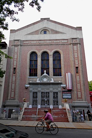
St. Leonard's Anglican Church, previously known as Shaari Zedek Synagogue and Congregation Achavat Achim, is a historic synagogue and church building at 767 Putnam Ave. in Bedford-Stuyvesant, Brooklyn, New York.

Broadway (Brooklyn)
Avenue in Brooklyn, New York
Distance: Approx. 786 meters
Latitude and longitude: 40.69424722,-73.93018889
Broadway is an avenue in the New York City borough of Brooklyn that extends from the East River in the neighborhood of Williamsburg in a southeasterly direction to East New York for a length of 4.32 miles (6.95 km). It was named for the Broadway in Manhattan. The East New York terminus is a complicated intersection with East New York Avenue, Fulton Street, Jamaica Avenue, and Alabama Avenue.

Wayfarers Gallery
Former art gallery in New York City, USA
Distance: Approx. 779 meters
Latitude and longitude: 40.6939629,-73.930809
Wayfarers was a non-profit studio program and art gallery in Bushwick, Brooklyn, New York founded by American artist George Ferrandi. The venue existed between 2011 and 2020 with a front gallery that faced DeKalb street that had rotating exhibitions, as well as studios for member artists, a commons area and additional exhibition space in the back. Wayfarers featured a wide range of programming including regular exhibitions by member and guest artists, pop-up exhibitions, performances, readings, editions, a summer artist-in-residence program, and an international exhibition exchange program.
The People's Garden
Community garden in New York City
Distance: Approx. 467 meters
Latitude and longitude: 40.69180556,-73.92555556
The People's Garden is a community garden established by Hernan Pagan in the Bushwick neighborhood of Brooklyn, New York City, United States. It is located on Broadway between Van Buren Street and Bushwick Avenue.
Saratoga Park
Public park in Brooklyn, New York
Distance: Approx. 716 meters
Latitude and longitude: 40.685,-73.919
Saratoga Park is a public park in Bedford–Stuyvesant, Brooklyn. It is bordered by Halsey Street, Saratoga Avenue, Macon Street, and Howard Avenue.
Weather in this IP's area
light rain
19 Celsius
19 Celsius
17 Celsius
20 Celsius
1009 hPa
81 %
1009 hPa
1008 hPa
10000 meters
5.66 m/s
250 degree
100 %
06:58:40
18:27:49